The Hague[b] is the capital city of the South Holland province of the Netherlands. With a population of over half a million, it is the third-largest city in the Netherlands. Situated on the west coast facing the North Sea, The Hague is the country's administrative centre and its seat of government, and while the official capital of the Netherlands is Amsterdam, The Hague has been described as the country's de facto capital since the time of the Dutch Republic.[7]
The Hague
Den Haag 's-Gravenhage | |
|---|---|
City and municipality | |
| Nicknames: De Hofstad, De Residentie, Agga, 070 | |
| Motto(s): Vrede en Recht (Peace and Justice) | |
.png) Location within South Holland | |
 The Hague Location within the Netherlands  The Hague Location within Europe | |
| Coordinates: 52°04′48″N 04°18′36″E / 52.08000°N 4.31000°E | |
| Country | Netherlands |
| Province | South Holland |
| Subregion | Haaglanden |
| District | |
| Government | |
| • Body | Municipal council |
| • Mayor | Jan van Zanen (VVD) |
| • Aldermen | List
|
| Area | |
| • Municipality | 98.13 km2 (37.89 sq mi) |
| • Land | 82.45 km2 (31.83 sq mi) |
| • Water | 15.68 km2 (6.05 sq mi) |
| • Urban | 286.31 km2 (110.54 sq mi) |
| • Metro | 1,256.40 km2 (485.10 sq mi) |
| • Randstad | 4,384.10 km2 (1,692.71 sq mi) |
| Elevation | 1 m (3 ft) |
| Population | |
| • Municipality | 549,163 |
| • Density | 6,650/km2 (17,200/sq mi) |
| • Urban | 883,720 |
| • Metro | 2,390,101 [a] |
| • Randstad | 6,396,416 |
| Demonym | Hagenaar or Hagenees |
| Time zone | UTC+01:00 (CET) |
| • Summer (DST) | UTC+02:00 (CEST) |
| Postcodes | 2490–2599 |
| Area code | 070, 015 |
| Website | www |
 | |
| Click on the map for a fullscreen view | |

.jpg)
.jpg)


The Hague is the core municipality of the Greater The Hague urban area containing over 800,000 residents, and is also part of the Rotterdam–The Hague metropolitan area, which, with a population of approximately 2.6 million, is the largest metropolitan area of the Netherlands. The city is also part of the Randstad region, one of the largest conurbations in Europe.
The Hague is the seat of the Cabinet, the States General, the Supreme Court, and the Council of State of the Netherlands.[8] King Willem-Alexander officially lives in the Huis ten Bosch and works at the Noordeinde Palace together with Queen Máxima.[9] Most foreign embassies in the Netherlands are in the city. The Hague is also home to the headquarters of many Dutch companies, with Shell plc having major offices in the city as well. The Royal Library of the Netherlands is also located there. The Hague's coastal area includes the popular seaside resort Scheveningen.
The Hague is known as the home of international law and arbitration. The International Court of Justice, the main judicial arm of the United Nations, is in the city, as are the International Criminal Court, the Permanent Court of Arbitration, the Organisation for the Prohibition of Chemical Weapons, Europol, and approximately 200 other international governmental organizations.[10] The name "The Hague" is commonly used as a totum pro parte to refer to either of the international courts that reside in the city.
Etymology edit
The Hague was first mentioned as Die Haghe in 1242.[11] In the 15th century, the name des Graven hage came into use, literally "The Count's Wood", with connotations such as "The Count's Hedge, Private Enclosure or Hunting Grounds". The spelling "'s-Gravenhage" was officially used for the city from the 17th century onward. Today, this name is only used in some official documents such as birth and marriage certificates. The city itself uses "Den Haag" in all its communications.[12] The post office specifies that letters must be addressed to "'s-Gravenhage", but a letter to "Den Haag" will be delivered just as well. The railway stations are named "Den Haag". Signposts mention "Den Haag".
History edit
Ancient history edit
The area was part of the Roman province of Germania Inferior and was close to the border of the empire, the Upper Germanic-Rhaetian Limes. In 1997, four Roman milestones were discovered at Wateringse Veld. The originals are in the "Museon" museum. The milestones indicate the distance from the nearest Roman city, Forum Hadriani (modern Voorburg), and can be dated to the reign of the emperors Antoninus Pius (138-161; the column is dated 151), Caracalla (211–217), Gordian III (238–244), and Decius (249–251).
Early history edit


Little is known about the origin of The Hague. There are no contemporary documents describing it, and later sources are often of dubious reliability. What is certain is that The Hague was founded by the last counts of the House of Holland. Floris IV already owned two residences in the area, but presumably purchased a third court situated by the present-day Hofvijver in 1229, previously owned by a woman called Meilendis. Presumably, Floris IV intended to rebuild the court into a large castle, but he died in a tournament in 1234, before anything was built.[13] His son and successor William II lived in the court, and after he was elected King of the Romans in 1248, he promptly returned to The Hague, and had builders turn the court into a "royal palace" (regale palacium), which would later be called the Binnenhof ("Inner Court"). He died in 1256 before this palace was completed but parts of it were finished during the reign of his son Floris V, of which the Ridderzaal ("Knights' Hall"), still intact, is the most prominent.[14][15] It is still used for political events, such as the annual speech from the throne by the Dutch monarch. From the 13th century onward, the counts of Holland used The Hague as their administrative center and residence when in Holland.
The village that originated around the Binnenhof was first mentioned as Die Haghe in a charter dating from 1242. It became the primary residence of the Counts of Holland in 1358 and thus became the seat of many government institutions. This status allowed the village to grow; by the Late Middle Ages, it had grown to the size of a city, although it did not receive city rights.[11] In its early years, the village was in the ambacht, or rural district, of Monster, which was governed by the Lord of Monster. Seeking to exercise more direct control over the village, however, the Count split the village off and created a separate ambacht called Haagambacht, governed directly by the Counts of Holland. The territory of Haagambacht was considerably expanded during the reign of Floris V.[16]
When the House of Burgundy inherited the counties of Holland and Zeeland in 1432, they appointed a stadtholder to rule in their stead with the States of Holland and West Friesland as an advisory council. Although their seat was in The Hague, the city became subordinate to more important centres of government such as Brussels and Mechelen, from where the sovereigns ruled over the increasingly centralised Burgundian Netherlands.[11]
At the beginning of the Eighty Years' War, the absence of city walls proved disastrous, as it allowed Spanish troops to easily occupy the town. In 1575, the States of Holland, temporarily based in Delft, even considered demolishing the city but this proposal was abandoned, after mediation by William the Silent. In 1588, The Hague became the permanent seat of the States of Holland as well as the States General of the Dutch Republic.[17] For the administration to maintain control over city matters, The Hague never received official city status, although it did have many of the privileges normally granted only to cities. In modern administrative law, "city rights" have no place anymore.
Modern history edit

In 1806, when the Kingdom of Holland was a puppet state of the First French Empire, the settlement was granted city rights by Louis Bonaparte.[18] After the Napoleonic Wars, modern-day Belgium and the Netherlands were combined in the United Kingdom of the Netherlands to form a buffer against France. As a compromise, Brussels and Amsterdam alternated as capital every two years, with the government remaining in The Hague. After the separation of Belgium in 1830, Amsterdam remained the capital of the Netherlands, while the government was situated in The Hague. When the government started to play a more prominent role in Dutch society after 1850, The Hague quickly expanded. Many streets were specifically built for the large number of civil servants employed in the country's government and for the Dutchmen who were retiring from the administration of the Netherlands East Indies. The growing city amalgamated the rural municipality of Loosduinen partly in 1903 and completely in 1923.[19]
The city sustained heavy damage during World War II. Many Jews were killed during the German occupation. Additionally, the Atlantic Wall was built through the city, causing a large quarter to be torn down by the Nazi occupants. On 3 March 1945, the Royal Air Force mistakenly bombed the Bezuidenhout quarter. The target was an installation of V-2 rockets in the nearby Haagse Bos park, but because of navigational errors, the bombs fell on a heavily populated and historic part of the city.[20] The bombardment wreaked widespread destruction in the area[21] and caused 511 fatalities.[22]
Because of uncertainty about what to do after the destructions of the bombing, nobody attempted to plan a reconstruction of Bezuidenhout. In 1962, David Jokinen saw an opportunity to put an end to the situation where two main stations each served only part of the rail traffic. The Jokinen Plan included the intent to demolish the Staatsspoor Station entirely, with Hollands Spoor becoming the central station. Jokinen's plan sparked fierce discussions. The plan was not implemented, in part because it was only presented when decision-making had finally reached an advanced stage. In the site of the Staatsspoor station now stands the Den Haag Centraal railway station.

After the war, The Hague became at one time the largest building site in Europe. The city expanded massively to the southwest, and the destroyed areas were quickly rebuilt. The population peaked at 600,000 inhabitants around 1965. In the 1970s and 1980s, mostly white middle-class families moved to neighbouring towns such as Voorburg, Leidschendam, Rijswijk and (most of all) Zoetermeer. This led to the traditional pattern of an impoverished inner city and more prosperous suburbs. Attempts to include parts of these municipalities in the city of The Hague were highly controversial. In the 1990s, with the consent of the Dutch Parliament, The Hague annexed fairly large areas from neighbouring towns as well as from not even bordering ones, on which the complete new residential areas were built and are still being built.
Geography edit


The Hague is the largest Dutch city on the North Sea in the Netherlands and forms the centre of the Greater The Hague urban area. Westland and Wateringen lie to the south, Rijswijk, Delft and the Rotterdam conurbation (known as Rijnmond) to the southeast, Pijnacker-Nootdorp and Zoetermeer to the east, Leidschendam-Voorburg, Voorschoten and the Leiden conurbation to the northeast and Wassenaar to the north.
The conurbations around The Hague and Rotterdam are close enough to be seen as a single conurbation in some contexts. For example, they share the Rotterdam The Hague Airport and a light rail system called RandstadRail. This led to the creation of the Rotterdam-The Hague metropolitan area. This large conurbation centred on The Hague and Rotterdam is, in turn, part of the Randstad—specifically a band of municipalities called the South Wing (Zuidvleugel). The Randstad, which also includes among others Amsterdam and Utrecht, has a population of 6,659,300. The Hague lies at the southwestern corner of the second-largest conurbation in the European Union.
The Hague is divided into eight official districts which are, in turn, divided into neighbourhoods.[23] Some of the most prosperous and some of the poorest neighbourhoods of the Netherlands can be found in The Hague. The wealthier areas such as Statenkwartier, Belgisch Park, Marlot, Benoordenhout and Archipelbuurt are generally in the northwestern part of the city, closer to the sea, whereas the southeastern neighbourhoods such as Transvaal, Moerwijk, and the Schilderswijk are significantly poorer, except the Vinex-locations of Leidschenveen-Ypenburg and Wateringse Veld. This division is reflected in the local accent: The more affluent citizens are usually called "Hagenaars" and speak so-called bekakt Haags ("posh"), this contrasts with the Hagenezen, who speak plat Haags ("vulgar"); see Demographics below.
The districts are:
- Centrum (106,000 inhabitants)[24] forms the heart of The Hague. The Binnenhof, the Noordeinde Palace, the Mauritshuis museum, the Nieuwe Kerk, the Grote Kerk, the Old City Hall and the City Hall are located here. Architecture varies from medieval up to the 20th century.
- Escamp (129,000 inhabitants)[24] is the most populous district of The Hague, built largely after the World War II as part of The Hague's large expansion to the southeast. One railway station can be found here: Den Haag Moerwijk. The district is divided into six neighbourhoods.
- Haagse Hout (48,000 inhabitants)[24] is a wealthy district in the northeast of the city and the location of the Haagse Bos, a large forest. The King of the Netherlands lives in the royal palace Huis ten Bosch, in this forest. The district also includes the financial centre of the city, the Beatrixkwartier.
- Laak (46,000 inhabitants)[24] is the smallest district of the city, southeast of its centre, for the most part, built in the 20th and 21st centuries. The area used to be part of Rijswijk until the municipality of The Hague bought the land in 1844. The Hollands Spoor railway station and The Hague University are located here, as well as the site of the planned mixed-use development Nieuw Binckhorst.
- Leidschenveen-Ypenburg (48,000 inhabitants)[24] is an early 21st-century Vinex-location southeast of the city, geographically connected to the main body of the city only by a narrow corridor. The district is divided into Leidschenveen and Ypenburg, which were part of Leidschendam, Nootdorp, and Rijswijk before the areas were annexed by The Hague in 2002. This area was the site of Ypenburg Airport which was a military airport during World War II.
- Loosduinen (50,000 inhabitants)[24] is the westernmost district of The Hague. It was a village unto itself until 1923 when it was annexed by The Hague. The less popular of the city's two seaside resorts, Kijkduin is located here. The district is divided into four neighbourhoods.
- Scheveningen (59,000 inhabitants)[24] is the wealthy northernmost district of The Hague. A modern beach resort, Scheveningen is a popular tourist destination. It has a long sandy beach and its own esplanade, pier, and lighthouse, but also a Pathé cinema, a musical theatre, a casino, and a special Museum for Scheveningen. The district also includes a fishing harbour. Notable buildings include the Kurhaus and farther inland, the Peace Palace.
- Segbroek (62,000 inhabitants)[24] is a district located between Scheveningen and Loosduinen. The population decreased until around 2005, but since then has begun to grow again, driven by students and east European immigrants. It became a district of The Hague in 1988 and is divided into five neighbourhoods.
Climate edit
The Hague experiences a temperate oceanic climate (Köppen: Cfb) similar to almost all of the Netherlands. Because of its location on the coast, it experiences milder winters and cooler summers than more inland locations. However, because of its location, it can also be extremely windy in the winter and humid in the summer. It also gets more sunshine.[citation needed]
| Climate data for Valkenburg Naval Air Base | |||||||||||||
|---|---|---|---|---|---|---|---|---|---|---|---|---|---|
| Month | Jan | Feb | Mar | Apr | May | Jun | Jul | Aug | Sep | Oct | Nov | Dec | Year |
| Record high °C (°F) | 13.8 (56.8) |
15.9 (60.6) |
20.8 (69.4) |
25.9 (78.6) |
29.7 (85.5) |
33.5 (92.3) |
36.5 (97.7) |
34.6 (94.3) |
31.7 (89.1) |
24.5 (76.1) |
17.5 (63.5) |
15.4 (59.7) |
36.5 (97.7) |
| Mean daily maximum °C (°F) | 6.4 (43.5) |
6.9 (44.4) |
9.8 (49.6) |
13.6 (56.5) |
17.0 (62.6) |
19.6 (67.3) |
21.6 (70.9) |
21.8 (71.2) |
18.9 (66.0) |
14.7 (58.5) |
10.2 (50.4) |
7.1 (44.8) |
14.0 (57.2) |
| Daily mean °C (°F) | 4.1 (39.4) |
4.2 (39.6) |
6.4 (43.5) |
9.4 (48.9) |
12.8 (55.0) |
15.6 (60.1) |
17.8 (64.0) |
17.8 (64.0) |
15.0 (59.0) |
11.4 (52.5) |
7.6 (45.7) |
4.8 (40.6) |
10.6 (51.1) |
| Mean daily minimum °C (°F) | 1.5 (34.7) |
1.2 (34.2) |
2.7 (36.9) |
4.8 (40.6) |
8.3 (46.9) |
11.2 (52.2) |
13.5 (56.3) |
13.4 (56.1) |
10.9 (51.6) |
7.9 (46.2) |
4.7 (40.5) |
2.1 (35.8) |
6.8 (44.2) |
| Record low °C (°F) | −16.4 (2.5) |
−14.0 (6.8) |
−11.1 (12.0) |
−4.4 (24.1) |
−1.5 (29.3) |
1.7 (35.1) |
5.4 (41.7) |
5.5 (41.9) |
1.2 (34.2) |
−4.4 (24.1) |
−7.1 (19.2) |
−10.6 (12.9) |
−16.4 (2.5) |
| Average precipitation mm (inches) | 70.0 (2.76) |
59.4 (2.34) |
52.8 (2.08) |
41.6 (1.64) |
52.7 (2.07) |
62.8 (2.47) |
72.7 (2.86) |
84.0 (3.31) |
89.2 (3.51) |
89.9 (3.54) |
90.4 (3.56) |
76.4 (3.01) |
841.9 (33.15) |
| Average precipitation days (≥ 1 mm) | 12 | 10 | 11 | 9 | 9 | 9 | 10 | 10 | 12 | 13 | 14 | 13 | 132 |
| Average snowy days | 5 | 5 | 3 | 1 | 0 | 0 | 0 | 0 | 0 | 0 | 2 | 4 | 20 |
| Average relative humidity (%) | 86 | 84 | 83 | 79 | 78 | 79 | 80 | 80 | 83 | 84 | 87 | 87 | 83 |
| Mean monthly sunshine hours | 71.7 | 96.7 | 152.0 | 207.2 | 240.5 | 229.3 | 237.5 | 213.4 | 160.0 | 116.7 | 68.2 | 56.5 | 1,849.7 |
| Source 1: Royal Netherlands Meteorological Institute (1981–2010 normal, snowy days normal for 1971–2000)[25] | |||||||||||||
| Source 2: Royal Netherlands Meteorological Institute (1971–2000 extremes)[26] | |||||||||||||
Cityscape edit

City life concentrates around the Hofvijver and the Binnenhof, where the States General of the Netherlands is located. Because of its history, the historical inner city of The Hague differs in various aspects from the nearby smaller cities of Leiden and Delft. It does not have a cramped inner city, bordered by canals and walls. Instead, it has some small streets in the town centre that may be dated from the late Middle Ages and several spacious streets boasting large and luxurious 18th-century residences built for diplomats and affluent Dutch families. It has a large church dating from the 15th century, a City Hall (built as such) from the 16th century, several large 17th-century palaces, a 17th-century Protestant church built in what was then a modern style, and many important 18th-century buildings.


The city is becoming more student-friendly with the introduction of a new campus in 2012 of Leiden University as well as Leiden University College The Hague, which was established in 2010. The Royal Conservatory of The Hague and the Royal Academy of Art are also located there, as well as The Hague University, a vocational university and a branch of The Open University of the Netherlands. The city has many civil servants and diplomats.[27] In fact, the number and variety of foreign residents (especially the expatriates) make the city quite culturally diverse, with many foreign pubs, shops and cultural events.
The Hague is the largest Dutch city on the North Sea and includes two distinct beach resorts. The main beach resort Scheveningen, in the northwestern part of the city, is a popular destination for tourists as well as for inhabitants. With 10 million visitors a year, it is the most popular beach town in the Benelux area. Kijkduin, in the southwest, is The Hague's other beach resort. It is significantly smaller and attracts mainly local residents.
The former Dutch colony of the East Indies, now Indonesia, has left its mark on The Hague. Since the 19th century, high-level civil servants from the Dutch East Indies often spent long-term leave and vacations in The Hague. Many streets are named after places in the Netherlands East Indies (as well as other former Dutch colonies such as Suriname) and there is a sizable "Indo" (i.e. mixed Dutch-Indonesian) community. Since the loss of these Dutch possessions in December 1949, "Indo people" also known as "Indische people" often refer to The Hague as "the Widow of the Indies".[28]
The older parts of the town have many characteristically wide and long streets. Houses are generally low-rise (often not more than three floors). A large part of the southwestern city was planned by the progressive Dutch architect H.P. Berlage about 1910. This 'Plan Berlage' decided the spacious and homely streets for several decades. In World War II, a large amount of the western portion of The Hague was destroyed by the Germans. Afterward, modernist architect W.M. Dudok planned its renewal, putting apartment blocks for the middle class in open park-like settings.
The layout of the city is more spacious than other Dutch cities and because of the incorporation of large and old nobility estates, the creation of various parks, and the use of green zones around natural streams, it is a much more green city than any other in the Netherlands. That is, excepting some medieval close-knitted streets in the centre. The Hague has a canal system around the old city center, which is mainly used for boat tours around the city. Most of the canals were drained in the late 19th century and some were filled between 1910 and 1970[29] but many have been restored recently.[when?]
The tallest buildings of The Hague are both 146-meter-tall ministries of Justice and Security and the Interior and Kingdom Relations of the Netherlands, designed by Hans Kollhoff. Other significant skyscrapers include the Hoftoren, Het Strijkijzer and De Kroon.
Demographics edit

|
|
| ||||||||||||||||||||||||||||||||||||||||||||||||||||||||||||||||||||||||||||||||||||||||||
| Source: Lourens & Lucassen 1997, pp. 108–110 (1369–1795) buurtmonitor.nl (1795–present) | ||||||||||||||||||||||||||||||||||||||||||||||||||||||||||||||||||||||||||||||||||||||||||||
| City of Den Haag population by country of origin (2018)[30] | |
|---|---|
| Country/Territory | Population |
| 246,633 (43%) | |
| 46,346 (8.70%) | |
| 40,064 (7.52%) | |
| 31,455 (5.91%) | |
| 17,635 (3.31%) | |
| 14,094 (2.65%) | |
| 13,218 (2.48%) | |
| Other | 123,116 (26%) |
Religions in The Hague (2015)[31]
As of 1 January 2021, The Hague counts 549,163 inhabitants, making it the third-largest city in the Netherlands. Between 1800 and 1960, the city saw considerable growth from 40,000 in 1800 to 200,000 in 1900 and eventually 600,000 in 1960. The growth following 1900 was partially caused by the housing act of 1901, which stimulated the expansion of cities such as The Hague. In the period between 1960 and 1980, The Hague saw a shrinkage from 600,000 to 440,000 inhabitants, caused mostly by spatial policy, demographic processes, and lack of space. After several annexations and housing constructions, The Hague has since grown again, celebrating its 500,000th inhabitant in 2011. The municipality expects the growth to continue to just over 600,000 inhabitants by 2030.[32]
The demonym of The Hague officially is Hagenaar, but the term Hagenees is informally used for someone who was born and raised in The Hague.[33] The usage of these demonyms appears to be class-bound, with Hagenaar being the upper-class term and Hagenees being that of the lower-class.[34]
Origin make-up edit
43% of the population of The Hague has two parents that were born in the Netherlands, while 15.6% has at least one parent who was born abroad in a western country, and 34.4% has at least one parent that was born in a non-western country.[35]
Inhabitants by birthplace edit
| 2020[36] | Numbers | % |
|---|---|---|
| Both parents born in NL | 242,441 | 44.42% |
| Western migration background | 105,315 | 19.29% |
| Non-Western migration background | 198,082 | 36.29% |
| Suriname | 45,783 | 8.39% |
| Turkey | 41,122 | 7.53% |
| Morocco | 32,355 | 5.93% |
| Indonesia | 17,187 | 3.15% |
| Netherlands Antilles and Aruba | 14,037 | 2.57% |
| Total | 545,838 | 100% |
Religion edit
Just under half of The Hague's population identifies with a religious group. The two most popular religions are Christianity (29%) and Islam (14.1%). Religiosity is higher among people with a recent migration background from Indonesia, Turkey, Morocco and Surinam. Islam is the most common religion among people with a Turkish or Moroccan migration background. Among people of Surinamese heritage there is more religious diversity, with Hinduism being the most common. Of The Hague's native Dutch population, most religious people adhere to Christianity. Just under 40% of the population of The Hague regularly attends a house of worship.[37]
Politics edit
Municipal government edit

As of the 2022 municipal election, the municipal council of The Hague contains thirteen parties, most notably the local Heart for The Hague (HvDH; 9 seats), Democrats 66 (D66; 8 seats), the People's Party for Freedom and Democracy (VVD; 7 seats) and GroenLinks (5 seats).[38]
| Party | Seats | |
|---|---|---|
| Heart for The Hague / Group de Mos | 9 / 45 | |
| Democrats 66 | 8 / 45 | |
| People's Party for Freedom and Democracy | 7 / 45 | |
| GroenLinks | 5 / 45 | |
| Party for the Animals | 3 / 45 | |
| Labour Party | 3 / 45 | |
| Christian Democratic Appeal | 3 / 45 | |
| DENK | 2 / 45 | |
| The Hague City Party | 1 / 45 | |
| Socialist Party | 1 / 45 | |
| Party for Freedom | 1 / 45 | |
| Christian Union – Reformed Political Party | 1 / 45 | |
| Forum for Democracy | 1 / 45 | |
Since 2019, the municipal executive has comprised VVD, D66, GroenLinks, CDA and PvdA. The chairman of the college is Mayor Jan van Zanen (VVD), and the city has eight aldermen: Anne Mulder, Kavita Parbhudayal (both VVD), Robert van Asten, Saskia Bruines (both D66), Liesbeth van Tongeren, Bert van Alphen (both GroenLinks), Hilbert Bredemeijer (CDA) and Martijn Balster (PvdA). Each alderman is responsible for a number of particular policy areas and one of the city's eight districts.[39]
On 1 October 2019, the National Department of Criminal Investigation (Rijksrecherche) performed a raid on the homes and offices of then-aldermen Richard de Mos and Rachid Guernaoui, as part of an investigation of alleged administrative corruption, bribery and violation of confidentiality. The offices of several municipal civil servants and the homes of three entrepreneurs were also searched for the investigation. The aldermen were suspected of receiving bribes in exchange for granting permits.[40] In April 2023, De Mos and Guernaoui were acquitted of all charges.[41][42][43]
International politics edit


The Hague is home to many different international judicial bodies, such as the International Court of Justice (ICJ), the International Criminal Court (ICC), and the International Residual Mechanism for Criminal Tribunals (IRMCT). It houses Scheveningen Prison, the ICC's detention center for those suspected of war crimes and other violations of international law.[44] The Hague is the fourth major centre for the United Nations, after New York, Geneva and Vienna.[45]
The foundation of The Hague as an "international city of peace and justice" started at the end of the 19th century, when the first global peace conference took place in The Hague on Tobias Asser's initiative, with a second one a few years later. A direct result of these meetings was the establishment of the world's first organisation for the settlement of international disputes, the Permanent Court of Arbitration (PCA). Shortly thereafter, the Scottish-American millionaire Andrew Carnegie made the necessary funds available to build the Peace Palace to house the PCA. After the establishment of the League of Nations, The Hague became the seat of the Permanent Court of International Justice, which was replaced (after World War II) by the UN's International Court of Justice. The establishments of the Iran–United States Claims Tribunal (1981), the International Criminal Tribunal for the former Yugoslavia (1993), and the International Criminal Court (2002) in the city further consolidated its role as a centre for international legal arbitration. Most recently, on 1 March 2009, the Special Tribunal for Lebanon, a UN tribunal to investigate and prosecute suspects in the 2005 assassination of Lebanese Prime Minister Rafik Hariri, opened in the former headquarters of the Dutch General Intelligence and Security Service in Leidschendam, a town within the greater area of The Hague.
Other major international and European organisations based in The Hague include:
- Europol, European Union Agency for Law Enforcement Cooperation
- Eurojust, European Union Agency for Criminal Justice Cooperation
- Europeana, European Union digital platform for cultural heritage.
- The Hague Academy of International Law, centre for high-level education in both public and private international law
- Hague Conference on Private International Law (HCCH), the oldest and preeminent private international law harmonisation institution
- International Commission on Missing Persons (ICMP)
- European Patent Office
- Unrepresented Nations and Peoples Organization
- NATO Communications and Information Agency, (NCI Agency)
- Organisation for the Prohibition of Chemical Weapons (OPCW)
- The European Library[46]
Many academic institutions in the fields of international relations, international law, and international development are based in The Hague. The Hague Academic Coalition (HAC) is a consortium of those institutions.
Its member institutions are:
- Carnegie Foundation
- Hague Institute for the Internationalisation of Law (HiiL)
- International Institute of Social Studies (ISS) of Erasmus University Rotterdam
- Leiden University College The Hague
- Netherlands Institute of International Relations 'Clingendael'
- The Hague Academy of International Law
- The Hague University of Applied Sciences
- T.M.C. Asser Instituut
In 1948, the Congress of Europe was held with 750 delegates from 26 European governments, providing them with the opportunity to discuss ideas about the development of European integration, which eventually culminated in the creation of the modern-day European Union.
Economy edit

The Hague has a service-oriented economy. A professional life in the city is dominated by a large number of civil servants and diplomats working in the city; as of 2006[update], 26% of the jobs in The Hague are those offered by the Dutch government or the international institutions. Large employers in this sector include the ministries of Defence, Justice, Housing, Spatial Planning and the Environment, Foreign Affairs, the Ministry of the Interior and Kingdom Relations and Transport, Public Works and Water Management.
Several large international businesses have their headquarters in The Hague. Significant companies headquartered in The Hague include Aegon, APM Terminals, Damco, NIBC Bank, Chicago Bridge & Iron Company and PostNL. The city is also host to the regional headquarters of Siemens, T-Mobile, AT&T, Huawei, Kuwait Petroleum Corporation, McDermott International, Saudi Aramco, TotalEnergies and Worley (company). There has never been any large-scale industrial activity in The Hague, with the possible exception of the fishing activities of the harbour in Scheveningen. Many of the city's logistical and minor-industrial services are in the Binckhorst in the Laak district, which contains many sizeable warehouses.
Tourism is an important sector in The Hague. The city is the second biggest Dutch tourist destination, after Amsterdam. In 2012, The Hague welcomed 1.2 million tourists (an increase of 80,000 compared to the previous year), half of whom came from abroad. The number of hotel nights in the city increased by 5%; in particular, visitors from neighbouring countries are finding their way to The Hague. Compared to 2011 Belgians booked 27% more hotel nights, while the Germans were good for 24% more hotel nights, and the French booked 20% more hotel nights. The 14% average increase in visits by foreign tourists more than compensated for the slight decrease of less than 1% by Dutch visitors. Tourists spend an average of €2 billion a year in the local economy. Today 1 in 10 residents make their living in the tourism sector.[47][48]
Culture edit
This section needs additional citations for verification. (May 2022) |
The Hague originated around the 13th century Binnenhof, and this is still considered the cultural centre of the city. Nightlife centres around the three main squares in the city centre. The Plein (literally "Square") is taken by several large sidewalk cafés where often politicians may be spotted. The Grote Markt (literally "Great Market") is completely strewn with chairs and tables, summer or winter. The Buitenhof (literally "Outer Court", located just outside the Binnenhof) contains a six-screen Pathé cinema and a handful of bars and restaurants in the immediate vicinity. Adjacent to the Buitenhof is De Passage, the country's first covered shopping mall. Dating from the late 19th century,[49] it contains many expensive and speciality shops. One of the country's largest music venues, Paard van Troje, can be found in the centre of The Hague. Another popular music venue in The Hague is Muziekcafé de Paap.

The Spuiplein is a modern fourth square in the city centre, opposite the Nieuwe Kerk. Besides the City Hall, this was also the location of the Anton Philipszaal, home to the Residentie Orchestra, and the Lucent Danstheater, home to the internationally celebrated modern dance company Nederlands Dans Theater. These buildings, designed by Rem Koolhaas in 1988, have been demolished to make space for a new theatre, Amare, which would house both institutes as well as the Royal Conservatory. Despite efforts of the municipality, public support for the proposed theatre remains low. At the heart of the city centre across the palace gardens is the home of Summerschool Den Haag, an international school for dance with guest teachers such as Valentina Scaglia, Igone de Jongh, and Maia Makhateli. The Koninklijke Schouwburg, home to Het Nationale Theater, can also be found in the city centre – on the Korte Voorhout. New European Ensemble is a collective for contemporary music consisting on international musicians. The ensemble has its main base in the city.
Scheveningen forms a second cultural centre of The Hague, having its own Pathé cinema as well as the musical theatre Circustheater although, especially in the summer, most night life concentrates around the sea-front boulevard with its bars, restaurants and gambling halls. Several other attractions can be found in Scheveningen, such as the miniature park Madurodam, the Beelden aan Zee museum, and a Sea Life Centre.
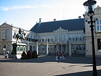
The Hague is the residence of the Dutch monarch, and several (former) royal palaces can be found in the city. King Willem-Alexander of the Netherlands and Queen Máxima of the Netherlands live in Huis ten Bosch in the Haagse Bos and work in the Noordeinde Palace in the city centre. Moreover, there are two former royal palaces in The Hague. The Kneuterdijk Palace, built in 1716, is now home to the Council of State of the Netherlands, and the Lange Voorhout Palace is now occupied by the Escher Museum, dedicated to Dutch graphical artist M. C. Escher.

The Hague has its share of museums, most notably the Mauritshuis, located next to the Binnenhof, which exhibits many paintings by Dutch masters, such as Johannes Vermeer, Rembrandt van Rijn and Paulus Potter. Other museums include the science museum Museon, the modern art museum Kunstmuseum, the historic museum Haags Historisch Museum, the national postal museum Museum voor Communicatie, the Museum Bredius, the Louis Couperus Museum, the museum Beelden aan Zee in Scheveningen, and the Gevangenpoort, a former prison housed in a 15th-century gatehouse.
Since early times, possibly as far back as the 16th century, the stork has been the symbol of The Hague.[50]
Several films have been (partially) shot in The Hague, including Mindhunters (2004), Hum Tum (2004), Ocean's Twelve (2004), Black Book (2006) and Sonny Boy (2011). Parts of the second season of the Netflix series Sense8 were filmed in The Hague.[51] Notable actors and filmmakers from The Hague include Martin Koolhoven, Georgina Verbaan, Carel Struycken, Frederique van der Wal, Marwan Kenzari, Anna Drijver, Renée Soutendijk and Paul Verhoeven, who grew up in the city from an early age.
-
 The Ridderzaal inside the Binnenhof, the political centre of the Netherlands
 -
 Monument commemorating the founding of the Kingdom of the Netherlands at Plein 1813
 -
-

-
 Huis ten Bosch is the residence of the king.
 -
 Louwman Museum is a museum for historic cars, coaches, and motorcycles.


Sports edit

The city's major football club is ADO Den Haag, which competes in the Eerste Divisie, the second-highest tier of football in the Netherlands. ADO Den Haag has won the KNVB Cup twice and won the League twice in the era before professional football. They play their matches at the 15,000 seat ADO Den Haag Stadium. Amateur team HVV are also based in the city. Before the professional era, the club won 10 national titles and one KNVB Cup, and they remain fourth in the all-time list of national title winners.[52] HBS Craeyenhout is another amateur club in the city, which won three national titles before the establishment of the Eredivisie.[52] On 13 May 2021, football club ADO Den Haag was relegated from the Eredivisie as they lost their final game of the season against Willem II. In effect, ADO Den Haag no longer holds a position in the top division of professional Dutch football.[53]
Since 2020, the basketball club The Hague Royals plays in the professional Dutch Basketball League (DBL). Home games are played at the Sportcampus Zuiderpark.
The local rugby union team is Haagsche Rugby Club (a.k.a. HRC). The ice hockey team is HYS The Hague and the local American Football team is Den Haag Raiders '99.
Darts is another sport played in The Hague; its popularity was increased by Raymond van Barneveld winning several World Championships.
The half-marathon race CPC Loop Den Haag is held annually in The Hague. In 1994, The Hague held the FEI World Equestrian Games.
Annual events edit
Koningsdag, or King's Day, is held annually on 27 April. It is traditionally celebrated with fairs and flea markets throughout the city. On this day, the colour orange predominates at a funfair (which sells orange cotton candy) and scores of informal street markets. The day is a vrijmarkt (literally "free market"), which means no licence is needed for street vending; children traditionally use this day to sell old unwanted toys. Since King's Day is a national holiday and thus a day off, many people also go out and party on the evening before King's Day. This evening is called King's Night, or Koningnacht in The Hague. The "t" is left out because nacht is pronounced as nach in The Hague. Outdoor concerts throughout the city centre of The Hague draw tens of thousands of visitors every year.[54][55]
Every third Tuesday in September is Prinsjesdag, or Prince's Day, the opening of the Dutch parliament. On a festive day, children in The Hague are free from school so they may watch the procession of the Golden Coach. The King is driven in the coach from Noordeinde Palace to the Ridderzaal in the Binnenhof. Here, the King reads the Speech from the Throne, written jointly by the Ministers and Secretaries of State. This troonrede outlines the government's plans for the coming year. As the procession returns to the Noordeinde Palace, the road is lined with members of the Dutch Royal Armed Forces, and in the afternoon, the Royal Family appears on the palace balcony to address an adoring and often frenzied public (balkonscène).[56]
Vlaggetjesdag (nl), literally Flag Day, is the annual celebration of the arrival of the year's first herring (Hollandse Nieuwe) in Scheveningen. Hundreds of thousands of people gather in Scheveningen for the festivities, and the fishing boats are decorated specially for the occasion. In addition to the omnipresent herring, this day also features several activities unrelated to fish. In Scheveningen, the first barrel of herring is traditionally sold at an auction on the Thursday preceding the official Vlaggetjesdag, and the proceeds go to charity. Vlaggetjesdag was made official in 1947, although the festive tradition around the beginning of herring season is much older: in the 18th century, the villages along the coast, including Scheveningen, were forbidden to gut the caught herring. Since herring was most appropriate for smoking around September, most fishing boats caught flatfish or round-bodied fish during part of the summer, to avoid a surplus of fresh herring.[57] In July or August, The Hague hosts a series of weekly firework displays by the sea front in Scheveningen, as part of an international fireworks festival and competition.
Tong Tong Fair, formerly Pasar Malam Besar, is the largest festival in the world for Indo culture. Established in 1959, it is one of the oldest festivals and the fourth-largest grand fair in the Netherlands. It is also the annual event with the highest number of paying visitors to The Hague, having consistently attracted more than 100,000 visitors since 1993. The Milan Festival is Europe's biggest Hindustani open-air event, annually held in Zuiderpark. The Hague also hosts several annual music festivals; on the last Sunday in June, the city hosts Parkpop, the largest free open-air pop concert in Europe. Crossing Border Festival, State-X and The Hague Jazz festival are among other music festivals in The Hague.[58]
Crossing Border Festival is an annual festival in November, focusing on music and literature.[59] The first edition took place in 1993.
Movies That Matter[60] is an international film and debate festival about peace and justice that takes place every year at the end of March; nine days filled with screenings of fiction films and documentaries, daily talk-shows, music performances, and exhibitions. The first such event took place in 2006.
Moreover, The Hague International Model United Nations, annually held in January, is a five-day conference held at the World Forum, gathering over 4,000 students from over 200 secondary schools across the globe. It is the oldest and largest high school United Nations simulation in the world. Den Haag Sculptuur is an open-air exhibition of sculptures; the tenth such event, in 2007, celebrated the 400 years of the relationship between the Netherlands and Australia. Since 2009, the city of The Hague also annually presents an LGBTQ+ emancipation award, called the John Blankenstein Award. The exact date of the ceremony varies each year.
Notable people edit
Transport edit

Air edit
The Hague shares an airport with Rotterdam. It can be reached from Central Station by RandstadRail Line E, with an Airport Shuttle to and from Meijersplein Station. However, with several direct trains per hour from the railway stations Hollands Spoor and Centraal, Amsterdam Airport Schiphol is more frequently used by people travelling to and from The Hague by air.
Rail edit

There are two main railway stations in The Hague: Hollands Spoor and Centraal Station, 1.5 km (1 mi) apart from each other. Because the two stations were built and run by two different railway companies in the 19th century, services have traditionally been split between the two: east–west lines terminate at Centraal Station, whereas north–south lines run through Hollands Spoor. However, Centraal Station now offers direct services to most major Dutch cities, such as Amsterdam, Rotterdam, and Utrecht.
Other destinations include Leiden, Haarlem, Zwolle, Groningen, Leeuwarden, Amersfoort, Enschede, Breda, Tilburg and Eindhoven. International travellers for Antwerp and Brussels have to change trains at Rotterdam.
Urban transport edit
Public transport in The Hague consists of a tramway network and a sizeable number of bus routes, operated by HTM Personenvervoer.[61] Plans for a subway were shelved in the early 1970s. However, in 2004 a tunnel was built under the city centre with two underground tram stations (Spui and Grote Markt); it is shared by RandstadRail lines 3 and 4 and tram routes 2 and 6.
RandstadRail connects The Hague to nearby cities, Zoetermeer, Rotterdam, and Leidschendam-Voorburg. It consists of four light rail lines (3, 4, and 19 to Zoetermeer, Rijswijk, Delft, and Leidschendam-Voorburg) and one subway line (E to Rotterdam).
Road edit
Major motorways connecting to The Hague include the A12, running to Utrecht and the German border. The A12 runs directly into the heart of the city in a cutting. Built in the 1970s, this section of the motorway (the "Utrechtsebaan") is now heavily overburdened. Plans were made in the late 1990s for a second artery road into the city (the "Rotterdamsebaan", previously called the "Trekvliettracé") which is due to be built between 2016 and 2019.[62] Other connecting motorways are the A4, which connects the city with Amsterdam, and the A13, which runs to Rotterdam and connects to motorways towards the Belgian border. There is also the A44 that connects the city to Leiden, Haarlem and Amsterdam. In the 1970s, plans of building another motorway to Leiden existed. This "Leidsebaan" was supposed to start in the city centre and then follow the railway line from The Hague to Amsterdam. Some works had been executed but had been removed by the 1980s.[citation needed]
See also edit
Notes edit
- ^ Counted as one with the city of Rotterdam, its seaport and industrial area, and its suburbs / metro area.
- ^ /ˈheɪɡ/ HAYG; Dutch: Den Haag [dɛn ˈɦaːx] ⓘ or 's‑Gravenhage [ˌsxraːvə(n)ˈɦaːɣə] ⓘ
References edit
Citations edit
- ^ "College van burgemeester en wethouders" [Municipal executive] (in Dutch). Gemeente Den Haag. Retrieved 28 August 2021.
- ^ "Kerncijfers wijken en buurten 2020" [Key figures for neighbourhoods 2020]. StatLine (in Dutch). CBS. 24 July 2020. Retrieved 19 September 2020.
- ^ a b Anita Bouman–Eijs; Thijmen van Bree; Wouter Jonkhoff; Olaf Koops; Walter Manshanden; Elmer Rietveld (17 December 2012). De Top 20 van Europese grootstedelijke regio's 1995–2011; Randstad Holland in internationaal perspectief [Top 20 of European metropolitan regions 1995–2011; Randstad Holland compared internationally] (PDF) (Technical report) (in Dutch). Delft: TNO. Archived from the original (PDF) on 3 March 2014. Retrieved 25 July 2013.
- ^ "Postcodetool for 2511BT". Actueel Hoogtebestand Nederland (in Dutch). Het Waterschapshuis. Archived from the original on 21 September 2013. Retrieved 23 July 2013.
- ^ "Bevolkingsontwikkeling; regio per maand" [Population growth; regions per month]. CBS Statline (in Dutch). CBS. 1 January 2021. Retrieved 2 January 2022.
- ^ "Bevolkingsontwikkeling; Regionale kerncijfers Nederland" [Regional core figures Netherlands]. CBS Statline (in Dutch). CBS. 1 January 2020. Retrieved 8 March 2021.
- ^ Kaufmann, David (2018). Varieties of Capital Cities: The Competitiveness Challenge for Secondary Capitals. Cheltenham, UK: Edward Elgar Publishing. ISBN 978-1-78811-643-5. OCLC 1049802517.
- ^ Daum, Andreas (2005). Berlin – Washington, 1800–2000 Capital Cities, Cultural Representation, and National Identities. Cambridge University Press. pp. 13, 38. ISBN 0521841178. Archived from the original on 3 May 2016. Retrieved 23 October 2015.
Amsterdam is the statuary capital of the Netherlands, while the Dutch government resides in De Hague. (sic) (p. 13) The Dutch seat of government is The Hague but its capital is bustling Amsterdam, the national cultural centre. (p. 38)
- ^ Huis ten Bosch Palace Archived 31 July 2017 at the Wayback Machine at "The Official Website of the Dutch Royal House in English", maintained by the Netherlands Government Information Service.
- ^ "Internationale organisaties in Den Haag". Gemeente Den Haag (in Dutch). Archived from the original on 4 February 2019. Retrieved 3 February 2019.
- ^ a b c "Geschiedenis van Den Haag". Geschiedenis van Zuid-Holland (in Dutch). Archived from the original on 16 June 2018. Retrieved 16 June 2018.
- ^ "'s-Gravenhage / Den Haag". Taaladvies.net. Archived from the original on 16 January 2013. Retrieved 16 November 2012.
- ^ "De geschiedenis van den Haag: graaf Floris IV". Geschiedenis van Den Haag (in Dutch). Archived from the original on 24 April 2019. Retrieved 16 June 2018.
- ^ "Den Haag en graaf Willem II". Geschiedenis van Den Haag (in Dutch). Archived from the original on 24 April 2019. Retrieved 16 June 2018.
- ^ "Het Binnenhof: ontstaat". Geschiedenis van Den Haag (in Dutch). Archived from the original on 24 April 2019. Retrieved 16 June 2018.
- ^ "Het dorp Die Haghe: het ontstaan". Geschiedenis van Den Haag (in Dutch). Archived from the original on 24 April 2019. Retrieved 16 June 2018.
- ^ "De allerkortste geschiedenis van Den Haag". Merkboek Den Haag (in Dutch). Archived from the original on 16 June 2018. Retrieved 16 June 2018.
- ^ "A short history of The Hague". Denhaag.nl. 28 November 2011. Archived from the original on 13 April 2014. Retrieved 9 April 2014.
- ^ Ad van der Meer and Onno Boonstra, Repertorium van Nederlandse gemeenten, KNAW, 2011.
- ^ "Bombardement op Bezuidenhout maart 1945" [Bombing of the Bezuidenhout March 1945] (in Dutch). Koninklijke Bibliotheek. Archived from the original on 15 December 2013. Retrieved 5 December 2013.
- ^ Stichting Ons Erfdeel (1998). The Low Countries: arts and society in Flanders and the Netherlands, a yearbook. Vol. 9. Flemish-Netherlands Foundation. p. 113. ISBN 9789075862287. Archived from the original on 17 June 2016. Retrieved 23 October 2015.
- ^ (in Dutch) Bombardement Bezuidenhout 3 maart '45 Voor velen stortte in luttele minuten de wereld in elkaar Archived 15 December 2013 at the Wayback Machine, Amigoe di Curacao, 4 March 1965
- ^ "Stadsdelen" (in Dutch). Denhaag.nl. 18 October 2010. Archived from the original on 28 September 2011. Retrieved 31 August 2011.
- ^ a b c d e f g h Den Haag in Cijfers (in Dutch)
- ^ "Klimaattabel Valkenburg, langjarige gemiddelden, tijdvak 1981–2010" (PDF) (in Dutch). Royal Netherlands Meteorological Institute. Archived (PDF) from the original on 10 October 2017. Retrieved 10 September 2013.
- ^ "Klimaattabel Valkenburg, langjarige extremen, tijdvak 1971–2000" (PDF) (in Dutch). Royal Netherlands Meteorological Institute. Retrieved 10 September 2013.[permanent dead link]
- ^ Haag, Den. "Diplomatic Corps and embassies". Gemeente Den Haag. Archived from the original on 28 February 2019. Retrieved 27 February 2019.
- ^ Dutch: 'de Weduwe van Indie'. As per song text by the famous singer Wieteke van Dort, see text of the song "Arm Den Haag" ("Pity The Hague"): [1] Archived 20 July 2011 at the Wayback Machine
- ^ "MVRDV - The Hague Canals". www.mvrdv.com.
- ^ "CBS StatLine – Bevolking; leeftijd, herkomstgroepering, geslacht en regio, 1 januari". Archived from the original on 30 June 2017. Retrieved 4 July 2017.
- ^ "Kerkelijke gezindte en kerkbezoek naar gemeenten 2010/2015" (XLSX). Centraal Bureau voor de Statistiek. Archived from the original on 21 June 2020. Retrieved 19 June 2020.
- ^ "Aantal personen prognose WBP - Gemeenten". Den Haag in Cijfers (in Dutch). Retrieved 7 February 2022.
- ^ Stam, Niek (17 December 2013). "Kaakstand maakt verschil tussen Hagenaar en Hagenees". Reformatorisch Dagblad (in Dutch). Archived from the original on 16 July 2018. Retrieved 15 July 2018.
- ^ Jaspers, Klaartje (30 March 2016). "Den Haag: uitvergrote versie van Keeping Up Appearances?". HAACS (in Dutch). Archived from the original on 16 July 2018. Retrieved 15 July 2018.
- ^ (in Dutch) Den Haag in Cijfers Archived 4 May 2013 at the Wayback Machine.
- ^ "CBS Statline". opendata.cbs.nl (in Dutch). Retrieved 28 June 2023.
- ^ "Burgerschapsmonitor (2009)". DenHaag.nl (in Dutch). 28 September 2009. Archived from the original on 2 December 2013. Retrieved 25 November 2013.
- ^ "Gemeenteraad 16 maart 2022". Verkiezingsuitslagen (in Dutch). Archived from the original on 26 March 2022. Retrieved 25 March 2022.
- ^ "Nieuwe Haagse coalitie presenteert haar coalitieakkoord". Den Haag (in Dutch). 29 May 2018. Archived from the original on 12 June 2018. Retrieved 7 June 2018.
- ^ "Invallen bij wethouders Den Haag wegens verdenking omkoping en corruptie" (in Dutch). Nederlandse Omroep Stichting. 1 October 2019. Archived from the original on 1 October 2019. Retrieved 1 October 2019.
- ^ "Vrijspraak voor Richard de Mos in corruptiezaak". Rechtspraak.nl. Retrieved 23 April 2023.
- ^ ECLI:NL:RBROT:2023:3199
- ^ ECLI:NL:RBROT:2023:3267
- ^ "Profile: Scheveningen prison". BBC News. 16 May 2012. Retrieved 23 April 2022.
- ^ Slager, Seije (11 March 2009). "Beveiliging is routine voor Haagse autoriteiten". Trouw (in Dutch). Archived from the original on 20 October 2012. Retrieved 31 August 2011.
- ^ "TheEuropeanLibrary.org". TheEuropeanLibrary.org. Archived from the original on 17 June 2008. Retrieved 4 July 2010.
- ^ More tourists visiting The Hague Archived 29 October 2013 at the Wayback Machine. Denhaag.nl. 7 May 2013 (last update 18 July 2013). Retrieved 25 October 2013.
- ^ Tourism sector growing in The Hague Archived 29 October 2013 at the Wayback Machine. Denhaag.nl. 24 October 2013. Retrieved 25 October 2013.
- ^ "Passage | DenHaag.com". denhaag.com.
- ^ "Den Haag – Haagse weetjes". Denhaag.nl. 12 July 2010. Archived from the original on 2 June 2016. Retrieved 16 November 2012.
- ^ "Opnamen Netflix-serie 'Sense8' dit weekend in Den Haag". DenhaagFM.nl. 10 July 2016. Archived from the original on 10 July 2016. Retrieved 20 May 2018.
- ^ a b "Netherlands – Champions". RSSSF. Archived from the original on 8 June 2017. Retrieved 6 October 2017.
- ^ "ADO and VVV relegated from Eredivisie as Willem II and Emmen win". 13 May 2021.
- ^ "King's Day (Koningsdag)". Denhaag.nl. 11 November 2013. Archived from the original on 19 April 2014. Retrieved 19 April 2013.
- ^ "The Hague turns Orange on King's Day!)". Denhaag.nl. 26 March 2014. Archived from the original on 19 April 2014. Retrieved 19 April 2013.
- ^ "Prince's Day (Prinsjesdag)". Denhaag.nl. 26 August 2013. Archived from the original on 19 April 2014. Retrieved 19 April 2013.
- ^ "Vlaggetjesdag (Flag Day)". Denhaag.nl. 19 July 2013. Archived from the original on 19 April 2014. Retrieved 19 April 2013.
- ^ "Music City The Hague". Denhaag.nl. 23 August 2012. Archived from the original on 19 April 2014. Retrieved 19 April 2013.
- ^ "Crossing Border Festival". Archived from the original on 15 September 2014. Retrieved 5 September 2014.
- ^ "Moviesthatmatter.nl". Archived from the original on 15 April 2017. Retrieved 8 April 2017.
- ^ Public transport map Archived 20 May 2009 at the Wayback Machine (from HTM)
- ^ "Rotterdamsebaan – Wegenwiki". www.wegenwiki.nl. Archived from the original on 5 October 2013. Retrieved 2 October 2013.
Sources edit
- Lourens, Piet; Lucassen, Jan (1997). Inwonertallen van Nederlandse steden ca. 1300–1800. Amsterdam: NEHA. ISBN 9057420082.
External links edit
 Definitions from Wiktionary
 Media from Commons
 News from Wikinews
 Travel information from Wikivoyage
- City of The Hague.
- The largest painting in the Netherlands Archived 11 January 2016 at the Wayback Machine.