The Apudthama National Park (formerly Jardine River National Park) is a national park in Queensland, Australia, 2,137 km (1,328 mi) northwest of Brisbane and about 900 km (559 mi) northwest of Cairns, on the tip of Cape York Peninsula.[1]
| Apudthama National Park Queensland | |
|---|---|
 Apudthama National Park | |
| Nearest town or city | Weipa |
| Established | 16 December 1994 |
| Area | 2,370 km2 (915.1 sq mi) |
| Managing authorities | Queensland Parks and Wildlife Service |
| Website | Apudthama National Park |
| See also | Protected areas of Queensland |
The park and reserves encompass the traditional country of several Aboriginal groups including people from the Atambaya, Angkamuthi, Yadhaykenu, Gudang and Wuthathi language and social groups. The area is a living cultural landscape, with places and features named in Aboriginal languages, story-places and story-beings, and occupation and ceremony sites throughout. Today the traditional owners retain a strong and continuing interest, through their traditional rights to, and responsibilities for, the land, in the protection and management of the area.[2]
In 2022, land formerly encompassing Jardine River National Park, Heathlands Resources Reserve and Jardine Resources Reserve were re-described as Apudthama National Park and transferred to Traditional Owners.[3][4]
Coastal features
editCoastal features include:[5]
- The southern half of Orford Bay
- Orford Ness
- False Orford Ness
- Hunter Point
Vegetation
editThe Apudthama National Park features a complex array of vegetation types, many of which, with the exception of minor occurrences in limited zones close to the south, do not exist elsewhere. [6] The forest types which occur in the National Park can be broken down into nine broad categories:
Closed forests
edit- Simple notophyll vine forest - Simple notophyll vine forest with Neofabricia myrtifolia and Melaleuca species
- Araucarian vine forest
- Mesophyll palm forest.[6]
Closed scrub
editAsteromyrtus lysicephala scrub - Ericaceae (Epacridaceae) scrub.[6]
Closed heath
editGrevillea pteridifolia heathland.[6]
Closed sedgeland
editGahnia sieberiana sedgeland.[6]
Open forest
edit- Eucalyptus nesophila forest
- Eucalyptus nesophila / Eucalyptus tetrodonta forest
- Eucalyptus tetrodonta forest.[6]
Low open forest
editAsteromyrtus symphyocarpa / Neofabricia myrtifolia forest.[6]
Open heath
editNepenthes mirabilis / Asteromyrtus lysicephala heath.[6]
Tall shrubland
edit- Melaleuca viridiflora shrubland
- Grevillea glauca shrubland with Eucalyptus species.[6]
Low open shrubland
editBaeckea frutescens / Asteromyrtus lysicephala shrubland.[6]
Waterfalls
editThe park contains several waterfalls and rock pools, including Twin Falls, where the waters of Elliot River and Canal Creek meet, Fruit Bat Falls, Savo Falls and Elliot (Indian Head) Falls.
Gallery
edit-
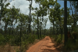 Apudthama National Park
 -
 Fruit Bat Falls


See also
editReferences
edit- ^ Hema, Maps (2007). Australia Road and 4WD Atlas (Map). Eight Mile Plains Queensland: Hema Maps. p. 104. ISBN 978-1-86500-456-3.
- ^ Qld. Govt. Department of National Parks - Jardine River
- ^ Hinchliffe, Joe (7 September 2022). "'New era': more than 360,000 hectares of Queensland's Cape York returned to traditional owners". the Guardian. Retrieved 4 October 2022.
- ^ Queensland Government (9 September 2022). "Park alert: Apudthama National Park (CYPAL)".
- ^ "Wuthathi Tumra Region - Schedule 2" (PDF). June 2008. Retrieved 5 February 2022.
- ^ a b c d e f g h i j Lavarack, P. S. (Peter S.); Stanton, J. P. (James Peter), 1940- (1976), Vegetation of the Jardine River catchment and adjacent coastal areas, the Royal Society of Queensland, pp. 39–48
{{citation}}: CS1 maint: multiple names: authors list (link) CS1 maint: numeric names: authors list (link)
External links
edit- Trek Earth Image of Fruit Bat Falls
- Trek Lens Image of Fruit Bat Falls
11°18′S 142°37′E / 11.30°S 142.62°E
This Queensland protected areas related article is a stub. You can help Wikipedia by expanding it. |
This Far North Queensland geography article is a stub. You can help Wikipedia by expanding it. |