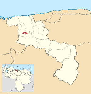
Francisco Linares Alcántara Municipality
The Francisco Linares Alcántara Municipality is one of the 18 municipalities (municipios) that makes up the Venezuelan state of Aragua and, according to the 2011 census by the National Institute of Statistics of Venezuela, the municipality has a population of 123,122.[1] The town of Santa Rita is the shire town of the Francisco Linares Alcántara Municipality.[2]
Francisco Linares Alcántara Municipality
Municipio Francisco Linares Alcántara | |
|---|---|
 Location in Aragua | |
| Coordinates: 10°12′30″N 67°32′30″W / 10.2083°N 67.5417°W | |
| Country | |
| State | Aragua |
| Municipal seat | Santa Rita |
| Government | |
| • Mayor | Raiza Márquez (PSUV) |
| Area | |
• Total | 18.6 km2 (7.2 sq mi) |
| Population (2011) | |
• Total | 123,122 |
| • Density | 6,600/km2 (17,000/sq mi) |
| Time zone | UTC−4 (VET) |
| Area code(s) | 0243 |
| Website | Official website |
Demographics
editThe Francisco Linares Alcántara Municipality, according to a 2007 population estimate by the National Institute of Statistics of Venezuela, has a population of 135,873 (up from 118,146 in 2000). This amounts to 8.2% of the state's population.[3] The municipality's population density is 5,661.38 inhabitants per square kilometre (14,662.9/sq mi).[4]
Government
editThe mayor of the Francisco Linares Alcántara Municipality is Raiza Márquez, elected on November 23, 2008, with 56% of the vote.[5] She replaced Hugo R. Peña A. shortly after the elections. The municipality is divided into three parishes; Capital Francisco Linares Alcántara, Francisco de Miranda (separated from Capital Francisco Linares Alcantara parish effective January 30, 1995), and Monseñor Feliciano González (separated from Francisco de Miranda parish effective December 16, 1997).[2]
See also
editReferences
edit- ^ "Archived copy". Archived from the original on 2016-03-15. Retrieved 2015-11-08.
{{cite web}}: CS1 maint: archived copy as title (link) - ^ a b http://www.ocei.gov.ve/secciones/division/Aragua.zip [permanent dead link]
- ^ http://www.ocei.gov.ve/sintesisestadistica/estados/aragua/cuadros/Poblacion5.xls [permanent dead link]
- ^ http://www.ocei.gov.ve/sintesisestadistica/estados/aragua/cuadros/Poblacion4.xls [permanent dead link]
- ^ "Divulgación Elecciones Regionales - 23 de Noviembre de 2008".
External links
edit- franciscolinaresalcantara-aragua.gob.ve (in Spanish)


