.svg)
.svg)
I'm afraid that I have to question this map. "Aridoamerica" is supposed to cover the desert or near-desert regions of Mexico and the Southwest U.S. that had significant pre-Columbian populations. The map shown encompasses large swaths of forested areas and even a great deal of swampland. The sources listed do not appear to explicitly define this region per se. You can look at the following for reference:
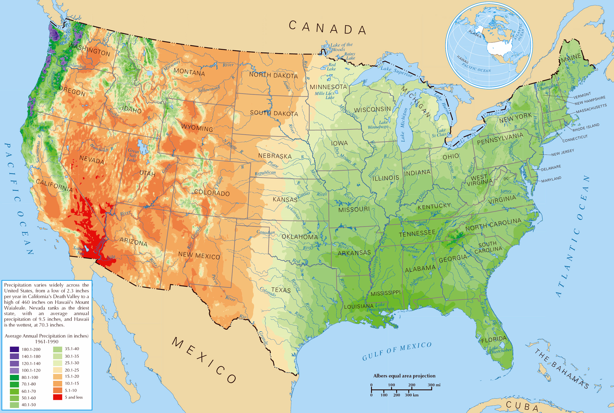
Precipitation Map
This shows that approximately 1/10 - 1/5 of the area shown on the map in the northeast cannot be classified in this way.
Is there any actual documentation that shows that anthropologists or geographers actually use the term in this way?
--MC
.svg&action=edit§ion=new)
.svg&oldid=575736034)