
Size of this preview: 800 × 529 pixels. Other resolutions: 320 × 212 pixels | 640 × 423 pixels | 1,024 × 677 pixels | 1,280 × 846 pixels | 2,560 × 1,692 pixels | 4,500 × 2,975 pixels.
Original file (4,500 × 2,975 pixels, file size: 18.7 MB, MIME type: image/png)
| This is a file from the Wikimedia Commons. Information from its description page there is shown below. Commons is a freely licensed media file repository. You can help. |
Summary
| Description |
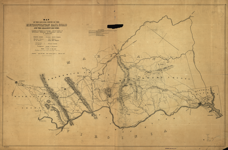
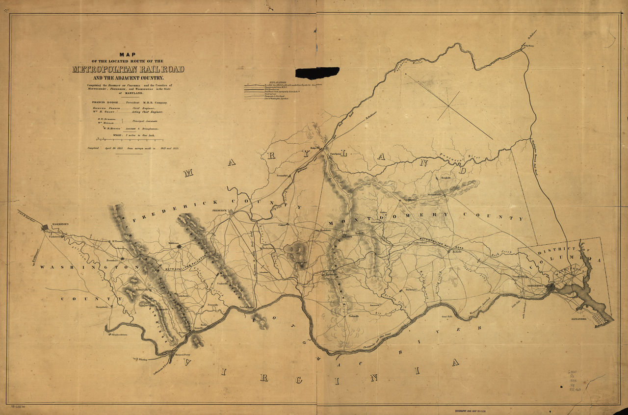
English: Map of the located route of the Metropolitan Rail Road and the adjacent country comprising the District of Columbia and the counties of Montgomery, Frederick, and Washington in the state of Maryland, Francis Dodge president M.R.R. Company, Edmund French, chief engineer, W. R. Hutton draughtsman, completed April 30, 1855 from surveys made in 1853 and 1854. |
||
| Date | |||
| Source |
|
||
| Author | William Rich Hutton (1826-1901) |

Licensing
|
The author died in 1901, so this work is in the public domain in its country of origin and other countries and areas where the copyright term is the author's life plus 100 years or fewer. This work is in the public domain in the United States because it was published (or registered with the U.S. Copyright Office) before January 1, 1929. | |
| This file has been identified as being free of known restrictions under copyright law, including all related and neighboring rights. | |
File history
Click on a date/time to view the file as it appeared at that time.
| Date/Time | Thumbnail | Dimensions | User | Comment | |
|---|---|---|---|---|---|
| current | 05:15, 19 April 2009 | | 4,500 × 2,975 (18.7 MB) | PKM | Higher res image of Library of Congress |
| 05:06, 19 April 2009 |  | 5,664 × 3,744 (31.12 MB) | PKM | Higher-res image from Library of Congress | |
| 01:34, 19 April 2009 |  | 3,794 × 2,508 (15.39 MB) | PKM | {{Information |Description=Map of the located route of the Metropolitan Rail Road and the adjacent country comprising the District of Columbia and the counties of Montgomery, Frederick, and Washington in the state of Maryland, Francis Dodge president M.R. |
File usage
The following pages on the English Wikipedia use this file (pages on other projects are not listed):