
Size of this PNG preview of this SVG file: 565 × 600 pixels. Other resolutions: 226 × 240 pixels | 452 × 480 pixels | 723 × 768 pixels | 964 × 1,024 pixels | 1,929 × 2,048 pixels | 1,651 × 1,753 pixels.
Original file (SVG file, nominally 1,651 × 1,753 pixels, file size: 430 KB)
| This is a file from the Wikimedia Commons. Information from its description page there is shown below. Commons is a freely licensed media file repository. You can help. |
Summary
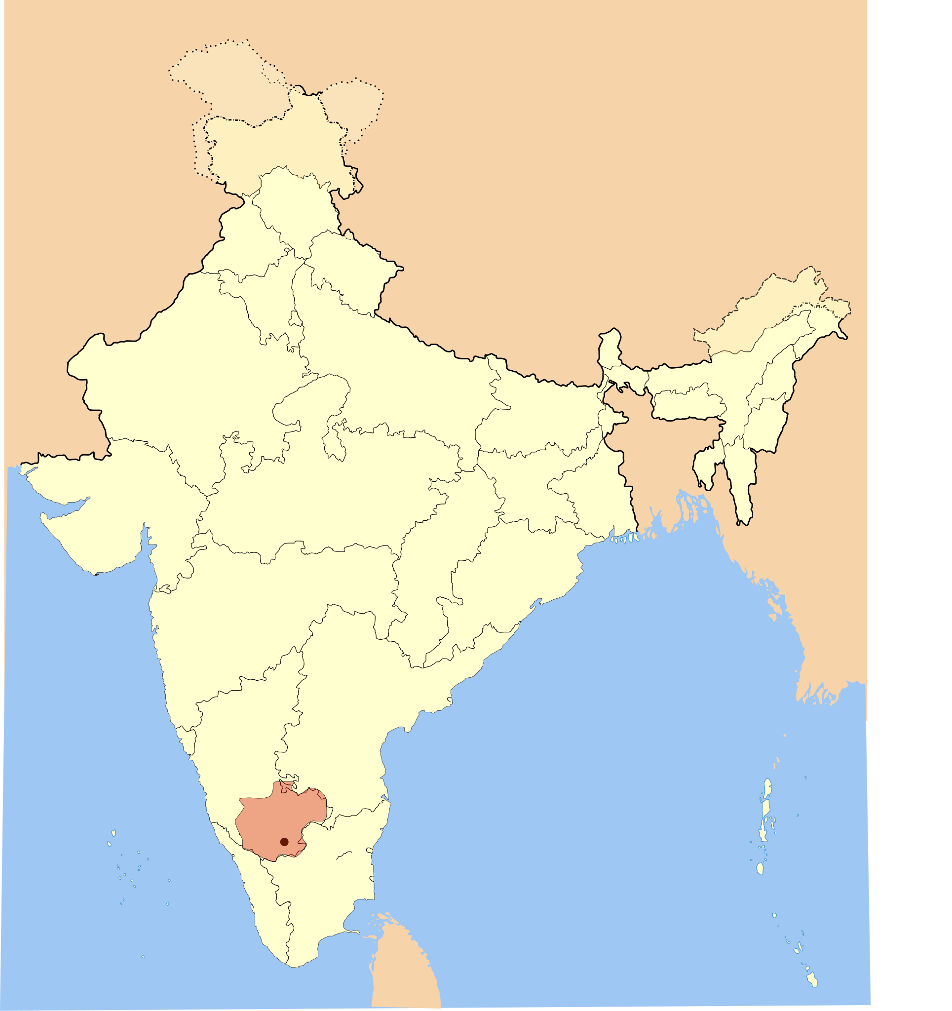
I used Image:India-locator-map-blank.svg as base and edited myself using inkspace and created it by looking at the following sources.
- Malini Adiga (2006), The Making of Southern Karnataka: Society, Polity and Culture in the early medieval period, AD 400-1030, Orient Longman, Chennai, , ISBN 81 250 2912 5 , p121
- Dr. Suryanath U. Kamath, A Concise history of Karnataka from pre-historic times to the present, Jupiter books, MCC, 2001 (Reprinted 2002) (page no - 329)
The Gangadomains map pertains to the "Western Ganga Dynasty" (Western Gangas). The double shaded region was under the control of their feudatories in 1st version. I deleted the double shade to avoid confusion and internalisation overhead in 2nd picture.
| Description | Western Ganga Empire Map |
| Date | |
| Source | Own work |
| Author | Mlpkr |
Licensing
I, the copyright holder of this work, hereby publish it under the following licenses:

|
Permission is granted to copy, distribute and/or modify this document under the terms of the GNU Free Documentation License, Version 1.2 or any later version published by the Free Software Foundation; with no Invariant Sections, no Front-Cover Texts, and no Back-Cover Texts. A copy of the license is included in the section entitled GNU Free Documentation License. |
| This file is licensed under the Creative Commons Attribution-Share Alike 3.0 Unported license. | ||
| ||
| This licensing tag was added to this file as part of the GFDL licensing update. |
This file is licensed under the Creative Commons Attribution-Share Alike 2.5 Generic, 2.0 Generic and 1.0 Generic license.
- You are free:
- to share – to copy, distribute and transmit the work
- to remix – to adapt the work
- Under the following conditions:
- attribution – You must give appropriate credit, provide a link to the license, and indicate if changes were made. You may do so in any reasonable manner, but not in any way that suggests the licensor endorses you or your use.
- share alike – If you remix, transform, or build upon the material, you must distribute your contributions under the same or compatible license as the original.
You may select the license of your choice.
File history
Click on a date/time to view the file as it appeared at that time.
| Date/Time | Thumbnail | Dimensions | User | Comment | |
|---|---|---|---|---|---|
| current | 00:40, 28 May 2007 | | 1,651 × 1,753 (430 KB) | Mlpkr | I used Image:India-locator-map-blank.svg as base and edited myself using inkspace and created it by looking at the following sources. * Malini Adiga (2006), The Making of Southern Karnataka: Society, Polity and Culture in the early medieval period, |
| 00:16, 28 May 2007 |  | 1,651 × 1,753 (431 KB) | Mlpkr | I used Image:India-locator-map-blank.svg as base and edited myself using inkspace and created it by looking at the following sources. * Malini Adiga (2006), The Making of Southern Karnataka: Society, Polity and Culture in the early medieval period, |
File usage
The following pages on the English Wikipedia use this file (pages on other projects are not listed):
Global file usage
The following other wikis use this file:
- Usage on ar.wikipedia.org
- Usage on azb.wikipedia.org
- Usage on bn.wikipedia.org
- Usage on ca.wikipedia.org
- Usage on es.wikipedia.org
- Usage on fa.wikipedia.org
- Usage on fr.wikipedia.org
- Usage on hi.wikipedia.org
- Usage on hu.wikipedia.org
- Usage on id.wikipedia.org
- Usage on it.wikipedia.org
- Usage on ka.wikipedia.org
- Usage on kn.wikipedia.org
- Usage on ko.wikipedia.org
- Usage on lt.wikipedia.org
- Usage on ml.wikipedia.org
- Usage on ne.wikipedia.org
- Usage on pnb.wikipedia.org
- Usage on pt.wikipedia.org
- Usage on ru.wikipedia.org
- Usage on sh.wikipedia.org
- Usage on ta.wikipedia.org
- Usage on tr.wikipedia.org
- Usage on uk.wikipedia.org
- Usage on ur.wikipedia.org
- Usage on www.wikidata.org
- Usage on zh.wikipedia.org