Size of this preview: 514 × 599 pixels. Other resolutions: 206 × 240 pixels | 411 × 480 pixels | 884 × 1,031 pixels.
Original file (884 × 1,031 pixels, file size: 160 KB, MIME type: image/png)
| This is a file from the Wikimedia Commons. Information from its description page there is shown below. Commons is a freely licensed media file repository. You can help. |
Summary
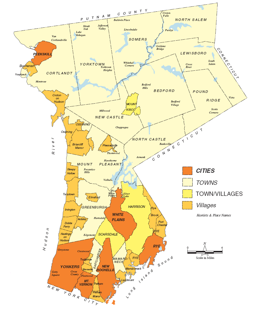
| Description | This map of the municipalities in Westchester County is an enhancement (created by me) of the original provided on the county website. |
| Date | |
| Source | westchestergov.com - county website |
| Author | Westyschuster |
| Other versions | Derivative works of this file: Northern-southern Westchester proposed boundary for NRHP lists.PNG |
Licensing
| I, the copyright holder of this work, release this work into the public domain. This applies worldwide. In some countries this may not be legally possible; if so: I grant anyone the right to use this work for any purpose, without any conditions, unless such conditions are required by law. |
File history
Click on a date/time to view the file as it appeared at that time.
| Date/Time | Thumbnail | Dimensions | User | Comment | |
|---|---|---|---|---|---|
| current | 10:43, 8 December 2008 | | 884 × 1,031 (160 KB) | Westyschuster | {{Information |Description= This map of the municipalities in Westchester County is an enhancement (created by me) of the original provided on the county website. |Source=westchestergov.com - county website |Date=December 8, 2008 |Author=Westyschuster |Pe |
File usage
No pages on the English Wikipedia use this file (pages on other projects are not listed).
Global file usage
The following other wikis use this file:
- Usage on de.wikipedia.org