Size of this preview: 449 × 600 pixels. Other resolutions: 179 × 240 pixels | 479 × 640 pixels.
Original file (479 × 640 pixels, file size: 130 KB, MIME type: image/jpeg)
| This is a file from the Wikimedia Commons. Information from its description page there is shown below. Commons is a freely licensed media file repository. You can help. |
Summary
| Description |
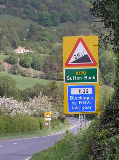
English: Warning signs on the approach to Sutton Bank The A170 climbs to the North York Moors plateau by this route and it is very steep for an A road.
Caravans are banned and as the sign indicates, HGVs are likely to have problems especially at the hairpin bend halfway up. |
| Date | |
| Source | From geograph.org.uk |
| Author | colin grice |
| Camera location | | View this and other nearby images on: OpenStreetMap |
|---|
_heading:90.00&language=en)
| Object location | | View this and other nearby images on: OpenStreetMap |
|---|
_heading:90.00&language=en)
Licensing

|
This image was taken from the Geograph project collection. See this photograph's page on the Geograph website for the photographer's contact details. The copyright on this image is owned by colin grice and is licensed for reuse under the Creative Commons Attribution-ShareAlike 2.0 license.
|
This file is licensed under the Creative Commons Attribution-Share Alike 2.0 Generic license.
Attribution: colin grice
- You are free:
- to share – to copy, distribute and transmit the work
- to remix – to adapt the work
- Under the following conditions:
- attribution – You must give appropriate credit, provide a link to the license, and indicate if changes were made. You may do so in any reasonable manner, but not in any way that suggests the licensor endorses you or your use.
- share alike – If you remix, transform, or build upon the material, you must distribute your contributions under the same or compatible license as the original.
File history
Click on a date/time to view the file as it appeared at that time.
| Date/Time | Thumbnail | Dimensions | User | Comment | |
|---|---|---|---|---|---|
| current | 10:18, 20 February 2011 | | 479 × 640 (130 KB) | GeographBot | == {{int:filedesc}} == {{Information |description={{en|1=Warning signs on the approach to Sutton Bank The A170 climbs to the North Yorkshire Moors plateau by this route and it is very steep for an A road. Caravans are banned and as the sign indicates, HG |
File usage
The following pages on the English Wikipedia use this file (pages on other projects are not listed):