No higher resolution available.
Waldseemuller_map_closeup_with_Catigara_and_Mallaqua.jpg (625 × 477 pixels, file size: 70 KB, MIME type: image/jpeg)
Summary edit
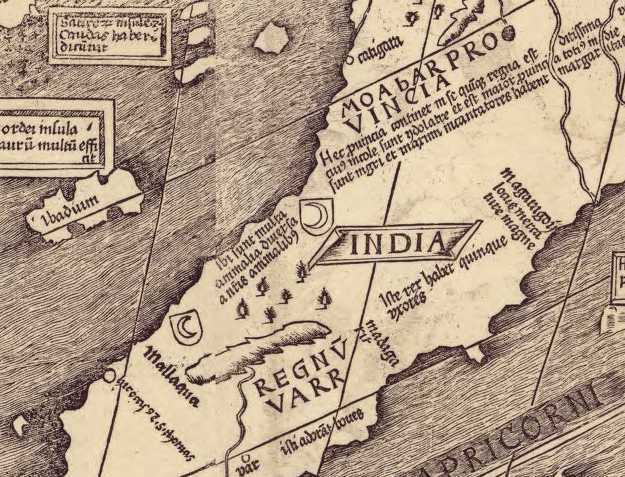
Image:Waldseemuller map closeup with Catigara and Mallaqua.jpg|thumb|350px|Detail of the map showing the names "Catigara" and "Mallaqua".
| Description |
Closeup of the Martin Waldseemüller map showing the names "Catigara" and "Mallaqua". |
|---|---|
| Source |
Library of Congress, [1] |
| Date |
original map: 1507 |
| Author |
Martin Waldseemüller |
| Permission (Reusing this file) |
reproduction of public domain work (due to age)
|
Licensing edit
| This image is in the public domain in the United States because it was first published outside the United States prior to January 1, 1929. Other jurisdictions have other rules. Also note that this image may not be in the public domain in the 9th Circuit if it was first published on or after July 1, 1909 in noncompliance with US formalities, unless the author is known to have died in 1953 or earlier (more than 70 years ago) or the work was created in 1903 or earlier (more than 120 years ago.)[2] |
This file is believed to be out of copyright in its home country, as well as the US. If this is confirmed when checked, it should be copied to Wikimedia Commons.
File history
Click on a date/time to view the file as it appeared at that time.
| Date/Time | Thumbnail | Dimensions | User | Comment | |
|---|---|---|---|---|---|
| current | 00:00, 27 September 2010 | | 625 × 477 (70 KB) | Kattigara (talk | contribs) | Image:Waldseemuller map closeup with Catigara and Mallaqua.jpg|thumb|350px|Detail of the map showing the names "Catigara" and "Mallaqua". |
You cannot overwrite this file.
File usage
The following pages on the English Wikipedia use this file (pages on other projects are not listed):