Size of this preview: 800 × 523 pixels. Other resolutions: 320 × 209 pixels | 640 × 418 pixels | 1,024 × 669 pixels | 1,280 × 836 pixels.
Original file (1,280 × 836 pixels, file size: 365 KB, MIME type: image/jpeg)
| This is a file from the Wikimedia Commons. Information from its description page there is shown below. Commons is a freely licensed media file repository. You can help. |
Summary
| Description |
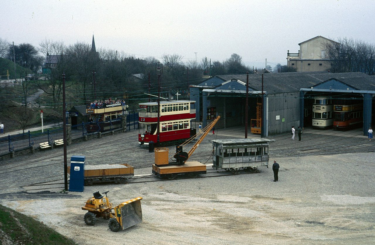
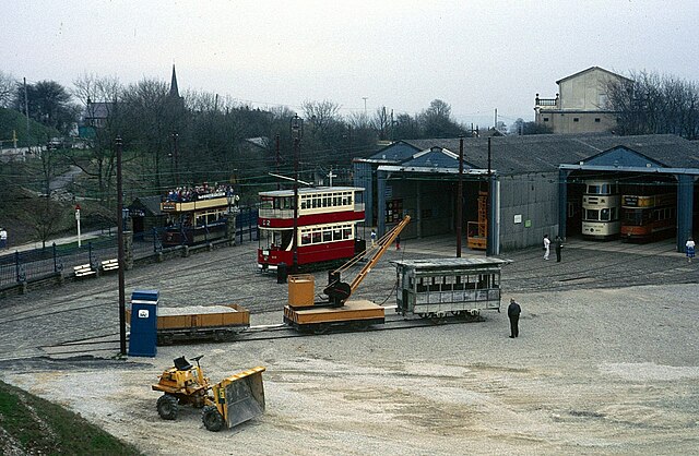
English: View of the tram depot at the National Tramway Museum in Crich, Derbyshire, UK. The view is from the picnic area and in the foreground the area is clear for the construction of the new Exhibition Hall. On the siding can be seen the unnumbered former London Tramways Company horse car found at Curry Rivel. |
| Date | Taken in May 1986 |
| Source | From geograph.org.uk |
| Author | Alan Murray-Rust |
| Permission (Reusing this file) |
Creative Commons Attribution Share-alike license 2.0 |
| Other versions | |
| Attribution (required by the license) | Alan Murray-Rust / View of the depots from the picnic area / |
_cropped.jpg)
.jpg)
.jpg&action=edit&redlink=1)
.jpg)
| Camera location | | View this and other nearby images on: OpenStreetMap |
|---|
.jpg¶ms=053.091197_N_-001.487496_E_globe:Earth_type:camera_source:geograph-osgb36(SK34425501)_heading:135.00&language=en)
| Object location | | View this and other nearby images on: OpenStreetMap |
|---|
.jpg¶ms=053.091010_N_-001.487080_E_globe:Earth_class:object_type:object_source:geograph-osgb36(SK3444854989)_heading:135.00&language=en)
Licensing

|
This image was taken from the Geograph project collection. See this photograph's page on the Geograph website for the photographer's contact details. The copyright on this image is owned by Alan Murray-Rust and is licensed for reuse under the Creative Commons Attribution-ShareAlike 2.0 license.
|
This file is licensed under the Creative Commons Attribution-Share Alike 2.0 Generic license.
Attribution: Alan Murray-Rust
- You are free:
- to share – to copy, distribute and transmit the work
- to remix – to adapt the work
- Under the following conditions:
- attribution – You must give appropriate credit, provide a link to the license, and indicate if changes were made. You may do so in any reasonable manner, but not in any way that suggests the licensor endorses you or your use.
- share alike – If you remix, transform, or build upon the material, you must distribute your contributions under the same or compatible license as the original.
File history
Click on a date/time to view the file as it appeared at that time.
| Date/Time | Thumbnail | Dimensions | User | Comment | |
|---|---|---|---|---|---|
| current | 10:12, 27 March 2024 | | 1,280 × 836 (365 KB) | Chris j wood | == {{int:filedesc}} == {{Information |Description={{en|1=View of the depots from the picnic area}} |Source=From [https://www.geograph.org.uk/photo/6541273 geograph.org.uk] |Date=1986-05 |Author=[https://www.geograph.org.uk/profile/9181 Alan Murray-Rust] |Permission=Creative Commons Attribution Share-alike license 2.0 |Other fields={{Credit line |Author=Alan Murray-Rust |License=[https://creativecommons.org/licenses/by-sa/2.0/ CC BY-SA 2.0] |Other=''View of the depots from the picnic area''... |
File usage
No pages on the English Wikipedia use this file (pages on other projects are not listed).
.jpg)