No higher resolution available.
View_from_Gad_Cliff_towards_Tyneham_Cap_-_geograph.org.uk_-_645107.jpg (640 × 480 pixels, file size: 105 KB, MIME type: image/jpeg)
| This is a file from the Wikimedia Commons. Information from its description page there is shown below. Commons is a freely licensed media file repository. You can help. |
Summary
| Description |
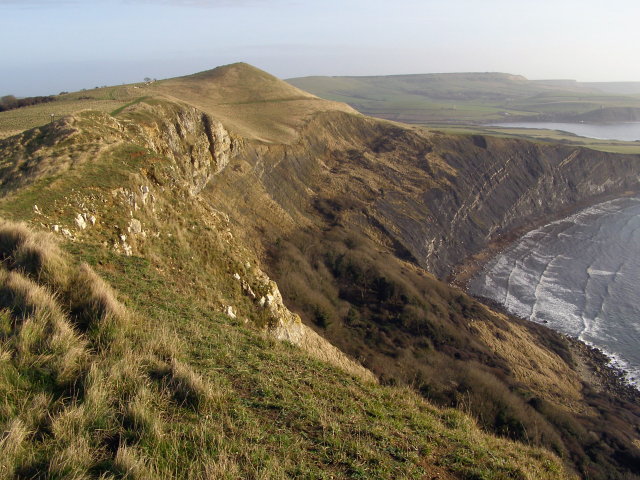
English: View from Gad Cliff towards Tyneham Cap Looking east from the top of Gad Cliff towards Tyneham Cap - the prominence left of centre. To the right is Brandy Bay, and beyond Kimmeridge Bay. The rock succession through the cliffs, starting at the bottom, is: Kimmeridge Clay, Portland Sand then Portland Stone. The undercliff is inaccessible to the public as it is part of the Lulworth Ranges "danger area". |
| Date | |
| Source | From geograph.org.uk |
| Author | Jim Champion |
| Attribution (required by the license) | Jim Champion / View from Gad Cliff towards Tyneham Cap / |
| Camera location | | View this and other nearby images on: OpenStreetMap |
|---|
_heading:90.00&language=en)
| Object location | | View this and other nearby images on: OpenStreetMap |
|---|
_heading:90.00&language=en)
Licensing

|
This image was taken from the Geograph project collection. See this photograph's page on the Geograph website for the photographer's contact details. The copyright on this image is owned by Jim Champion and is licensed for reuse under the Creative Commons Attribution-ShareAlike 2.0 license.
|
This file is licensed under the Creative Commons Attribution-Share Alike 2.0 Generic license.
Attribution: Jim Champion
- You are free:
- to share – to copy, distribute and transmit the work
- to remix – to adapt the work
- Under the following conditions:
- attribution – You must give appropriate credit, provide a link to the license, and indicate if changes were made. You may do so in any reasonable manner, but not in any way that suggests the licensor endorses you or your use.
- share alike – If you remix, transform, or build upon the material, you must distribute your contributions under the same or compatible license as the original.
File history
Click on a date/time to view the file as it appeared at that time.
| Date/Time | Thumbnail | Dimensions | User | Comment | |
|---|---|---|---|---|---|
| current | 20:00, 11 March 2011 | | 640 × 480 (105 KB) | GeographBot | == {{int:filedesc}} == {{Information |description={{en|1=View from Gad Cliff towards Tyneham Cap Looking east from the top of Gad Cliff towards Tyneham Cap - the prominence left of centre. To the right is Brandy Bay, and beyond Kimmeridge Bay. The rock su |
File usage
The following pages on the English Wikipedia use this file (pages on other projects are not listed):
Global file usage
The following other wikis use this file:
- Usage on www.wikidata.org