.jpg)
.jpg&action=edit&redlink=1)

Original file (4,000 × 3,000 pixels, file size: 2.38 MB, MIME type: image/jpeg)
| This is a file from the Wikimedia Commons. Information from its description page there is shown below. Commons is a freely licensed media file repository. You can help. |
.jpg)
Summary
| Description |
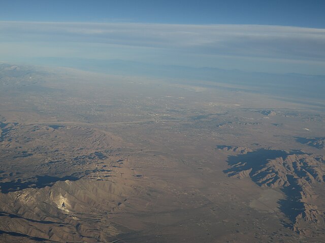
Victor Valley is a subregion of Southern California, north of the San Bernardino Mountains in the Mojave Desert. It is located in San Bernardino County and situated east of the Antelope Valley and north of the Cucamonga Valley. The Victor Valley is part of the Inland Empire subregion of the Greater Los Angeles Area. Out of 4 incorporated cities, the largest one is Victorville. The Victor Valley contains only 4 incorporated towns and cities, but has 15 unincorporated communities. Adding the population of them all, the Victor Valley is about the same size as the city of Oakland. The Victor Valley has an estimated population of 390,000. The densest human population is in a 10-mile radius from Victorville in a rural desert region. en.wikipedia.org/wiki/Victor_Valley en.wikipedia.org/wiki/Wikipedia:Text_of_Creative_Commons_... |
| Date | |
| Source | Victor Valley, California |
| Author | Ken Lund from Reno, Nevada, USA |
| Camera location | | View this and other nearby images on: OpenStreetMap |
|---|
.jpg¶ms=034.485495_N_-117.335349_E_globe:Earth_type:camera_source:Flickr_&language=en)
Licensing
- You are free:
- to share – to copy, distribute and transmit the work
- to remix – to adapt the work
- Under the following conditions:
- attribution – You must give appropriate credit, provide a link to the license, and indicate if changes were made. You may do so in any reasonable manner, but not in any way that suggests the licensor endorses you or your use.
- share alike – If you remix, transform, or build upon the material, you must distribute your contributions under the same or compatible license as the original.
| This image was originally posted to Flickr by Ken Lund at https://flickr.com/photos/75683070@N00/14331131328. It was reviewed on 4 December 2015 by FlickreviewR and was confirmed to be licensed under the terms of the cc-by-sa-2.0. |
File history
Click on a date/time to view the file as it appeared at that time.
| Date/Time | Thumbnail | Dimensions | User | Comment | |
|---|---|---|---|---|---|
| current | 03:57, 4 December 2015 | | 4,000 × 3,000 (2.38 MB) | INeverCry | Transferred from Flickr via Flickr2Commons |
File usage
Global file usage
The following other wikis use this file:
- Usage on www.wikidata.org
.jpg)