
Size of this preview: 440 × 600 pixels. Other resolutions: 176 × 240 pixels | 352 × 480 pixels | 563 × 768 pixels | 751 × 1,024 pixels | 1,511 × 2,060 pixels.
Original file (1,511 × 2,060 pixels, file size: 410 KB, MIME type: image/png)
| This is a file from the Wikimedia Commons. Information from its description page there is shown below. Commons is a freely licensed media file repository. You can help. |
Summary
| Description |
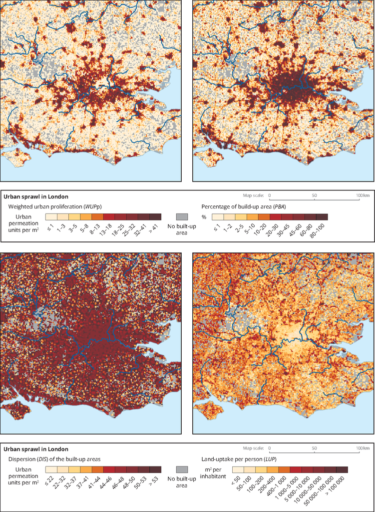
English: Urban sprawl in London at the 1-km2 scale in 2009 for: Weighted urban proliferation (WUPp), Percentage of build-up area (PBA), Dispersion (DIS) of the built-up areas and Land-uptake per person (LUP) |
| Date | |
| Source | https://www.eea.europa.eu/data-and-maps/figures/urban-sprawl-in-london-for#tab-metadata |
| Author | European Environment Agency (EEA) |
Licensing

|
The copyright holder of this file allows anyone to use it for any purpose, provided that the copyright holder is properly attributed. Redistribution, derivative work, commercial use, and all other use is permitted. |
|
|
EEA (European Environment Agency)
File history
Click on a date/time to view the file as it appeared at that time.
| Date/Time | Thumbnail | Dimensions | User | Comment | |
|---|---|---|---|---|---|
| current | 09:45, 19 May 2019 | | 1,511 × 2,060 (410 KB) | PJ Geest | User created page with UploadWizard |
File usage
The following pages on the English Wikipedia use this file (pages on other projects are not listed):