No higher resolution available.
Ukraine_Map_CIA_20201118.jpg (635 × 324 pixels, file size: 56 KB, MIME type: image/jpeg)
| This is a file from the Wikimedia Commons. Information from its description page there is shown below. Commons is a freely licensed media file repository. You can help. |
Summary
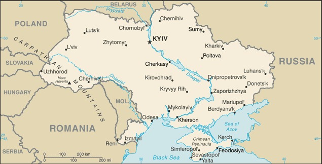
| Description |
English: Map of Ukraine, November 2020 |
| Date | |
| Source | https://www.cia.gov/library/publications/the-world-factbook/geos/up.html |
| Author | US Central Intelligence Agency |
Licensing
This image is in the public domain because it contains materials that originally came from the United States Central Intelligence Agency's World Factbook.
|
 |
File history
Click on a date/time to view the file as it appeared at that time.
| Date/Time | Thumbnail | Dimensions | User | Comment | |
|---|---|---|---|---|---|
| current | 02:20, 23 November 2020 | | 635 × 324 (56 KB) | Mzajac | Uploaded a work by US Central Intelligence Agency from https://www.cia.gov/library/publications/the-world-factbook/geos/up.html with UploadWizard |
File usage
The following pages on the English Wikipedia use this file (pages on other projects are not listed):
Global file usage
The following other wikis use this file:
- Usage on bn.wikipedia.org
- Usage on ha.wikipedia.org
- Usage on he.wikipedia.org
- Usage on hi.wikipedia.org
- Usage on hu.wikipedia.org
- Usage on incubator.wikimedia.org
- Usage on mni.wikipedia.org
- Usage on nl.wikipedia.org
- Usage on pt.wikipedia.org
- Usage on tr.wikipedia.org
- Usage on uz.wikipedia.org