Size of this preview: 800 × 540 pixels. Other resolutions: 320 × 216 pixels | 640 × 432 pixels | 1,024 × 691 pixels | 1,476 × 996 pixels.
Original file (1,476 × 996 pixels, file size: 559 KB, MIME type: image/jpeg)
| This is a file from the Wikimedia Commons. Information from its description page there is shown below. Commons is a freely licensed media file repository. You can help. |
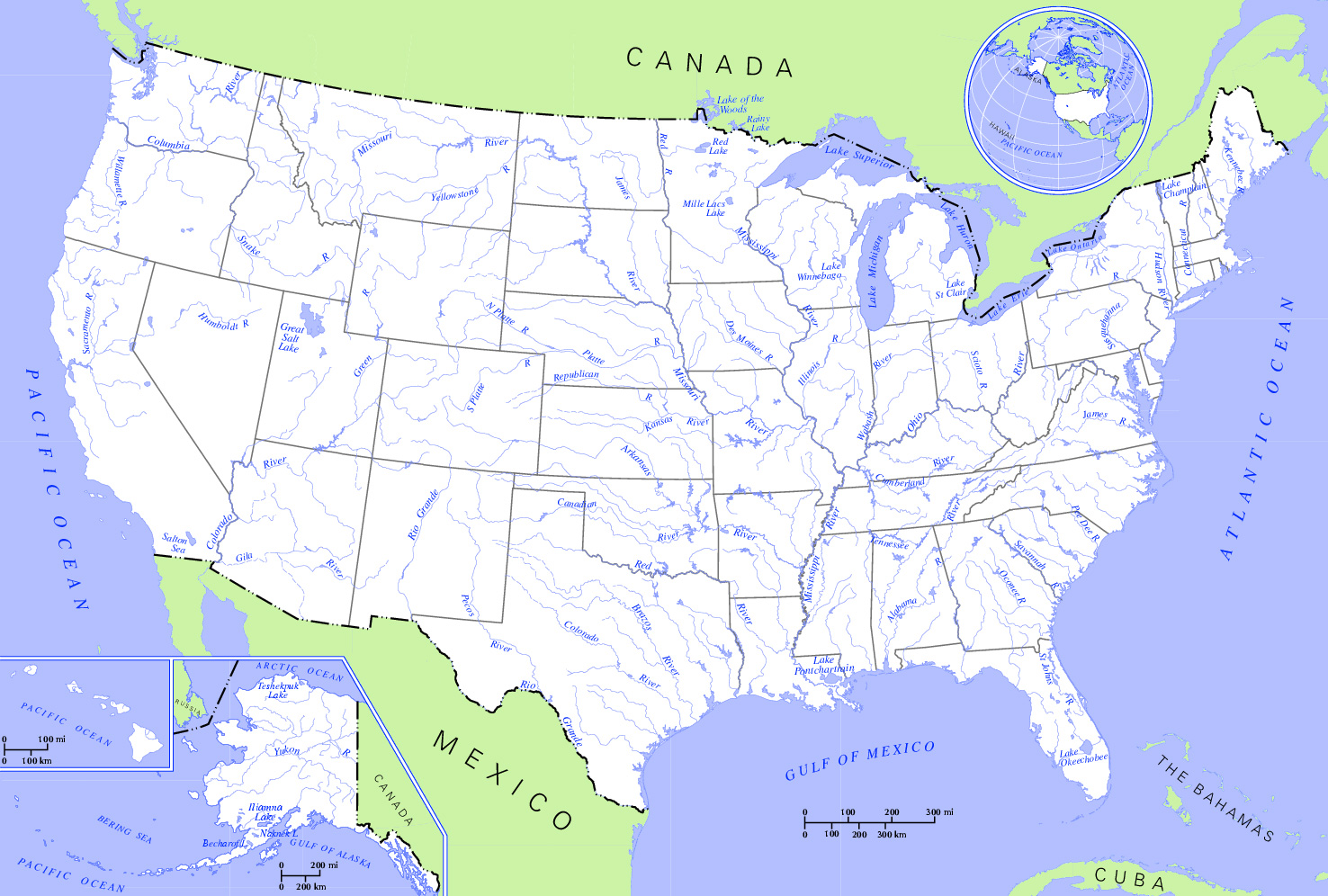
| Description | Rivers and Lakes in the United States. * Author: US Department of Interior * Source: http://nationalatlas.gov, there also available as PDF |
| Date | (UTC) |
| Source | |
| Author | US Department of Interior |
| This is a retouched picture, which means that it has been digitally altered from its original version. Modifications: Changed hue to increase contrast and cropped the map. The original can be viewed here: US map - rivers and lakes.png:
|
This map was obtained from an edition of the National Atlas of the United States. Like almost all works of the U.S. federal government, works from the National Atlas are in the public domain in the United States.
Online access: NationalAtlas.gov | 1970 print edition: Library of Congress, Perry-Castañeda Library
|
Original upload log
This image is a derivative work of the following images:
- File:US_map_-_rivers_and_lakes.png licensed with PD-USGov
- 2004-11-12T15:11:08Z Duesentrieb 1584x1224 (308269 Bytes) Rivers and lakes in the US; Dept. of Interior, Public Domain
Uploaded with derivativeFX
File history
Click on a date/time to view the file as it appeared at that time.
| Date/Time | Thumbnail | Dimensions | User | Comment | |
|---|---|---|---|---|---|
| current | 21:12, 2 January 2009 | | 1,476 × 996 (559 KB) | Monfornot | {{Information |Description=Rivers and Lakes in the United States. * '''Author:''' US Department of Interior * '''Source:''' http://nationalatlas.gov, there also available as PDF |Source=*File:US_map_-_rivers_and_lakes.png |Date=2009-01-02 21:0 |
File usage
The following pages on the English Wikipedia use this file (pages on other projects are not listed):
Global file usage
The following other wikis use this file:
- Usage on az.wikipedia.org
- Usage on be.wikipedia.org
- Usage on bg.wikipedia.org
- Usage on hy.wikipedia.org
- Usage on ru.wikipedia.org