
Size of this preview: 563 × 599 pixels. Other resolutions: 225 × 240 pixels | 451 × 480 pixels | 721 × 768 pixels | 962 × 1,024 pixels | 1,923 × 2,048 pixels | 2,840 × 3,024 pixels.
Original file (2,840 × 3,024 pixels, file size: 2.13 MB, MIME type: image/jpeg)
| This is a file from the Wikimedia Commons. Information from its description page there is shown below. Commons is a freely licensed media file repository. You can help. |
Summary
| Description |
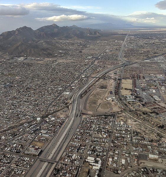
English: US Highway 54 in El Paso, aerial view from over the US–Mexico border. The old route of Highway 54, Dyer Street, is visible just left of the modern route, also known in El Paso as the North–South Freeway. |
| Date | |
| Source | Own work |
| Author | Dicklyon |
| Camera location | | View this and other nearby images on: OpenStreetMap |
|---|
Licensing
I, the copyright holder of this work, hereby publish it under the following license:
This file is licensed under the Creative Commons Attribution-Share Alike 4.0 International license.
- You are free:
- to share – to copy, distribute and transmit the work
- to remix – to adapt the work
- Under the following conditions:
- attribution – You must give appropriate credit, provide a link to the license, and indicate if changes were made. You may do so in any reasonable manner, but not in any way that suggests the licensor endorses you or your use.
- share alike – If you remix, transform, or build upon the material, you must distribute your contributions under the same or compatible license as the original.
File history
Click on a date/time to view the file as it appeared at that time.
| Date/Time | Thumbnail | Dimensions | User | Comment | |
|---|---|---|---|---|---|
| current | 05:23, 29 June 2020 | | 2,840 × 3,024 (2.13 MB) | Dicklyon | Uploaded own work with UploadWizard |
File usage
The following pages on the English Wikipedia use this file (pages on other projects are not listed):