
Size of this preview: 800 × 529 pixels. Other resolutions: 320 × 211 pixels | 640 × 423 pixels | 1,024 × 677 pixels | 1,500 × 991 pixels.
Original file (1,500 × 991 pixels, file size: 467 KB, MIME type: image/jpeg)
| This is a file from the Wikimedia Commons. Information from its description page there is shown below. Commons is a freely licensed media file repository. You can help. |
| Description |
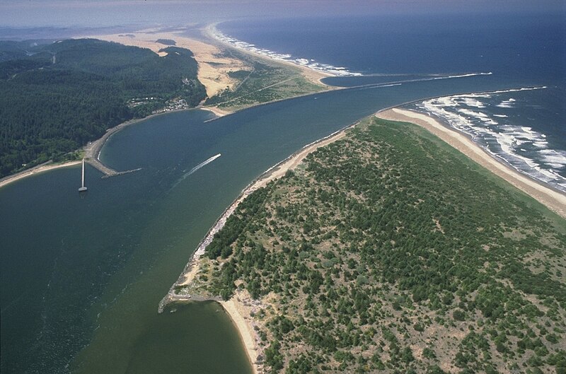
English: Aerial view of the mouth of the Umpqua River on the Pacific Ocean at Winchester Bay, Oregon, USA. |
|||
| Location | Winchester Bay, Oregon, USA 43°40′11.04″N 124°12′26.92″W / 43.6697333°N 124.2074778°W |
|||
| Date | ||||
| Source |
U.S. Army Corp of Engineers Digital Visual Library Digital Visual Library home page Image page Image description page |
|||
| Author | Bob Heims, U.S. Army Corps of Engineers | |||
| Permission (Reusing this file) |
|
File history
Click on a date/time to view the file as it appeared at that time.
| Date/Time | Thumbnail | Dimensions | User | Comment | |
|---|---|---|---|---|---|
| current | 03:07, 16 April 2007 | | 1,500 × 991 (467 KB) | DanMS | {{Information2 | Description = {{en|Aerial view of the mouth of the Coos River on the Pacific Ocean at Coos Bay, Oregon, USA.}} | Source = U.S. Army Corp of Engineers Digital Visual Library<br />[http://images.usace.army.mil/Main.html Digital Visual |
File usage
No pages on the English Wikipedia use this file (pages on other projects are not listed).
Global file usage
The following other wikis use this file:
- Usage on fr.wikipedia.org