Size of this preview: 790 × 599 pixels. Other resolutions: 316 × 240 pixels | 633 × 480 pixels | 1,012 × 768 pixels | 1,280 × 971 pixels | 2,560 × 1,943 pixels | 5,000 × 3,794 pixels.
Original file (5,000 × 3,794 pixels, file size: 4.32 MB, MIME type: image/jpeg)
| This is a file from the Wikimedia Commons. Information from its description page there is shown below. Commons is a freely licensed media file repository. You can help. |
Summary
| Description |
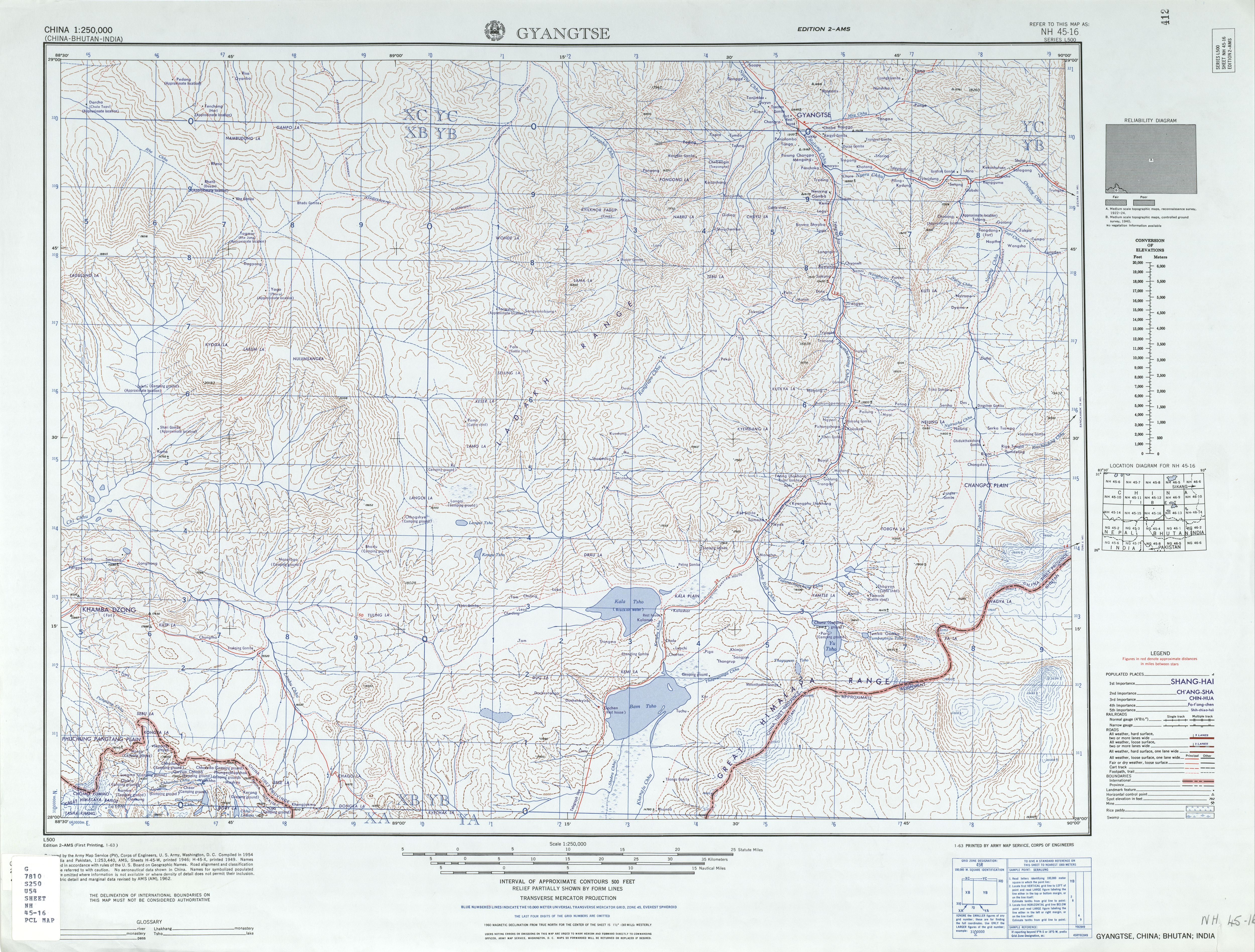
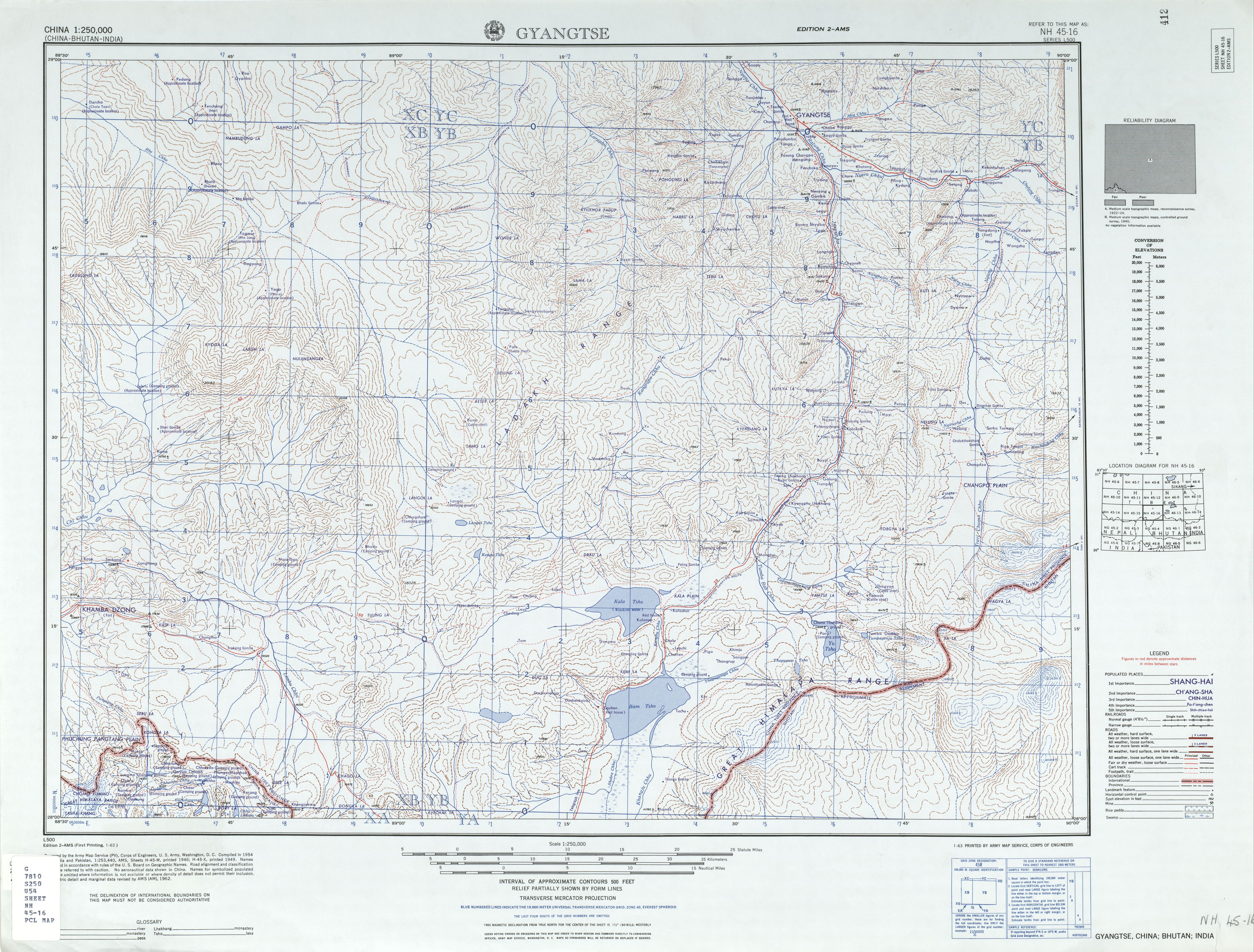
English: Map of Gyantse (Gyangtse) area, Tibet |
| Date |
Compiled: 1954 Printed: January 1963 |
| Source | http://legacy.lib.utexas.edu/maps/ams/china/txu-oclc-10552568-nh45-16.jpg (Archived https://archive.ph/sPeZs[]) |
| Author | Army Map Service (PV), Corps of Engineers, US Federal Government |
| Other versions |
|

-
 Index Map

Licensing
This image or file is a work of a U.S. Army Corps of Engineers soldier or employee, taken or made as part of that person's official duties. As a work of the U.S. federal government, the image is in the public domain.
|
| Annotations | This image is annotated: View the annotations at Commons |
File history
Click on a date/time to view the file as it appeared at that time.
| Date/Time | Thumbnail | Dimensions | User | Comment | |
|---|---|---|---|---|---|
| current | 05:49, 10 September 2019 | | 5,000 × 3,794 (4.32 MB) | Geographyinitiative | User created page with UploadWizard |
File usage
The following pages on the English Wikipedia use this file (pages on other projects are not listed):
Global file usage
The following other wikis use this file:
- Usage on en.wiktionary.org
- Usage on he.wikipedia.org
- Usage on it.wikipedia.org
- Usage on ru.wikipedia.org
- Usage on sl.wikipedia.org