Size of this preview: 525 × 600 pixels. Other resolutions: 210 × 240 pixels | 420 × 480 pixels | 672 × 768 pixels | 1,050 × 1,200 pixels.
Original file (1,050 × 1,200 pixels, file size: 239 KB, MIME type: image/gif)
| This is a file from the Wikimedia Commons. Information from its description page there is shown below. Commons is a freely licensed media file repository. You can help. |
Summary
| Description |
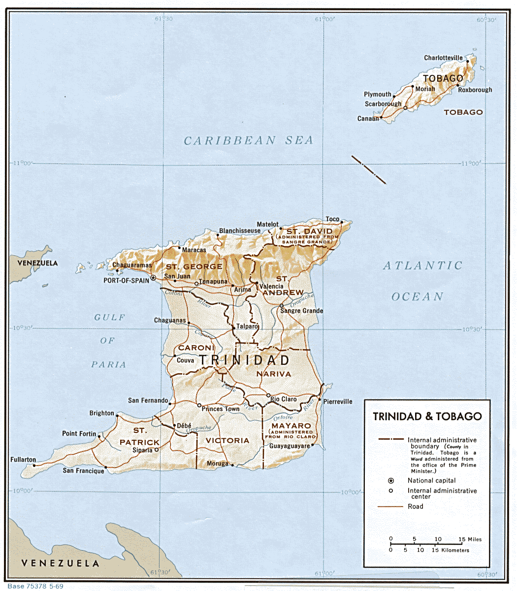
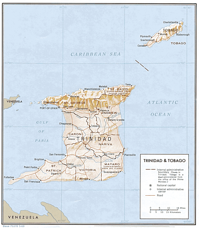
English: general map of Trinidad and Tobago, with old county boundaries |
| Date | |
| Source | http://www.lib.utexas.edu/maps/americas.html |
| Author | CIA |
Licensing
| This image is a work of a Central Intelligence Agency employee, taken or made as part of that person's official duties. As a Work of the United States Government, this image or media is in the public domain in the United States.
|

|
File history
Click on a date/time to view the file as it appeared at that time.
| Date/Time | Thumbnail | Dimensions | User | Comment | |
|---|---|---|---|---|---|
| current | 21:32, 8 December 2010 | | 1,050 × 1,200 (239 KB) | Ratzer | {{Information |Description={{en|1=general map of Trinidad and Tobago, with old county boundaries}} |Source=http://www.lib.utexas.edu/maps/americas.html |Author=CIA |Date=1969 |Permission= |other_versions= }} Category:Maps of Trinidad and Tobago |
File usage
The following pages on the English Wikipedia use this file (pages on other projects are not listed):
Global file usage
The following other wikis use this file:
- Usage on de.wikipedia.org
- Usage on el.wikipedia.org
- Usage on es.wikipedia.org
- Usage on fa.wikipedia.org
- Usage on it.wikipedia.org