
Size of this preview: 545 × 599 pixels. Other resolutions: 218 × 240 pixels | 436 × 480 pixels | 698 × 768 pixels | 931 × 1,024 pixels | 2,328 × 2,560 pixels.
Original file (2,328 × 2,560 pixels, file size: 594 KB, MIME type: image/jpeg)
| This is a file from the Wikimedia Commons. Information from its description page there is shown below. Commons is a freely licensed media file repository. You can help. |
Summary
| Description |
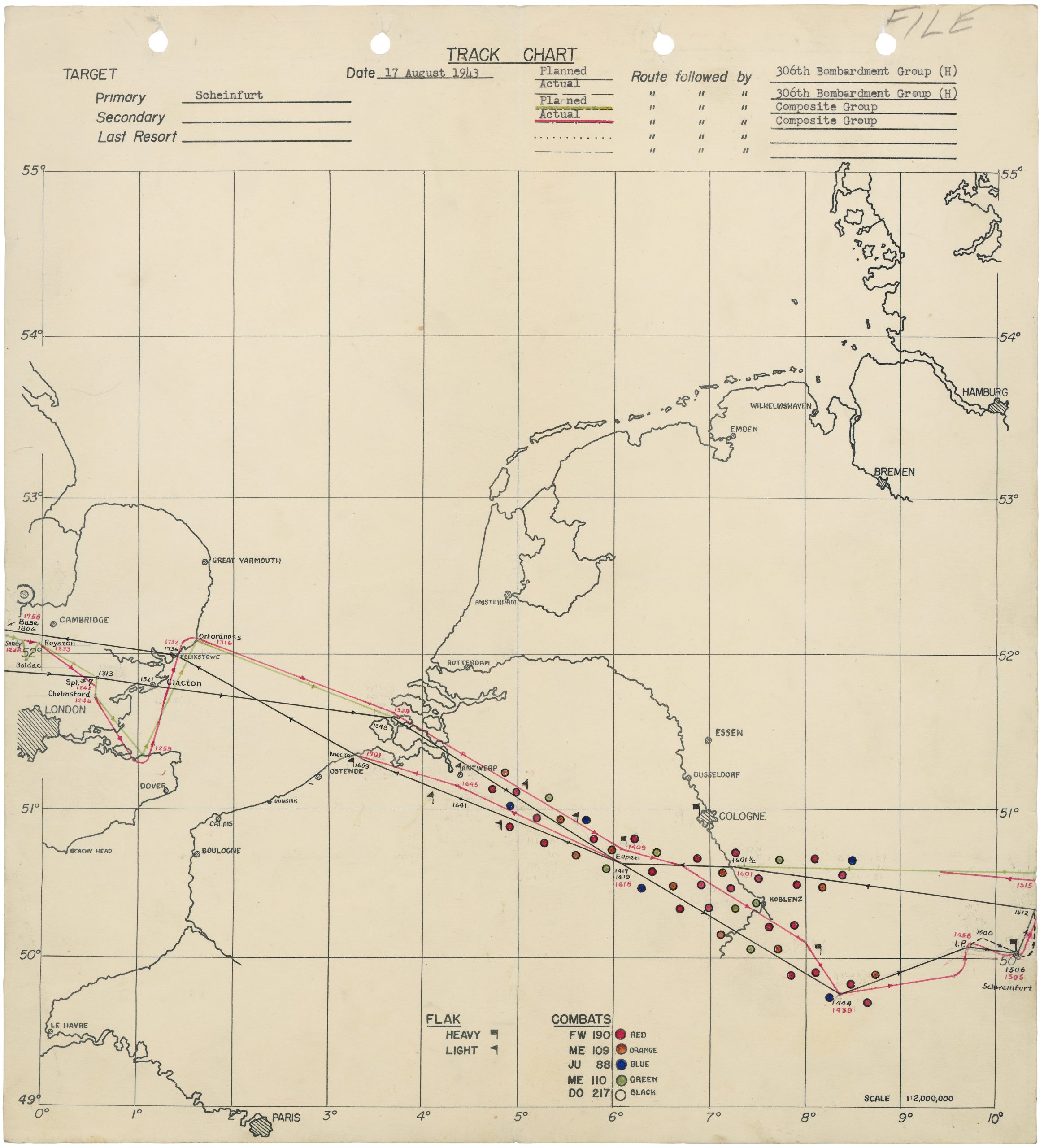
English: see title |
| Date | Before 17 August 1943 |
| Source | https://b17flyingfortress.de/cms/wp-content/uploads/2020/05/schweinfurt-route-306th_BG-scaled.jpg |
| Author | Unknown author |
Licensing
This file is a work of a U.S. Army soldier or employee, taken or made as part of that person's official duties. As a work of the U.S. federal government, it is in the public domain in the United States.
|
 |
File history
Click on a date/time to view the file as it appeared at that time.
| Date/Time | Thumbnail | Dimensions | User | Comment | |
|---|---|---|---|---|---|
| current | 17:29, 13 November 2022 | | 2,328 × 2,560 (594 KB) | Buidhe | Reverted to version as of 19:13, 26 July 2021 (UTC) high res version already uploaded and low res might be more useful to someone |
| 09:08, 7 August 2021 |  | 5,131 × 5,642 (17.76 MB) | Remitamine | Higher resolution version | |
| 19:13, 26 July 2021 |  | 2,328 × 2,560 (594 KB) | Buidhe | Uploaded a work by Unknown from https://b17flyingfortress.de/cms/wp-content/uploads/2020/05/schweinfurt-route-306th_BG-scaled.jpg with UploadWizard |
File usage
The following pages on the English Wikipedia use this file (pages on other projects are not listed):
Global file usage
The following other wikis use this file:
- Usage on pt.wikipedia.org