
No higher resolution available.
Timor_sea.jpg (459 × 282 pixels, file size: 37 KB, MIME type: image/jpeg)
| This is a file from the Wikimedia Commons. Information from its description page there is shown below. Commons is a freely licensed media file repository. You can help. |
Summary
| Description |
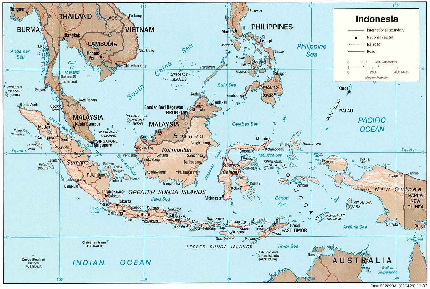
English: The Timor Sea, showing disputed exploitation zone the Timor Gap. |
| Date | |
| Source | From CIA map at http://www.lib.utexas.edu/maps/middle_east_and_asia/indonesia_rel_2002.jpg |
| Author | Prepared for Wikipedia by Keith Edkins April 2004. |
Licensing
| This image is a work of a Central Intelligence Agency employee, taken or made as part of that person's official duties. As a Work of the United States Government, this image or media is in the public domain in the United States.
|

|
Original upload log
Transferred from en.wikipedia to Commons by Bulwersator using CommonsHelper.
The original description page was here. All following user names refer to en.wikipedia.
- 2004-04-29 13:08 Keith Edkins 459×282× (38149 bytes)
- 2004-04-28 12:17 Keith Edkins 520×260× (36820 bytes)
File history
Click on a date/time to view the file as it appeared at that time.
| Date/Time | Thumbnail | Dimensions | User | Comment | |
|---|---|---|---|---|---|
| current | 19:38, 19 December 2011 | | 459 × 282 (37 KB) | File Upload Bot (Magnus Manske) | {{BotMoveToCommons|en.wikipedia|year={{subst:CURRENTYEAR}}|month={{subst:CURRENTMONTHNAME}}|day={{subst:CURRENTDAY}}}} {{Information |Description={{en|The Timor Sea, showing disputed exploitation zone the ''Timor Gap''.}} |Source=Transferred from [http:/ |
File usage
The following pages on the English Wikipedia use this file (pages on other projects are not listed):
Global file usage
The following other wikis use this file:
- Usage on ban.wikipedia.org
- Usage on be.wikipedia.org
- Usage on he.wikipedia.org
- Usage on id.wikipedia.org
- Usage on it.wikipedia.org
- Usage on ru.wikipedia.org