Size of this preview: 800 × 354 pixels. Other resolutions: 320 × 142 pixels | 640 × 283 pixels | 1,199 × 531 pixels.
Original file (1,199 × 531 pixels, file size: 221 KB, MIME type: image/jpeg)
| This is a file from the Wikimedia Commons. Information from its description page there is shown below. Commons is a freely licensed media file repository. You can help. |
Summary
| Description |
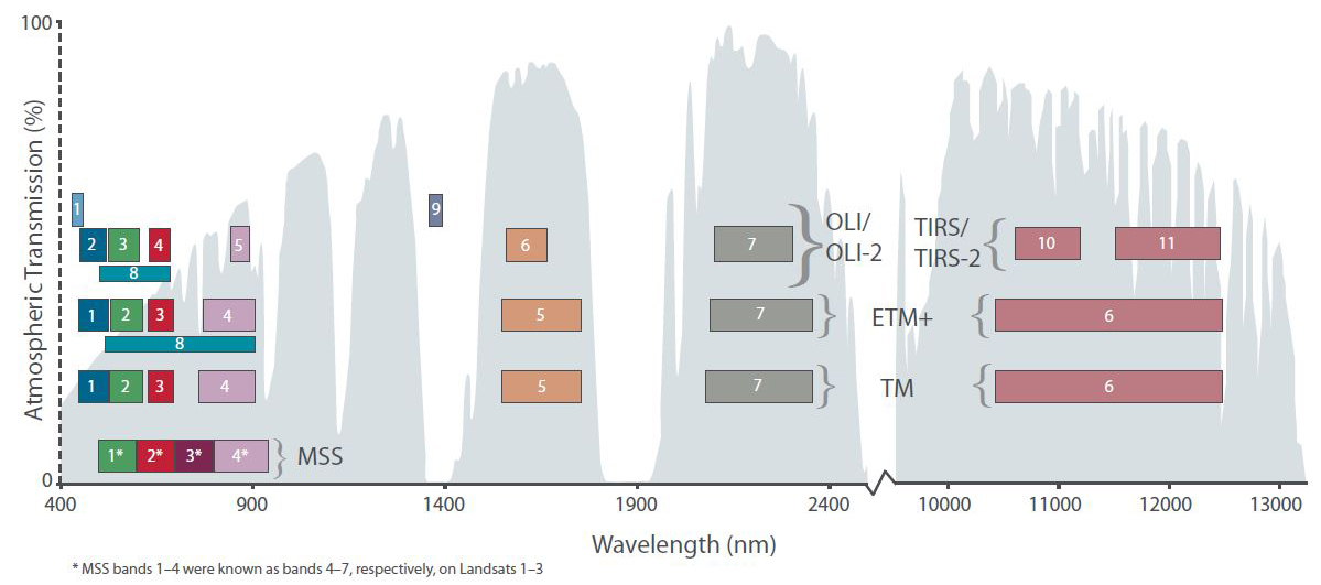
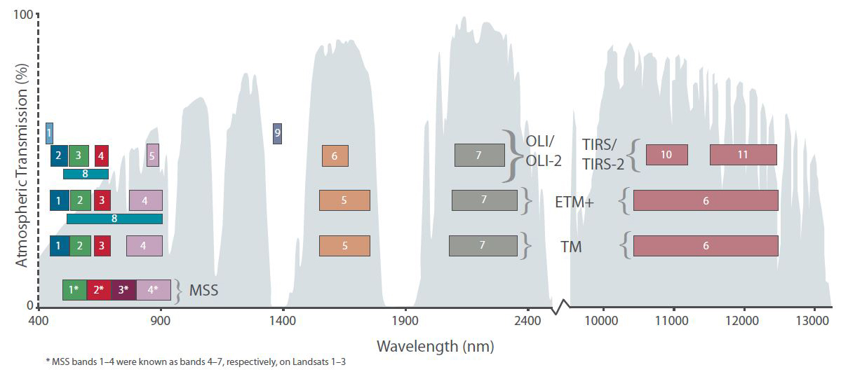
English: The spectral band placement for each sensor of Landsat |
| Date | |
| Source | https://landsat.usgs.gov/sites/default/files/images/MSS-thru-L9-wavelengths.jpg |
| Author | NASA |
Licensing
| This file is in the public domain in the United States because it was solely created by NASA. NASA copyright policy states that "NASA material is not protected by copyright unless noted". (See Template:PD-USGov, NASA copyright policy page or JPL Image Use Policy.) | ||
 |
Warnings:
|
File history
Click on a date/time to view the file as it appeared at that time.
| Date/Time | Thumbnail | Dimensions | User | Comment | |
|---|---|---|---|---|---|
| current | 06:03, 11 March 2022 | | 1,199 × 531 (221 KB) | Artem.G | Uploaded a work by NASA from https://landsat.usgs.gov/sites/default/files/images/MSS-thru-L9-wavelengths.jpg with UploadWizard |
File usage
The following pages on the English Wikipedia use this file (pages on other projects are not listed):
Global file usage
The following other wikis use this file:
- Usage on tr.wikipedia.org