
Size of this PNG preview of this SVG file: 565 × 362 pixels. Other resolutions: 320 × 205 pixels | 640 × 410 pixels | 1,024 × 656 pixels | 1,280 × 820 pixels | 2,560 × 1,640 pixels.
Original file (SVG file, nominally 565 × 362 pixels, file size: 285 KB)
| This is a file from the Wikimedia Commons. Information from its description page there is shown below. Commons is a freely licensed media file repository. You can help. |
Summary
| Description |
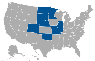
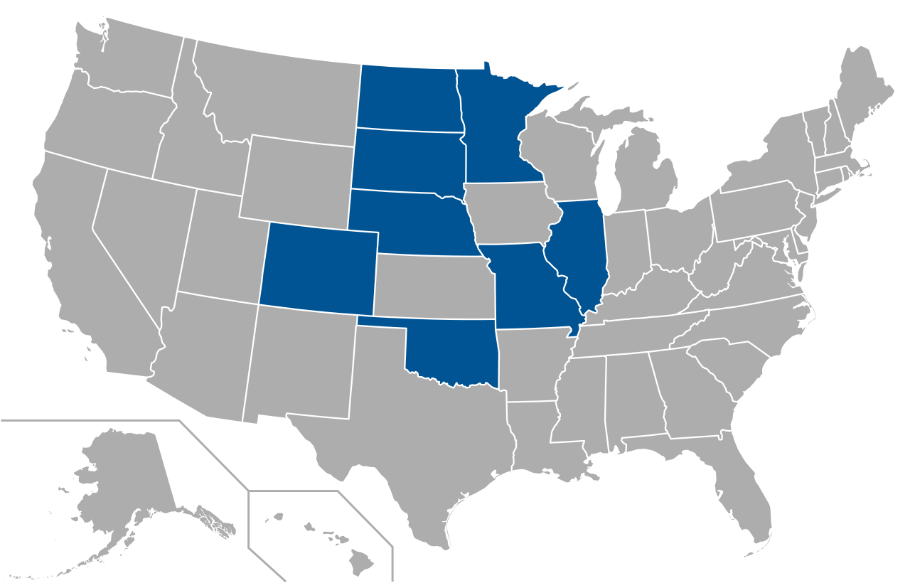
English: Map of schools in The Summit League |
| Date | |
| Source | Own work, derivative of File:USA Counties.svg by the U.S. Census Bureau |
| Author | Spyder_Monkey |
Licensing
| I, the copyright holder of this work, release this work into the public domain. This applies worldwide. In some countries this may not be legally possible; if so: I grant anyone the right to use this work for any purpose, without any conditions, unless such conditions are required by law. |
File history
Click on a date/time to view the file as it appeared at that time.
| Date/Time | Thumbnail | Dimensions | User | Comment | |
|---|---|---|---|---|---|
| current | 02:30, 2 July 2021 | | 565 × 362 (285 KB) | Lsw2472 | + Minnesota |
| 22:56, 4 July 2020 |  | 565 × 362 (286 KB) | KCVelaga | Indiana removed, Missouri added | |
| 18:54, 21 March 2015 |  | 565 × 362 (285 KB) | Dafoeberezin3494 | Add OK (Oral Roberts returned) | |
| 23:12, 1 July 2013 |  | 565 × 362 (285 KB) | Spyder Monkey | {{Information |Description={{en|Map of schools in {{w|The Summit League}}}} |Source={{own}}, derivative of File:USA Counties.svg by the [http://www.census.gov/ U.S. Census Bureau] |Date=2013-07-01 |Author=Spyder_Monkey |Perm... |
File usage
The following pages on the English Wikipedia use this file (pages on other projects are not listed):
Global file usage
The following other wikis use this file:
- Usage on de.wikipedia.org
- Usage on es.wikipedia.org
- Usage on fr.wikipedia.org
- Usage on it.wikipedia.org