No higher resolution available.
Tasmania_southern_coast_1916.jpg (369 × 304 pixels, file size: 69 KB, MIME type: image/jpeg)
| This is a file from the Wikimedia Commons. Information from its description page there is shown below. Commons is a freely licensed media file repository. You can help. |
| Description |
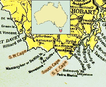
Southern Coast of Tasmania. |
| Date | |
| Source |
map "Commonwealth of Australia", published with the Official Year Book of the Commonwealth of Australia, Melbourne: McCarron, Bird and Co., 1916. |
| Author |
|
| Other versions |
|

|
Permission is granted to copy, distribute and/or modify this document under the terms of the GNU Free Documentation License, Version 1.2 or any later version published by the Free Software Foundation; with no Invariant Sections, no Front-Cover Texts, and no Back-Cover Texts. A copy of the license is included in the section entitled GNU Free Documentation License. |
| This file is licensed under the Creative Commons Attribution-Share Alike 3.0 Unported license. | ||
| ||
| This licensing tag was added to this file as part of the GFDL licensing update. |
File history
Click on a date/time to view the file as it appeared at that time.
| Date/Time | Thumbnail | Dimensions | User | Comment | |
|---|---|---|---|---|---|
| current | 06:46, 17 April 2007 | | 369 × 304 (69 KB) | Ibn Battuta | okay, okay, okay: I'll leave (make) "Hobart" visible... :o) ... |
| 06:30, 17 April 2007 |  | 369 × 304 (69 KB) | Ibn Battuta | Let's try again: including locator map!? | |
| 06:18, 17 April 2007 |  | 369 × 304 (69 KB) | Ibn Battuta | included locator map of Tasmania | |
| 06:46, 1 April 2007 |  | 369 × 304 (76 KB) | Ibn Battuta | {{Information |Description=Southern Coast of Tasmania. <br/>From the map "Commonwealth of Australia", published with the Official Year Book of the Commonwealth of Australia, Melbourne: McCarron, Bird and Co., 1916. |Source=map "Commonwealth of Australia", |
File usage
The following pages on the English Wikipedia use this file (pages on other projects are not listed):
Global file usage
The following other wikis use this file:
- Usage on ar.wikipedia.org
- Usage on ceb.wikipedia.org
- Usage on de.wikipedia.org
- Usage on eo.wikipedia.org
- Usage on eu.wikipedia.org
- Usage on id.wikipedia.org
- Usage on it.wikipedia.org
- Usage on pt.wikipedia.org
- Usage on ru.wikipedia.org
- Usage on uk.wikipedia.org
- Usage on www.wikidata.org
- Usage on zh.wikipedia.org