Size of this preview: 800 × 536 pixels. Other resolutions: 320 × 214 pixels | 640 × 429 pixels | 1,024 × 686 pixels | 1,280 × 857 pixels.
Original file (1,280 × 857 pixels, file size: 199 KB, MIME type: image/jpeg)
| This is a file from the Wikimedia Commons. Information from its description page there is shown below. Commons is a freely licensed media file repository. You can help. |
Summary
| Description |
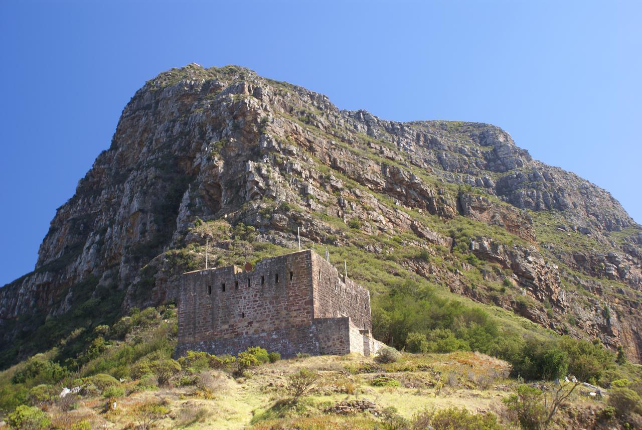
Afrikaans: Die Koning se blokhuis teen Mowbrayrif van Duiwelspiek, dateer van 1796. Hierdie klein fort is vernoem na koning George III, en kon seine stuur na laer geleë blokhuise omtrent skepe in Valsbaai. Dit is geleë naby Tafelberg in Kaapstad, Suid-Afrika.
English: The King's Blockhouse on Mowbray Ridge of Devil's Peak, was built in 1796. The small fort was named after king George III, and could signal observations of ships in False Bay to blockhouses lower down. It is situated near Table Mountain in Cape Town, South Africa.[1][2] |
||
| Date | |||
| Source | King's Blockhouse, Cape Town, South Africa | ||
| Author | Danie van der Merwe from Cape Town, South Africa | ||
| Permission (Reusing this file) |
|
||
| Other versions | [1] |
| Camera location | | View this and other nearby images on: OpenStreetMap |
|---|
References
Licensing
This file is licensed under the Creative Commons Attribution 2.0 Generic license.
- You are free:
- to share – to copy, distribute and transmit the work
- to remix – to adapt the work
- Under the following conditions:
- attribution – You must give appropriate credit, provide a link to the license, and indicate if changes were made. You may do so in any reasonable manner, but not in any way that suggests the licensor endorses you or your use.
| This image was originally posted to Flickr by DanieVDM at https://www.flickr.com/photos/12915821@N00/2380974758. It was reviewed on 1 February 2009 by FlickreviewR and was confirmed to be licensed under the terms of the cc-by-2.0. |
File history
Click on a date/time to view the file as it appeared at that time.
| Date/Time | Thumbnail | Dimensions | User | Comment | |
|---|---|---|---|---|---|
| current | 08:53, 1 February 2009 | | 1,280 × 857 (199 KB) | NJR ZA | {{Information |Description={{en|1=King's Blockhouse on Table Mountain, Cape Town, South Africa}} |Source=[http://www.flickr.com/photos/12915821@N00/2380974758/ King's Blockhouse, Cape Town, South Africa] |Author=[http://www.flickr.com/people/12915821@N00 |
File usage
The following pages on the English Wikipedia use this file (pages on other projects are not listed):
Global file usage
The following other wikis use this file:
- Usage on de.wikipedia.org
- Usage on fr.wikipedia.org
- Usage on fr.wikivoyage.org