
Size of this preview: 479 × 599 pixels. Other resolutions: 192 × 240 pixels | 383 × 480 pixels | 614 × 768 pixels | 818 × 1,024 pixels | 2,057 × 2,574 pixels.
Original file (2,057 × 2,574 pixels, file size: 601 KB, MIME type: image/jpeg)
| This is a file from the Wikimedia Commons. Information from its description page there is shown below. Commons is a freely licensed media file repository. You can help. |
| Description |
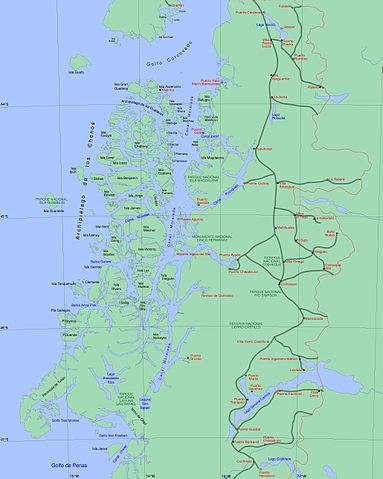
English: Chile map from "Archiepelago de los Chonos" (43°S to 47°S), generated with GMT |
||||||||||
| Date | |||||||||||
| Source | Own work | ||||||||||
| Author | Createaccount | ||||||||||
| Permission (Reusing this file) |
|
||||||||||
| Other versions | Sur0.gif is now obsolet |

File history
Click on a date/time to view the file as it appeared at that time.
| Date/Time | Thumbnail | Dimensions | User | Comment | |
|---|---|---|---|---|---|
| current | 10:32, 28 June 2013 | | 2,057 × 2,574 (601 KB) | Keysanger | Laguna San Rafael conectada con Canal Moraleda |
| 14:03, 14 September 2008 |  | 2,057 × 2,574 (607 KB) | Keysanger | {{Information |Description={{en|1=Chile map from "Archiepelago de los Chonos" (43°S to 47°S), generated with GMT}} |Source=Own work by uploader |Author=Createaccount |Date=2008 |Permission={{GFDL-GMT}} |other_versions=Sur0.gif is |
File usage
The following pages on the English Wikipedia use this file (pages on other projects are not listed):
Global file usage
The following other wikis use this file:
- Usage on ast.wikipedia.org
- Usage on az.wikipedia.org
- Usage on br.wikipedia.org
- Usage on ceb.wikipedia.org
- Usage on de.wikipedia.org
- Usage on es.wikipedia.org
- Usage on fr.wikipedia.org
- Usage on gl.wikipedia.org
- Usage on it.wikipedia.org
- Usage on ja.wikipedia.org
- Usage on ka.wikipedia.org
- Usage on pl.wikipedia.org
- Usage on ru.wikipedia.org
- Usage on sv.wikipedia.org
- Usage on tr.wikipedia.org
- Usage on vi.wikipedia.org
- Usage on www.wikidata.org