
Size of this preview: 800 × 543 pixels. Other resolutions: 320 × 217 pixels | 640 × 434 pixels | 948 × 643 pixels.
Original file (948 × 643 pixels, file size: 131 KB, MIME type: image/png)
| This is a file from the Wikimedia Commons. Information from its description page there is shown below. Commons is a freely licensed media file repository. You can help. |
Summary
| Description | |
| Date | 2 August 2006 (original upload date) |
| Source | Own work |
| Author | User:Lentisco |
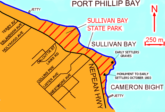
Map of Sullivan Bay,Victoria (250m) scale
Licensing
| This work has been released into the public domain by its author, Lentisco. This applies worldwide. In some countries this may not be legally possible; if so: |
Original upload log
Transferred from en.wikipedia to Commons using For the Common Good.
The original description page was here. All following user names refer to en.wikipedia.
| Date/Time | Dimensions | User | Comment |
|---|---|---|---|
| 02:03, 2 August 2006 | 948 × 643 (133,783 bytes) | w:en:Lentisco (talk | contribs) | (Map of Sullivan Bay,Victoria (250m) scale) |
File history
Click on a date/time to view the file as it appeared at that time.
| Date/Time | Thumbnail | Dimensions | User | Comment | |
|---|---|---|---|---|---|
| current | 09:38, 22 June 2012 | | 948 × 643 (131 KB) | Hydriz | Transferred from en.wikipedia: see original upload log above |
File usage
The following pages on the English Wikipedia use this file (pages on other projects are not listed):