
Size of this preview: 800 × 471 pixels. Other resolutions: 320 × 189 pixels | 640 × 377 pixels | 1,024 × 603 pixels | 1,517 × 894 pixels.
Original file (1,517 × 894 pixels, file size: 1.98 MB, MIME type: image/jpeg)
| This is a file from the Wikimedia Commons. Information from its description page there is shown below. Commons is a freely licensed media file repository. You can help. |
| Description |
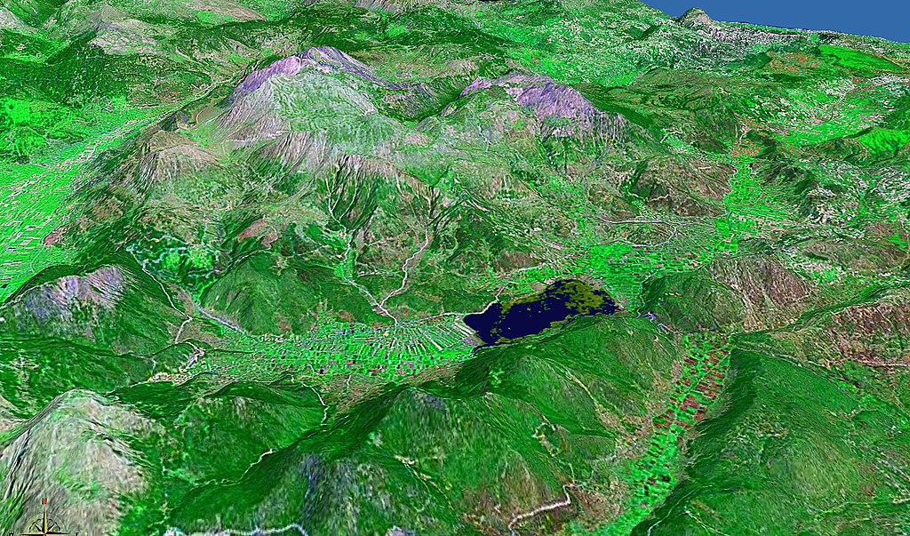
de:Stymfalia, See / lake, Mount Ziria (2374m); Peloponnese |
| Date | |
| Source | Installed WW-Software needed: [1] |
| Author | ulrichstill |
| Permission (Reusing this file) |
by author for Creative Commons |
| This image is in the public domain because it is a screenshot from NASA’s globe software World Wind using a public domain layer, such as Blue Marble, MODIS, Landsat, SRTM, USGS or GLOBE.
|
 |
File history
Click on a date/time to view the file as it appeared at that time.
| Date/Time | Thumbnail | Dimensions | User | Comment | |
|---|---|---|---|---|---|
| current | 23:39, 6 September 2006 | | 1,517 × 894 (1.98 MB) | Ulrichstill | {{Information| |Description = de:Stymfalia, See / lake, Mount Ziria (2374m); Peloponnese<br> Blickrichtung süd-nord, aus 8000m; See mit Maximalwasserstand; Hauptzufluss aus Karstquellen am Ebenen-Ostzipfel und direkt am See<br> View south-north, alt |
File usage
The following pages on the English Wikipedia use this file (pages on other projects are not listed):
Global file usage
The following other wikis use this file: