Size of this preview: 402 × 599 pixels. Other resolutions: 161 × 240 pixels | 322 × 480 pixels | 986 × 1,470 pixels.
Original file (986 × 1,470 pixels, file size: 1.12 MB, MIME type: image/jpeg)
| This is a file from the Wikimedia Commons. Information from its description page there is shown below. Commons is a freely licensed media file repository. You can help. |
Summary
| Description |
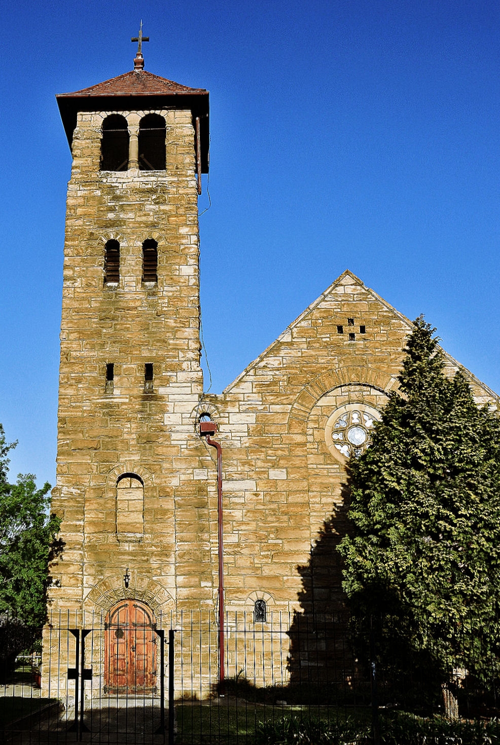
English: No 1641 20 September 1974 DECLARATION OF A NATIONAL MONUMENT By virtue of the powers vested in me by section10 (1) of the National Monuments Act, 1969 (Act 28 of 1969), I, Johannes Petrus van der Spuy, Minister of National Education, hereby declare the church, known as St Michael and All Angels, Boksburg, to be national monument. Description The church, known as St Michael and All Angels, situate on Erven 253, 254, 255 and 256 in Boksburg in the Division of the Transvaal, and measuring as such 1486 square metres. Deed of Transfer F3568/25 of 9 October 1925 (Erven 253 and 254) Historical Interest The church of St Michael and All Angels was designed by Sir Herbert Baker in the Romanesque style aand consecrated in 1912. J. P. VAN DER APUY, Minister of National Education. |
| Date | |
| Source | Own work |
| Author | Ossewa |
Licensing
I, the copyright holder of this work, hereby publish it under the following license:
This file is licensed under the Creative Commons Attribution-Share Alike 3.0 Unported license.
- You are free:
- to share – to copy, distribute and transmit the work
- to remix – to adapt the work
- Under the following conditions:
- attribution – You must give appropriate credit, provide a link to the license, and indicate if changes were made. You may do so in any reasonable manner, but not in any way that suggests the licensor endorses you or your use.
- share alike – If you remix, transform, or build upon the material, you must distribute your contributions under the same or compatible license as the original.
| Camera location | | View this and other nearby images on: OpenStreetMap |
|---|
| This media shows a South African Protected Site with SAHRA file reference 9/2/209/0007. |

|
This image was uploaded as part of Wiki Loves Monuments 2012.
|
 |
File history
Click on a date/time to view the file as it appeared at that time.
| Date/Time | Thumbnail | Dimensions | User | Comment | |
|---|---|---|---|---|---|
| current | 19:21, 4 September 2012 | | 986 × 1,470 (1.12 MB) | Ossewa | User created page with UploadWizard |
File usage
The following pages on the English Wikipedia use this file (pages on other projects are not listed):