Size of this preview: 527 × 599 pixels. Other resolutions: 211 × 240 pixels | 422 × 480 pixels | 675 × 768 pixels | 900 × 1,024 pixels | 1,550 × 1,763 pixels.
Original file (1,550 × 1,763 pixels, file size: 679 KB, MIME type: image/jpeg)
| This is a file from the Wikimedia Commons. Information from its description page there is shown below. Commons is a freely licensed media file repository. You can help. |
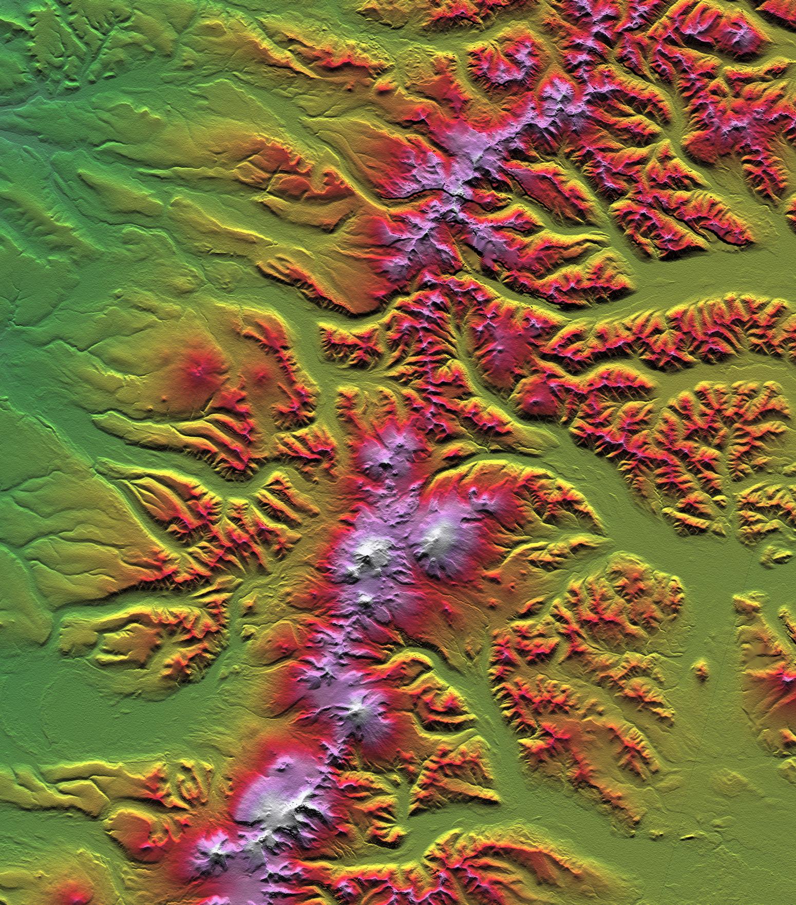
| Description | Sredinny Range, Kamchatka Peninsula | |||||
| Date | ||||||
| Source | http://photojournal.jpl.nasa.gov/catalog/PIA03314 | |||||
| Author | NASA/JPL/NIMA | |||||
| Permission (Reusing this file) |
|

This image or video was catalogued by Jet Propulsion Laboratory of the United States National Aeronautics and Space Administration (NASA) under Photo ID: PIA03314. This tag does not indicate the copyright status of the attached work. A normal copyright tag is still required. See Commons:Licensing. Other languages:
|
File history
Click on a date/time to view the file as it appeared at that time.
| Date/Time | Thumbnail | Dimensions | User | Comment | |
|---|---|---|---|---|---|
| current | 16:53, 17 March 2009 | | 1,550 × 1,763 (679 KB) | Sasha Krotov | {{Information |Description=Sredinny Range, Kamchatka Peninsula |Source=http://photojournal.jpl.nasa.gov/catalog/PIA03314 |Date=February 2000 |Author=NASA/JPL/NIMA |Permission={{PD-USGov-NASA-SRTM}} |other_versions= }} {{NASA-image|id=PIA03314|center=JPL |
File usage
The following pages on the English Wikipedia use this file (pages on other projects are not listed):
Global file usage
The following other wikis use this file:
- Usage on af.wikipedia.org
- Usage on ceb.wikipedia.org
- Usage on cs.wikipedia.org
- Usage on da.wikipedia.org
- Usage on ka.wikipedia.org
- Usage on ru.wikipedia.org
- Usage on sk.wikipedia.org