
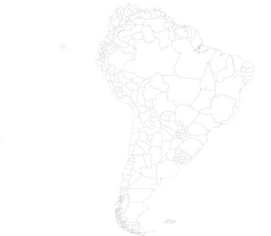
Size of this PNG preview of this SVG file: 689 × 600 pixels. Other resolutions: 276 × 240 pixels | 551 × 480 pixels | 882 × 768 pixels | 1,176 × 1,024 pixels | 2,352 × 2,048 pixels | 8,000 × 6,965 pixels.
Original file (SVG file, nominally 8,000 × 6,965 pixels, file size: 2.54 MB)
| This is a file from the Wikimedia Commons. Information from its description page there is shown below. Commons is a freely licensed media file repository. You can help. |
NOTE!
This file is very large. It takes 329MB of memory (557MB on a 64-bit system) just to open it in inkscape.
Summary
| Description | Map of South America as of 1998, with first level administrative units. See also Image:World98.svg |
| Date | |
| Source | world98.shp from the US CDC [1] |
| Author | Translated to SVG by User:Brianski |
| SVG development |
TODO
- Fix blips, change background color so these blips are more obvious and thus easier to fix.
- Also make proper hierarchical groups.
Generation Notes
perl xml2svg.pl --proj=cylindrical_equidistant:0,0.793353340291235 -x8000 --incl=./import/continents/south_america.txt world98
mv -f world98.svg south_america98.svg
Licensing
This image is a work of the Centers for Disease Control and Prevention, part of the United States Department of Health and Human Services, taken or made as part of an employee's official duties. As a work of the U.S. federal government, the image is in the public domain.
|
File history
Click on a date/time to view the file as it appeared at that time.
| Date/Time | Thumbnail | Dimensions | User | Comment | |
|---|---|---|---|---|---|
| current | 07:59, 29 July 2021 | | 8,000 × 6,965 (2.54 MB) | Danfosky | Improvement |
| 05:40, 23 October 2007 |  | 8,000 × 6,965 (2.51 MB) | Brianski | add falkland islands/islas malvinas | |
| 02:15, 23 October 2007 |  | 8,000 × 6,965 (2.49 MB) | Brianski | == NOTE! == This file is very large. It takes 555MB of memory just to open it in inkscape. == Summary == {{Information |Description=Map of South America as of 1998, with first level administrative units. |Source=world98.shp from the [[:en:Centers_for_Dis |
File usage
No pages on the English Wikipedia use this file (pages on other projects are not listed).