.jpg)
.jpg&action=edit&redlink=1)
Size of this preview: 800 × 600 pixels. Other resolutions: 320 × 240 pixels | 640 × 480 pixels | 1,024 × 768 pixels | 1,280 × 960 pixels | 2,560 × 1,920 pixels | 4,608 × 3,456 pixels.
Original file (4,608 × 3,456 pixels, file size: 2.84 MB, MIME type: image/jpeg)
| This is a file from the Wikimedia Commons. Information from its description page there is shown below. Commons is a freely licensed media file repository. You can help. |
.jpg)
Summary
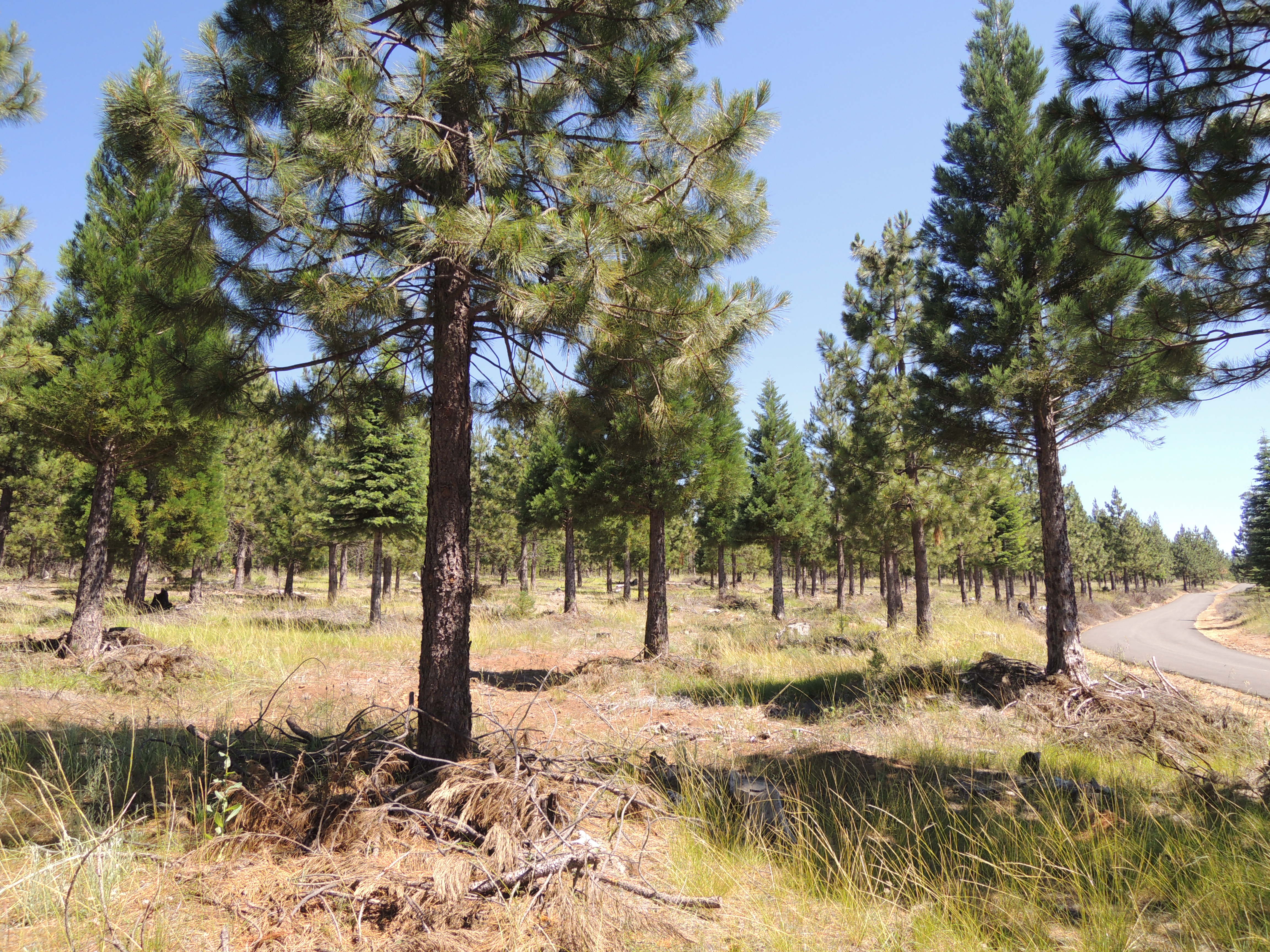
| Description | A collaborative meeting of multiple agencies, stakeholders and concerned residents gathered July 12 in Camino and the surrounding Highway 50 corridor to showcase some of the all-lands wildland fire management practices taking place in an effort to make that region of the Eldorado National Forest more adapt to fire. The main effort is in response to the King Fire that blazed through the area and threatened the town of Camino and Pollock Pines in 2012. Participants included the U.S. Forest Service, Cal Fire, National Wild Turkey Foundation, Mule Deer Foundation, El Dorado Irrigation District, Sierra Pacific Industries, El Dorado County Resource Conservation District, and more. Over 50 people concerned over the state of the region saw efforts being made in Bumpy Meadows with the Sly Park Vegetation Project, along Highway 50 with fuels reduction in the Cleveland Plantation, around the Union Valley Reservoir pennisulas with prescribed burns and fuel reduction and finally on a stretch of the Peavine Ridge Fuel Break. These projects addressed the all-lands approach, long-term management, good neighbor authority, partnerships, fire as maintenance, burning across boundaries, etc. (USDA photo by Paul Wade) |
| Date | |
| Source | South Fork Amercian River Cohesive Strategy Field Trip |
| Author | Pacific Southwest Region 5 |
Licensing
This file is licensed under the Creative Commons Attribution 2.0 Generic license.
- You are free:
- to share – to copy, distribute and transmit the work
- to remix – to adapt the work
- Under the following conditions:
- attribution – You must give appropriate credit, provide a link to the license, and indicate if changes were made. You may do so in any reasonable manner, but not in any way that suggests the licensor endorses you or your use.
| This image was originally posted to Flickr by Forest Service, USDA at https://flickr.com/photos/39108150@N05/36013609855 (archive). It was reviewed on 8 May 2018 by FlickreviewR 2 and was confirmed to be licensed under the terms of the cc-by-2.0. |
This image or file is a work of a United States Department of Agriculture employee, taken or made as part of that person's official duties. As a work of the U.S. federal government, the image is in the public domain.
|
 |
File history
Click on a date/time to view the file as it appeared at that time.
| Date/Time | Thumbnail | Dimensions | User | Comment | |
|---|---|---|---|---|---|
| current | 21:14, 8 May 2018 | | 4,608 × 3,456 (2.84 MB) | OceanAtoll | Transferred from Flickr via #flickr2commons |
File usage
The following pages on the English Wikipedia use this file (pages on other projects are not listed):
.jpg)