
Size of this preview: 800 × 494 pixels. Other resolutions: 320 × 198 pixels | 640 × 395 pixels | 1,024 × 632 pixels | 1,280 × 790 pixels | 2,560 × 1,581 pixels | 3,859 × 2,383 pixels.
Original file (3,859 × 2,383 pixels, file size: 596 KB, MIME type: image/png)
| This is a file from the Wikimedia Commons. Information from its description page there is shown below. Commons is a freely licensed media file repository. You can help. |
Summary
| Description |
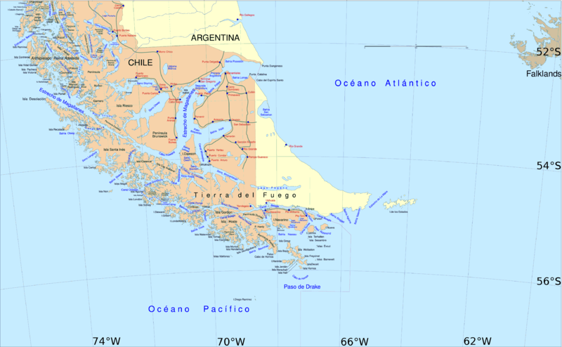
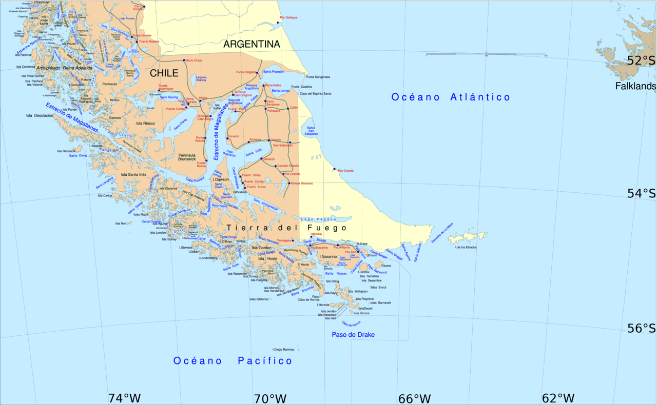
English: Political map of southern Chile and Argentina, from Straits of Magellan to Cape Horn.
Español: Mapa político del sur de Chile y la Argentina, entre el estrecho de Magallanes y el cabo de Hornos. |
||||
| Date | |||||
| Source | File:Sur2.gif | ||||
| Author | User:Createaccount | ||||
| Permission (Reusing this file) |
|
||||
| Other versions | Derivative works of this file: Metula.svg |
Licensing

|
Permission is granted to copy, distribute and/or modify this document under the terms of the GNU Free Documentation License, Version 1.2 or any later version published by the Free Software Foundation; with no Invariant Sections, no Front-Cover Texts, and no Back-Cover Texts. A copy of the license is included in the section entitled GNU Free Documentation License. |
| This file is licensed under the Creative Commons Attribution-Share Alike 3.0 Unported license. | ||
| ||
| This licensing tag was added to this file as part of the GFDL licensing update. |
File history
Click on a date/time to view the file as it appeared at that time.
| Date/Time | Thumbnail | Dimensions | User | Comment | |
|---|---|---|---|---|---|
| current | 14:06, 30 April 2016 | | 3,859 × 2,383 (596 KB) | Hohum | Cartographic colours |
| 11:09, 3 April 2013 |  | 3,859 × 2,383 (597 KB) | Keysanger | Margin right and top cropped | |
| 10:47, 3 April 2013 |  | 3,859 × 2,383 (597 KB) | Keysanger | "Estrecho Nelson" added Bigger Latitude and Longitude within the image empty margin cropped | |
| 19:30, 3 May 2009 |  | 3,894 × 2,441 (639 KB) | Pitichinaccio | different colour | |
| 19:29, 3 May 2009 |  | 3,894 × 2,441 (639 KB) | Pitichinaccio | {{Information |Description={{en|1=political map of southern Chile/Argentina: From Straits of Magellan to Cape Horn}} |Source=File:Sur2.gif |Author=User:Createaccount |Date=2008 |Permission={{GFDL-GMT}}} |other_versions=File:Sur2.gif }} <!-- |
File usage
The following pages on the English Wikipedia use this file (pages on other projects are not listed):
- Abra Channel
- Almirantazgo Fjord
- Aracena Island
- Ballenero Channel
- Brunswick Peninsula
- Bárbara Channel
- Camerón
- Canal Whiteside
- Cape Froward
- Cockburn Channel
- False Cape Horn
- Fitzroy Channel
- Fjord of the Mountains
- Fjords and channels of Chile
- Maritime history of California
- Marlborough (1876 ship)
- Mitre Peninsula
- Muñoz Gamero Peninsula
- Operation Mikado
- Porvenir, Chile
- Primera Angostura
- Puerto Toro
- Puerto del Hambre
- Punta Dúngeness
- Rennell Islands
- Santa Inés Island
- Segunda Angostura
- Seno Otway
- Seno Skyring
- Señoret Channel
- Villa Tehuelches
Global file usage
The following other wikis use this file:
- Usage on af.wikipedia.org
- Usage on als.wikipedia.org
- Usage on ar.wikipedia.org
- Usage on ast.wikipedia.org
- Usage on br.wikipedia.org
- Usage on ca.wikipedia.org
- Usage on de.wikipedia.org
- Usage on de.wiktionary.org
- Usage on el.wikipedia.org
- Usage on eo.wikipedia.org
- Usage on es.wikipedia.org
- Isla Grande de Tierra del Fuego
- Puerto Toro
- Seno Otway
- Canal Murray
- Canal Abra
- Canal Bárbara
- Canal Acwalisnan
- Canal O'Brien
- Seno Darwin
- Brazo del Noroeste
- Brazo del Sudoeste
- Usuario:Jorval/Esquema para artículo sobre un CANAL
- Canal Ocasión
- Usuario:Jorval/Seno Darwin (corregido)
- Usuario:Jorval/Brazo del Noroeste (corregido)
View more global usage of this file.