
Size of this preview: 800 × 500 pixels. Other resolutions: 320 × 200 pixels | 640 × 400 pixels | 1,024 × 639 pixels | 1,278 × 798 pixels.
Original file (1,278 × 798 pixels, file size: 2.39 MB, MIME type: image/png)
| This is a file from the Wikimedia Commons. Information from its description page there is shown below. Commons is a freely licensed media file repository. You can help. |
Summary
| Description |
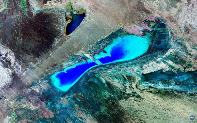
English: Satellite Image of Lake Manas, Xinjiang, China
中文:新疆玛纳斯湖卫星图像 |
| Source | NASA Landsat Image |
| Author | NASA |
| Camera location | | View this and other nearby images on: OpenStreetMap |
|---|
Licensing
| This file is in the public domain in the United States because it was solely created by NASA. NASA copyright policy states that "NASA material is not protected by copyright unless noted". (See Template:PD-USGov, NASA copyright policy page or JPL Image Use Policy.) | ||
 |
Warnings:
|
File history
Click on a date/time to view the file as it appeared at that time.
| Date/Time | Thumbnail | Dimensions | User | Comment | |
|---|---|---|---|---|---|
| current | 13:36, 18 March 2009 | | 1,278 × 798 (2.39 MB) | Camphora | {{Information |Description={{en|1=Satellite Image of Lake Manas, Xinjiang, China}} {{zh|1=新疆玛纳斯湖卫星图像}} |Source=NASA Landsat Image |Author=NASA |Date= |Permission= |other_versions= }} [location |45|48|N|85|58|E|scale:1000000_type:Waterb |
File usage
The following pages on the English Wikipedia use this file (pages on other projects are not listed):
Global file usage
The following other wikis use this file:
- Usage on fa.wikipedia.org
- Usage on ja.wikipedia.org
- Usage on pa.wikipedia.org
- Usage on sr.wikipedia.org
- Usage on te.wikipedia.org
- Usage on tr.wikipedia.org
- Usage on zh.wikipedia.org