
Size of this preview: 579 × 600 pixels. Other resolutions: 232 × 240 pixels | 463 × 480 pixels | 741 × 768 pixels | 989 × 1,024 pixels | 1,977 × 2,048 pixels | 2,800 × 2,900 pixels.
Original file (2,800 × 2,900 pixels, file size: 1.87 MB, MIME type: image/jpeg)
| This is a file from the Wikimedia Commons. Information from its description page there is shown below. Commons is a freely licensed media file repository. You can help. |
Summary
| Description |
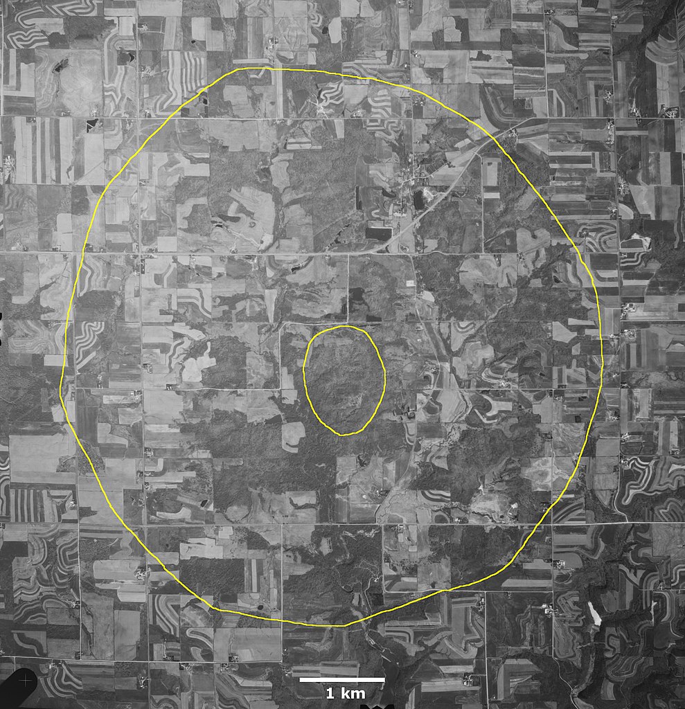
English: The extent of Rock Elm crater as mapped by William S. Cordua, Department of Plant and Earth Science, University of Wisconsin-River Falls, in Figure 2 of publication The Rock Elm Disturbance, Pierce County, Wisconsin in FIELD TRIP GUIDEBOOK FOR THE UPPER MISSISSIPPI VALLEY, MINNESOTA, IOWA, AND WISCONSIN. Edited by N.H. Balaban. Prepared for the 21st Annual Meeting of the Geological Society of America, North-Central Section, St. Paul, Minnesota, 1987. Air photo N10NAPPW05490016, dated 7 May 1992, downloaded from USGS using EarthExplorer. Outer yellow line is approximate crater rim, and inner line is central uplift. |
| Date | |
| Source | Own work |
| Author | Jstuby |
Licensing
I, the copyright holder of this work, hereby publish it under the following license:
| This file is made available under the Creative Commons CC0 1.0 Universal Public Domain Dedication. | |
| The person who associated a work with this deed has dedicated the work to the public domain by waiving all of their rights to the work worldwide under copyright law, including all related and neighboring rights, to the extent allowed by law. You can copy, modify, distribute and perform the work, even for commercial purposes, all without asking permission.
|
File history
Click on a date/time to view the file as it appeared at that time.
| Date/Time | Thumbnail | Dimensions | User | Comment | |
|---|---|---|---|---|---|
| current | 01:33, 9 December 2021 | | 2,800 × 2,900 (1.87 MB) | Jstuby | Uploaded own work with UploadWizard |
File usage
The following pages on the English Wikipedia use this file (pages on other projects are not listed):