No higher resolution available.
Richmond-artha.PNG (316 × 346 pixels, file size: 9 KB, MIME type: image/png)
| This is a file from the Wikimedia Commons. Information from its description page there is shown below. Commons is a freely licensed media file repository. You can help. |

|
This file was moved to Wikimedia Commons from en.wikipedia using a bot script. All source information is still present. It requires review. Additionally, there may be errors in any or all of the information fields; information on this file should not be considered reliable and the file should not be used until it has been reviewed and any needed corrections have been made. Once the review has been completed, this template should be removed. For details about this file, see below. Check now! |
Summary
| Description |
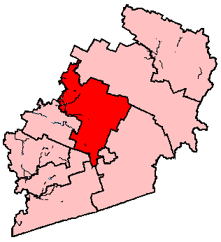
English: Locater map for the Richmond—Arthabaska electoral district in Quebec. |
| Date | 25 April 2011 (original upload date) |
| Source | Earl Andrew (talk) |
| Author | Earl Andrew (talk) |
Licensing
| This work has been released into the public domain by its author, Earl Andrew at English Wikipedia. This applies worldwide. In some countries this may not be legally possible; if so: Earl Andrew grants anyone the right to use this work for any purpose, without any conditions, unless such conditions are required by law. |
Original upload log
The original description page was here. All following user names refer to en.wikipedia.
- 2011-04-25 03:55 Earl Andrew 316×346 (9365 bytes) {{PD-self}} Summary: Map
File history
Click on a date/time to view the file as it appeared at that time.
| Date/Time | Thumbnail | Dimensions | User | Comment | |
|---|---|---|---|---|---|
| current | 12:45, 25 December 2011 | | 316 × 346 (9 KB) | MGA73bot2 | {{BotMoveToCommons|en.wikipedia|year={{subst:CURRENTYEAR}}|month={{subst:CURRENTMONTHNAME}}|day={{subst:CURRENTDAY}}}} == {{int:filedesc}} == {{Information |description={{en|1=Locater map for the Richmond—Arthabaska electo |
File usage
The following pages on the English Wikipedia use this file (pages on other projects are not listed):
Global file usage
The following other wikis use this file:
- Usage on fr.wikipedia.org