
Size of this preview: 800 × 496 pixels. Other resolutions: 320 × 198 pixels | 640 × 397 pixels | 1,090 × 676 pixels.
Original file (1,090 × 676 pixels, file size: 221 KB, MIME type: image/jpeg)
| This is a file from the Wikimedia Commons. Information from its description page there is shown below. Commons is a freely licensed media file repository. You can help. |
Summary
| Description |
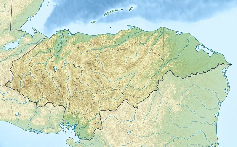
Русский: Физическая карта Гондураса
| top = 16.7 | bottom = 12.8 | left = -89.5 | right = -83.0 |
| Date | |
| Source |
|
| Author | |
| Other versions |
|

Licensing
This file is licensed under the Creative Commons Attribution-Share Alike 2.0 Generic license.
- You are free:
- to share – to copy, distribute and transmit the work
- to remix – to adapt the work
- Under the following conditions:
- attribution – You must give appropriate credit, provide a link to the license, and indicate if changes were made. You may do so in any reasonable manner, but not in any way that suggests the licensor endorses you or your use.
- share alike – If you remix, transform, or build upon the material, you must distribute your contributions under the same or compatible license as the original.
File history
Click on a date/time to view the file as it appeared at that time.
| Date/Time | Thumbnail | Dimensions | User | Comment | |
|---|---|---|---|---|---|
| current | 20:26, 19 November 2010 | | 1,090 × 676 (221 KB) | Виктор В | srtm3 |
| 19:19, 18 November 2010 |  | 1,090 × 677 (277 KB) | Виктор В | == {{int:filedesc}} == {{Information |Description={{ru|1=Физическая карта Гондураса * Проекция — равноугольная цилиндрическая * Координаты краёв карты: <pre> | top = 16.7 |
File usage
The following pages on the English Wikipedia use this file (pages on other projects are not listed):
- Aguán River
- Bay Islands Department
- Bolitoglossa cataguana
- Capiro Calentura National Park
- Cayos Cochinos
- Celaque National Park
- Cerro Azul Meámbar National Park
- Cerro Azul de Copán National Park
- Cerro Congolón
- Cerro Las Minas
- Cerro Tenán
- Chamelecón River
- Copán
- Craugastor chrysozetetes
- Cusuco National Park
- El Cajón Dam (Honduras)
- El Plan Formation
- Esquias Formation
- Gracias Formation
- Gualcarque River
- Guarajambala River
- Honduras Open
- Jeannette Kawas National Park
- La Muralla National Park
- La Tigra National Park
- Lake Yojoa
- List of fossiliferous stratigraphic units in Central America
- List of journalists killed in Honduras
- Marcala Airport
- Mocal River
- Montaña Santa Bárbara National Park
- Montaña de Comayagua National Park
- Montaña de Erapuca
- Montaña de Yoro National Park
- Montecristo Trifinio National Park
- Patuca National Park
- Patuca River
- Peñol de Cerquín
- Pico Bonito National Park
- Pico Pijol National Park
- Port Royal National Park
- Puerto Castilla Airport
- Roatán
- Río Negro (Central America)
- Río Plátano Biosphere Reserve
- Santa Rosa de Copán Airport
- Sierra de Agalta National Park
- Torola River
- Valle de Ángeles Group
- Valle de Ángeles Redbeds
- Water resources management in Honduras
- West Bay Roatan
- User:Ty654/List of earthquakes from 1900-1949 exceeding magnitude 7+
- User:Ty654/List of earthquakes from 1950-1954 exceeding magnitude 6+
- User:Ty654/List of earthquakes from 1980-1984 exceeding magnitude 6+
- User:Ty654/List of earthquakes from 1995-1999 exceeding magnitude 6+
- User:Walrasiad/Vespucci
- Module:Location map/data/Honduras
- Module:Location map/data/Honduras/doc
Global file usage
The following other wikis use this file:
- Usage on ar.wikipedia.org
- Usage on ast.wikipedia.org
- Usage on az.wikipedia.org
- Usage on ba.wikipedia.org
- Usage on be.wikipedia.org
- Usage on bg.wikipedia.org
- Тегусигалпа
- Сан Педро Сула
- Копан
- Ла Сейба
- Хондураски залив
- Булгария (река)
- Шаблон:ПК Хондурас
- Комаягуа
- Токоа
- Трухильо (Хондурас)
- Чолома
- Лас Вегас (Хондурас)
- Чолутека
- Вилянуева (Хондурас)
- Оланчито
- Лима (Хондурас)
- Пуерто Кортес
- Катакамас
- Ла Ентрада
- Санта Барбара (Хондурас)
- Данли
- Санта Роса де Копан
- Сан Лоренсо (Хондурас)
- Санта Рита (Хондурас)
- Ел Прогресо (град)
- Сан Хуан де Опоа
- Фонсека (залив)
- Usage on bn.wikipedia.org
- Usage on bs.wikipedia.org
- Usage on ca.wikipedia.org
- Usage on ceb.wikipedia.org
- Usage on ce.wikipedia.org
View more global usage of this file.