Size of this preview: 800 × 600 pixels. Other resolutions: 320 × 240 pixels | 640 × 480 pixels | 1,024 × 768 pixels.
Original file (1,024 × 768 pixels, file size: 327 KB, MIME type: image/jpeg)
| This is a file from the Wikimedia Commons. Information from its description page there is shown below. Commons is a freely licensed media file repository. You can help. |
Summary
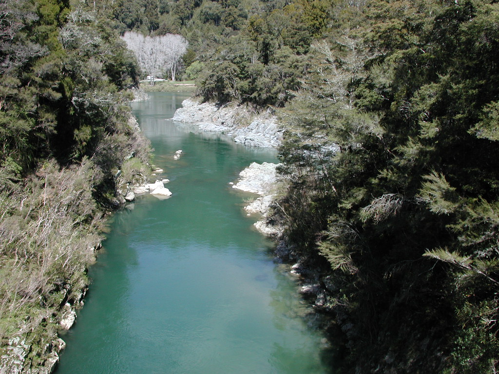
| Description | Rai River and Pelorus River from swing bridge in Pelorus Bridge Scenic Reserve. Rai River flows away from the bridge and into Pelorus River, which comes from the right in the picture and continues towards the picnic area in the distance. |
| Date | |
| Source | Own work |
| Author | Pseudopanax at English Wikipedia |
| Camera location | | View this and other nearby images on: OpenStreetMap |
|---|
Licensing
| I, the copyright holder of this work, release this work into the public domain. This applies worldwide. In some countries this may not be legally possible; if so: I grant anyone the right to use this work for any purpose, without any conditions, unless such conditions are required by law. |
File history
Click on a date/time to view the file as it appeared at that time.
| Date/Time | Thumbnail | Dimensions | User | Comment | |
|---|---|---|---|---|---|
| current | 05:44, 16 June 2012 | | 1,024 × 768 (327 KB) | Pseudopanax | == {{int:filedesc}} == {{Information |Description=Rai River and Pelorus River from swing bridge in Pelorus Bridge Scenic Reserve |Source={{Own}} |Date=2011-10-9 |Author=[[:en:User:Pseudopan... |
File usage
The following pages on the English Wikipedia use this file (pages on other projects are not listed):