
Size of this PNG preview of this SVG file: 687 × 600 pixels. Other resolutions: 275 × 240 pixels | 550 × 480 pixels | 880 × 768 pixels | 1,173 × 1,024 pixels | 2,347 × 2,048 pixels | 699 × 610 pixels.
Original file (SVG file, nominally 699 × 610 pixels, file size: 18 KB)
| This is a file from the Wikimedia Commons. Information from its description page there is shown below. Commons is a freely licensed media file repository. You can help. |
Summary
| Description |
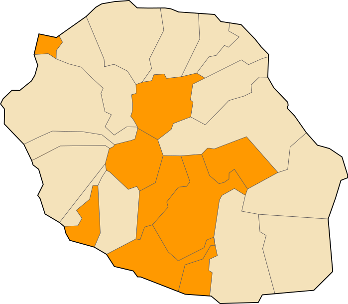
English: Map of the communes of Réunion Island showing the structures of administrative borders. The current divisions that are filled in orange here, are newer ones that no longer use the old definition Du battant des lames au sommet des montagnes (historical legal expression in French, specifically used in Réunion, and meaning “from the seashore to the top of mountains”). Français : Carte des communes de La Réunion montrant la structure des frontières adminsitratives. Les divisions actuelles qui sont colorées ici en orange sont de nouvelles qui ne suivent plus l’ancienne définition « Du battant des lames au sommet des montagnes » (expression historique légale consacrée, spécifiquement utilisée à La Réunion). |
| Date | |
| Source | Image:Réunion communes.svg |
| Author | User:Kimdime69 |

|
This SVG file contains embedded text that can be translated into your language, using any capable SVG editor, text editor or the SVG Translate tool. For more information see: About translating SVG files. |
Licensing
I, the copyright holder of this work, hereby publish it under the following licenses:

|
Permission is granted to copy, distribute and/or modify this document under the terms of the GNU Free Documentation License, Version 1.2 or any later version published by the Free Software Foundation; with no Invariant Sections, no Front-Cover Texts, and no Back-Cover Texts. A copy of the license is included in the section entitled GNU Free Documentation License. |
| This file is licensed under the Creative Commons Attribution-Share Alike 3.0 Unported license. | ||
| ||
| This licensing tag was added to this file as part of the GFDL licensing update. |
This file is licensed under the Creative Commons Attribution 2.5 Generic license.
- You are free:
- to share – to copy, distribute and transmit the work
- to remix – to adapt the work
- Under the following conditions:
- attribution – You must give appropriate credit, provide a link to the license, and indicate if changes were made. You may do so in any reasonable manner, but not in any way that suggests the licensor endorses you or your use.
You may select the license of your choice.
File history
Click on a date/time to view the file as it appeared at that time.
| Date/Time | Thumbnail | Dimensions | User | Comment | |
|---|---|---|---|---|---|
| current | 22:55, 29 December 2012 | | 699 × 610 (18 KB) | Tiger66 | Correction de bugs, amélioration du fichier, suppression de metadata Adobe, réduction du poids. |
| 19:06, 10 March 2007 |  | 699 × 610 (482 KB) | Kimdime | {{Information |Description=Map of the communes of Réunion Island showing the structures of administrative borders (see fr:Du battant des lames au sommet des montagnes |Source= Image:Réunion communes.svg |Date=2007 |Author=User;Kimdime69 |Pe |
File usage
The following pages on the English Wikipedia use this file (pages on other projects are not listed):
Global file usage
The following other wikis use this file: