
Size of this PNG preview of this SVG file: 623 × 600 pixels. Other resolutions: 249 × 240 pixels | 498 × 480 pixels | 798 × 768 pixels | 1,063 × 1,024 pixels | 2,127 × 2,048 pixels | 1,133 × 1,091 pixels.
Original file (SVG file, nominally 1,133 × 1,091 pixels, file size: 26 KB)
| This is a file from the Wikimedia Commons. Information from its description page there is shown below. Commons is a freely licensed media file repository. You can help. |
Summary
| Description |
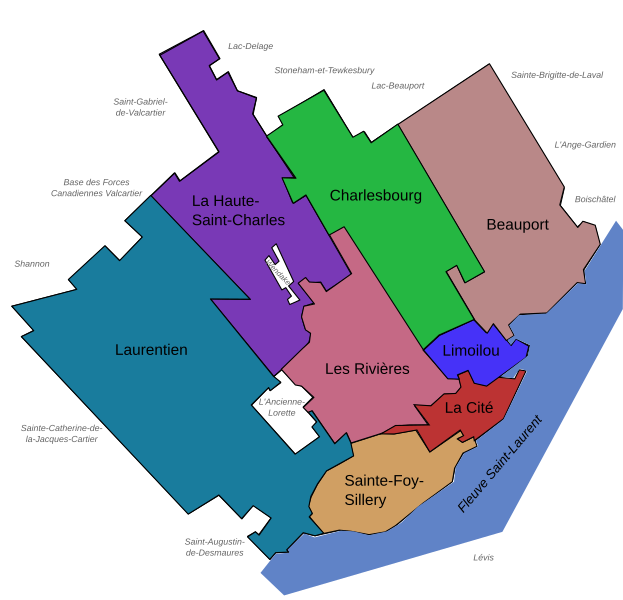
Français : Carte des arrondissements de la ville de Québec (Québec, Canada) en 2007.
English: Maps of the Boroughs ("Arrondissements") of Quebec City (Quebec, Canada), 2007. |
||
| Date | |||
| Source | Own work, made with Inkscape | ||
| Author | User:Boréal | ||
| Permission (Reusing this file) |
|
||
| Other versions |
Version modifiée illustrant les arrondissements le 1er novembre 2009 Modified version illustrating the boroughs on November 1, 2009 |

File history
Click on a date/time to view the file as it appeared at that time.
| Date/Time | Thumbnail | Dimensions | User | Comment | |
|---|---|---|---|---|---|
| current | 18:28, 16 May 2008 | | 1,133 × 1,091 (26 KB) | Essin | Spelling edit: Stoneham-et-Tewksbury -> Stoneham-et-Tewkesbury |
| 20:43, 9 December 2007 |  | 1,133 × 1,091 (26 KB) | Boréal | {{Information |Description= {{fr}} Carte des arrondissements de la ville de Québec (Québec, Canada) en 2007. {{en}} Maps of the Boroughs ("Arrondissements") of Quebec City (Quebec, Canada), 2007. |Source=Own work, made with Inkscape |Date=2007-12-09 |Au | |
| 20:35, 9 December 2007 |  | 1,133 × 1,091 (26 KB) | Boréal | {{Information |Description= {{fr}} Carte des arrondissements de la ville de Québec (Québec, Canada) en 2007. {{en}} Maps of the Boroughs ("Arrondissements") of Quebec City (Quebec, Canada), 2007. |Source=Own work, made with Inkscape |Date=2007-12-09 |Au | |
| 20:30, 9 December 2007 |  | 1,133 × 1,091 (25 KB) | Boréal | {{Information |Description= {{fr}} Carte des arrondissements de la ville de Québec (Québec, Canada) en 2007. {{en}} Maps of the Boroughs ("Arrondissements") of Quebec City (Quebec, Canada), 2007. |Source=Own work, made with Inkscape |Date=2007-12-09 |Au |
File usage
The following pages on the English Wikipedia use this file (pages on other projects are not listed):
Global file usage
The following other wikis use this file:
- Usage on ar.wikipedia.org
- Usage on de.wikipedia.org
- Usage on eo.wikipedia.org
- Usage on fr.wikipedia.org
- Usage on la.wikipedia.org
- Usage on ru.wikipedia.org