
Size of this PNG preview of this SVG file: 435 × 600 pixels. Other resolutions: 174 × 240 pixels | 348 × 480 pixels | 557 × 768 pixels | 742 × 1,024 pixels | 1,485 × 2,048 pixels | 2,660 × 3,668 pixels.
Original file (SVG file, nominally 2,660 × 3,668 pixels, file size: 39 KB)
| This is a file from the Wikimedia Commons. Information from its description page there is shown below. Commons is a freely licensed media file repository. You can help. |
| Description |
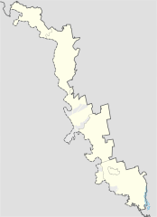
English: Location map of Pridnestrovian Moldavian Republic
Русский: Контурная карта Приднестровской Молдавской Республики |
||||||||
| Date | |||||||||
| Source | based on File:Naddniestrze.png by Aotearoa | ||||||||
| Author | Iguacu | ||||||||
| Permission (Reusing this file) |
I, the copyright holder of this work, hereby publish it under the following licenses:
You may select the license of your choice. |

File history
Click on a date/time to view the file as it appeared at that time.
| Date/Time | Thumbnail | Dimensions | User | Comment | |
|---|---|---|---|---|---|
| current | 07:33, 13 November 2014 | | 2,660 × 3,668 (39 KB) | Nicolay Sidorov | microdistrict "Severny" ("Northern") of Bendery city is under transnistrian control |
| 20:42, 1 March 2010 |  | 2,660 × 3,668 (38 KB) | Iguacu | small corrections | |
| 13:32, 1 March 2010 |  | 2,660 × 3,668 (38 KB) | Iguacu | small changes | |
| 11:29, 1 March 2010 |  | 2,660 × 3,668 (38 KB) | Iguacu | {{Information |Description={{en|1=Location map of Pridnestrovian Moldavian Republic}} {{ru|1=Контурная карта Приднестровской Молдавской Республики}} |Source=based on File:Naddniestrze.png by [[User:Aot |
File usage
The following pages on the English Wikipedia use this file (pages on other projects are not listed):
Global file usage
The following other wikis use this file:
- Usage on af.wikipedia.org
- Usage on ar.wikipedia.org
- Usage on ast.wikipedia.org
- Usage on ba.wikipedia.org
- Usage on bg.wikipedia.org
- Usage on bs.wikipedia.org
- Usage on ca.wikipedia.org
- Usage on ceb.wikipedia.org
- Usage on ckb.wikipedia.org
- Usage on cs.wikipedia.org
- Usage on da.wikipedia.org
- Usage on de.wikipedia.org
- Tiraspol
- Bender (Stadt)
- Rîbnița
- Slobozia (Dnister)
- Grigoriopol
- Wikipedia:Kartenwerkstatt/Positionskarten/Europa
- Vorlage:Positionskarte Republik Moldau Transnistrien
- Sheriff-Stadion
- Dubăsari
- Parcani (Transnistrien)
- Dnestrovsc
- Vorlage:Infobox Ort in Transnistrien
- Camenca (Transnistrien)
- Chițcani (Dnister)
- Ofatinți
- Hlinaia (Rajon Grigoriopol)
- Carmanova
- Colosova
- Frunzăuca
- Usage on de.wikivoyage.org
- Usage on eo.wikipedia.org
- Usage on es.wikipedia.org
View more global usage of this file.