Size of this preview: 450 × 600 pixels. Other resolutions: 180 × 240 pixels | 360 × 480 pixels | 576 × 768 pixels | 768 × 1,024 pixels | 1,536 × 2,048 pixels.
Original file (1,536 × 2,048 pixels, file size: 516 KB, MIME type: image/jpeg)
| This is a file from the Wikimedia Commons. Information from its description page there is shown below. Commons is a freely licensed media file repository. You can help. |
| Description |
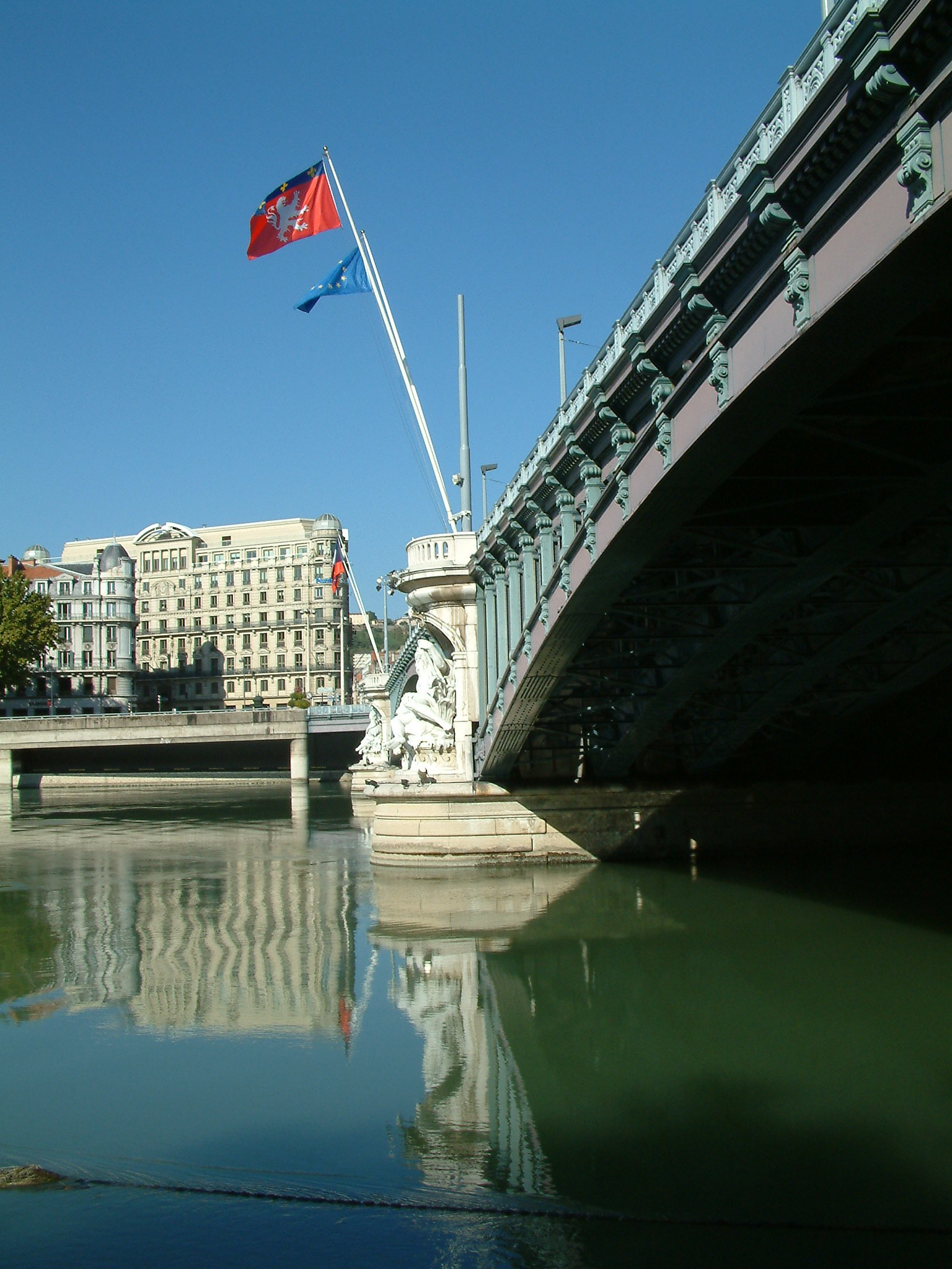
Français : Le pont Lafayette, à Lyon. Vue vers l'ouest depuis la berge Amalia Rodriguez (ou berge reine Astrid ?) en rive gauche, côté aval. Le quai en face est le quai Jules Courmont, mais le grand immeuble blanc à huit étages est au n° 2 rue du Président Carnot. |
| Date | |
| Source | Own work |
| Author | Frédéric Jacquot (deelight@poulet.org) |
| Camera location | | View this and other nearby images on: OpenStreetMap |
|---|
This file is licensed under the Creative Commons Attribution-Share Alike 2.5 Generic license.
- You are free:
- to share – to copy, distribute and transmit the work
- to remix – to adapt the work
- Under the following conditions:
- attribution – You must give appropriate credit, provide a link to the license, and indicate if changes were made. You may do so in any reasonable manner, but not in any way that suggests the licensor endorses you or your use.
- share alike – If you remix, transform, or build upon the material, you must distribute your contributions under the same or compatible license as the original.
File history
Click on a date/time to view the file as it appeared at that time.
| Date/Time | Thumbnail | Dimensions | User | Comment | |
|---|---|---|---|---|---|
| current | 23:44, 27 July 2005 | | 1,536 × 2,048 (516 KB) | Deelight | Le pont Lafayette, à Lyon {{cc-by-sa-2.5}} Author: Frédéric Jacquot ([mailto:deelight@poulet.org deelight@poulet.org]), 2005 |
File usage
The following pages on the English Wikipedia use this file (pages on other projects are not listed):
Global file usage
The following other wikis use this file:
- Usage on fr.wikipedia.org