Size of this preview: 688 × 600 pixels. Other resolutions: 275 × 240 pixels | 551 × 480 pixels | 881 × 768 pixels | 1,175 × 1,024 pixels | 1,870 × 1,630 pixels.
Original file (1,870 × 1,630 pixels, file size: 75 KB, MIME type: image/png)
| This is a file from the Wikimedia Commons. Information from its description page there is shown below. Commons is a freely licensed media file repository. You can help. |
Summary
| Description |
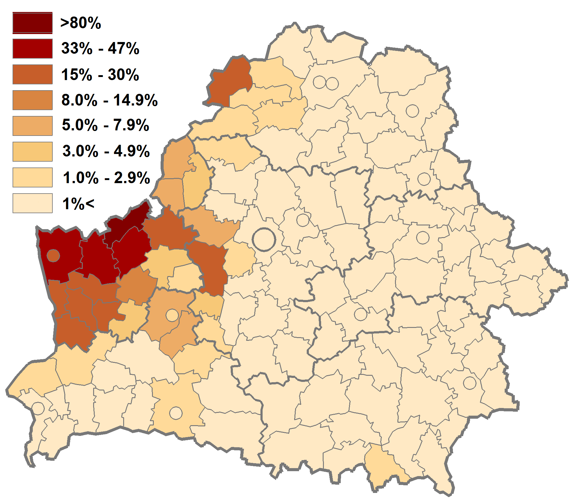
English: Belarus National Census 2009 data used. District level divisions, circles - larger cities not included into districts in the Census tables
Polski: Dane spisu narodowego 2009, dane wg poziomu rejonowego (powiatowego), powiaty grodzkie pokazane umownie przez kółka
Русский: Данные переписи 2009 г. на уровне районов, города областного подчинения и Минск показаны кружками |
| Date | |
| Source | Own work |
| Author | Bogomolov.PL |
Licensing
| I, the copyright holder of this work, release this work into the public domain. This applies worldwide. In some countries this may not be legally possible; if so: I grant anyone the right to use this work for any purpose, without any conditions, unless such conditions are required by law. |
File history
Click on a date/time to view the file as it appeared at that time.
| Date/Time | Thumbnail | Dimensions | User | Comment | |
|---|---|---|---|---|---|
| current | 11:13, 24 September 2010 | | 1,870 × 1,630 (75 KB) | Bogomolov.PL | {{Information |Description={{en|1=Belarus National Census 2009 data used. District level divisions, circles - larger cities not included into districts in the Census tables}} {{pl|1=Dane spisu narodowego 2009, dane wg poziomu rejonowego (powiatowego), pow |
File usage
The following pages on the English Wikipedia use this file (pages on other projects are not listed):
Global file usage
The following other wikis use this file:
- Usage on be-tarask.wikipedia.org
- Usage on myv.wikipedia.org
- Usage on pl.wikipedia.org
- Usage on ru.wikipedia.org
- Usage on uz.wikipedia.org