Size of this preview: 800 × 600 pixels. Other resolutions: 320 × 240 pixels | 640 × 480 pixels | 1,024 × 768 pixels | 1,280 × 960 pixels | 2,560 × 1,920 pixels | 4,608 × 3,456 pixels.
Original file (4,608 × 3,456 pixels, file size: 16.8 MB, MIME type: image/jpeg)
| This is a file from the Wikimedia Commons. Information from its description page there is shown below. Commons is a freely licensed media file repository. You can help. |
Summary
| Description |
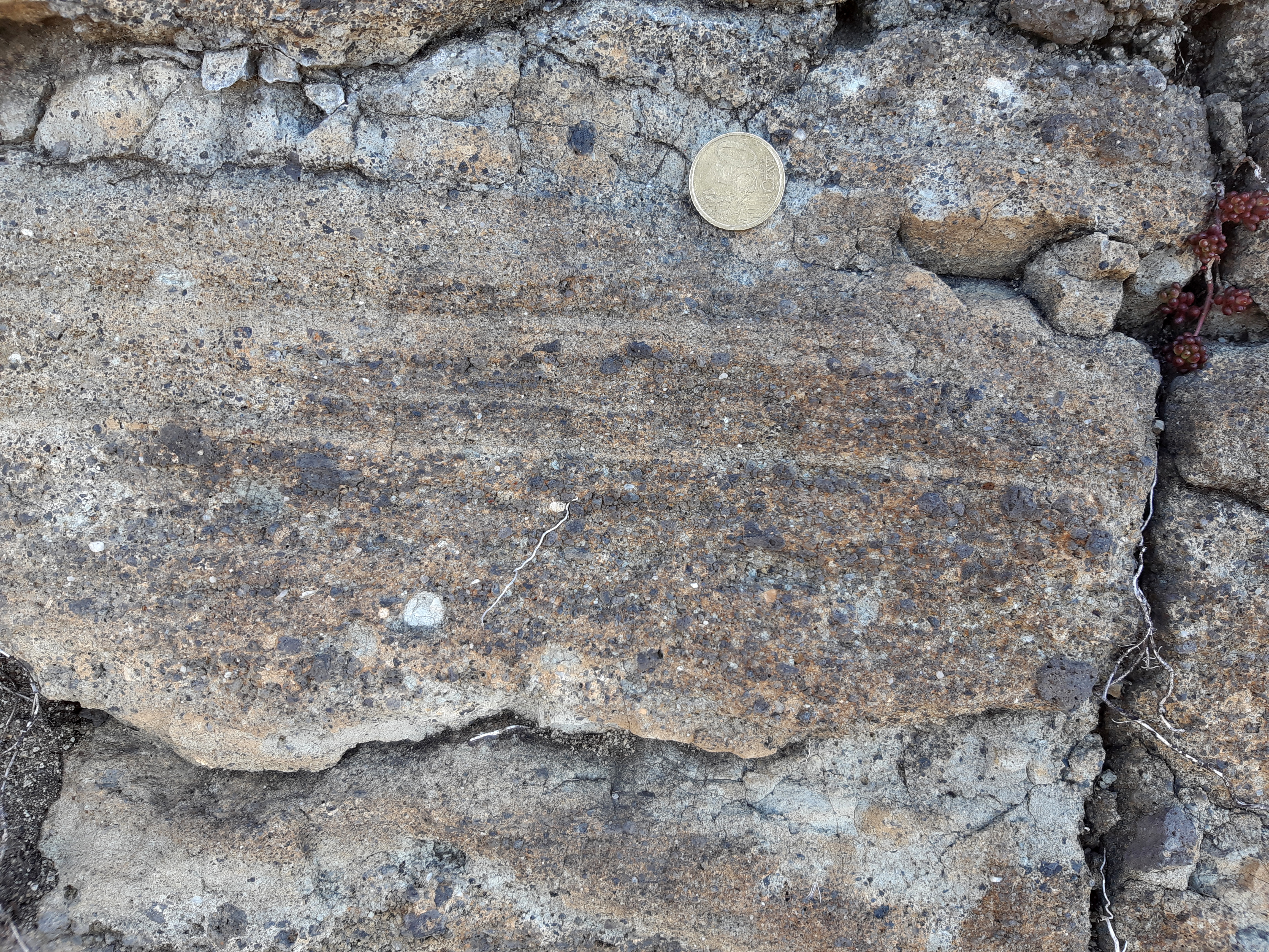
English: Peperite at Puy de Crouel in Puy-de-Dôme department, France.
Français : Les pépérites du Puy de Crouel s’observent mieux sur son flanc est.
Elles présentent tantôt un faciès stratifié, tantôt un faciès non stratifié. Dans la premier cas, les bancs dépassent rarement deux centimètres. Ces pépérites sont composées d’une matrice gris clair - qui forme la majorité de la roche - de nature marneuse (calcaire argileux). On retrouve également des fragments basaltiques lobés, caractéristiques des pépérites, dont la forme s’explique par la différence de température entre l’eau et le magma lors de l’éruption. D’autre fragments de basaltes sont anguleux et l’encaissant (des marnes oligocènes) se retrouve également dans la brèche, sous la forme de granules gris clair. |
| Date | |
| Source | https://www.geodiversite.net/media2062 |
| Author | Romain Cadiou (https://www.geodiversite.net/auteur421) |
| Camera location | | View this and other nearby images on: OpenStreetMap |
|---|
Licensing
This file is licensed under the Creative Commons Attribution-Share Alike 3.0 Unported license.
- You are free:
- to share – to copy, distribute and transmit the work
- to remix – to adapt the work
- Under the following conditions:
- attribution – You must give appropriate credit, provide a link to the license, and indicate if changes were made. You may do so in any reasonable manner, but not in any way that suggests the licensor endorses you or your use.
- share alike – If you remix, transform, or build upon the material, you must distribute your contributions under the same or compatible license as the original.

|
This file, which was originally posted to an external website, has not yet been reviewed by an administrator or reviewer to confirm that the above license is valid. See Category:License review needed for further instructions.
|
File history
Click on a date/time to view the file as it appeared at that time.
| Date/Time | Thumbnail | Dimensions | User | Comment | |
|---|---|---|---|---|---|
| current | 18:27, 12 June 2022 | | 4,608 × 3,456 (16.8 MB) | GeoWriter | Uploaded a work by Romain Cadiou (https://www.geodiversite.net/auteur421) from https://www.geodiversite.net/media2062 with UploadWizard |
File usage
The following pages on the English Wikipedia use this file (pages on other projects are not listed):