Size of this preview: 428 × 600 pixels. Other resolutions: 171 × 240 pixels | 343 × 480 pixels | 548 × 768 pixels | 1,200 × 1,681 pixels.
Original file (1,200 × 1,681 pixels, file size: 977 KB, MIME type: image/jpeg)
| This is a file from the Wikimedia Commons. Information from its description page there is shown below. Commons is a freely licensed media file repository. You can help. |
Summary
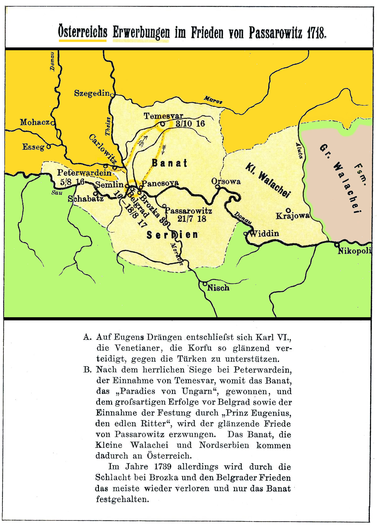
I scanned the map. Source: Karten und Skizzen aus der vaterländischen Geschichte der Neueren Zeit (1517-1789). III. Band des "Historischen Kartenwerkes" Düsseldorf. 5. Auflage, 1900.
Licensing
|
This work is in the public domain in its country of origin and other countries and areas where the copyright term is the author's life plus 70 years or fewer. | |
| This file has been identified as being free of known restrictions under copyright law, including all related and neighboring rights. | |
File history
Click on a date/time to view the file as it appeared at that time.
| Date/Time | Thumbnail | Dimensions | User | Comment | |
|---|---|---|---|---|---|
| current | 11:12, 3 May 2014 | | 1,200 × 1,681 (977 KB) | Spiridon Ion Cepleanu | Better contrast |
| 11:03, 3 May 2014 |  | 1,200 × 1,681 (971 KB) | Spiridon Ion Cepleanu | Cosmetic change (coloured) | |
| 12:43, 11 December 2009 |  | 1,200 × 2,073 (309 KB) | Alex:D | whitened | |
| 12:40, 11 December 2009 |  | 1,200 × 2,073 (320 KB) | Alex:D | whitened | |
| 10:50, 5 April 2007 |  | 1,200 × 2,073 (320 KB) | Olahus | I scanned the map. Source: ''Karten und Skizzen aus der vaterländischen Geschichte der Neueren Zeit (1517-1789). III. Band des "Historischen Kartenwerkes" Düsseldorf.'' 5. Auflage, 1900. == Licensing == {{PD-old}} Category:Maps in German |
File usage
The following pages on the English Wikipedia use this file (pages on other projects are not listed):
Global file usage
The following other wikis use this file:
- Usage on als.wikipedia.org
- Usage on de.wikipedia.org
- Usage on es.wikipedia.org
- Usage on fa.wikipedia.org
- Usage on fr.wikipedia.org
- Usage on hu.wikipedia.org
- Usage on it.wikipedia.org
- Usage on nn.wikipedia.org
- Usage on pl.wikipedia.org
- Usage on ro.wikipedia.org
- Usage on sh.wikipedia.org
- Usage on sr.wikipedia.org