File:Part of the Afon Tarell between the A470 and the Taff Trail - geograph.org.uk - 1327738.jpg
No higher resolution available.
Part_of_the_Afon_Tarell_between_the_A470_and_the_Taff_Trail_-_geograph.org.uk_-_1327738.jpg (640 × 480 pixels, file size: 145 KB, MIME type: image/jpeg)
| This is a file from the Wikimedia Commons. Information from its description page there is shown below. Commons is a freely licensed media file repository. You can help. |
Summary
| Description |
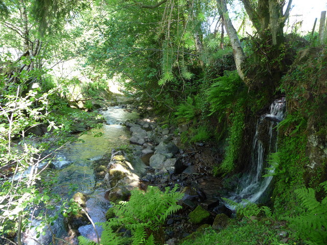
English: Part of the Afon Tarell between the A470 and the Taff Trail Even on the hottest day of the year so far this small river course is very cool, secluded and shaded. |
| Date | |
| Source | From geograph.org.uk |
| Author | Jeremy Bolwell |
| Attribution (required by the license) | Jeremy Bolwell / Part of the Afon Tarell between the A470 and the Taff Trail / |
| Camera location | | View this and other nearby images on: OpenStreetMap |
|---|
_heading:22.00&language=en)
| Object location | | View this and other nearby images on: OpenStreetMap |
|---|
_heading:22.00&language=en)
Licensing

|
This image was taken from the Geograph project collection. See this photograph's page on the Geograph website for the photographer's contact details. The copyright on this image is owned by Jeremy Bolwell and is licensed for reuse under the Creative Commons Attribution-ShareAlike 2.0 license.
|
This file is licensed under the Creative Commons Attribution-Share Alike 2.0 Generic license.
Attribution: Jeremy Bolwell
- You are free:
- to share – to copy, distribute and transmit the work
- to remix – to adapt the work
- Under the following conditions:
- attribution – You must give appropriate credit, provide a link to the license, and indicate if changes were made. You may do so in any reasonable manner, but not in any way that suggests the licensor endorses you or your use.
- share alike – If you remix, transform, or build upon the material, you must distribute your contributions under the same or compatible license as the original.
File history
Click on a date/time to view the file as it appeared at that time.
| Date/Time | Thumbnail | Dimensions | User | Comment | |
|---|---|---|---|---|---|
| current | 22:10, 27 February 2011 | | 640 × 480 (145 KB) | GeographBot | == {{int:filedesc}} == {{Information |description={{en|1=Part of the Afon Tarell between the A470 and the Taff Trail Even on the hottest day of the year so far this small river course is very cool, secluded and shaded.}} |date=2009-05-30 |source=From [htt |
File usage
The following pages on the English Wikipedia use this file (pages on other projects are not listed):
Global file usage
The following other wikis use this file:
- Usage on cy.wikipedia.org
- Usage on www.wikidata.org