
Size of this preview: 800 × 531 pixels. Other resolutions: 320 × 212 pixels | 640 × 425 pixels | 1,024 × 679 pixels | 1,278 × 848 pixels.
Original file (1,278 × 848 pixels, file size: 28 KB, MIME type: image/png)
| This is a file from the Wikimedia Commons. Information from its description page there is shown below. Commons is a freely licensed media file repository. You can help. |
Summary
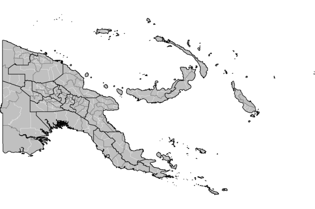
| Description | Map of the Local Level Governments (LLGs) of Papua New Guinea, updated to show outlines of Hela and Jiwaka provinces. |
| Date | |
| Source | Derived from File:Papua New Guinea LLGs.png |
| Author | Keith Edkins |
Licensing
| I, the copyright holder of this work, release this work into the public domain. This applies worldwide. In some countries this may not be legally possible; if so: I grant anyone the right to use this work for any purpose, without any conditions, unless such conditions are required by law. |
File history
Click on a date/time to view the file as it appeared at that time.
| Date/Time | Thumbnail | Dimensions | User | Comment | |
|---|---|---|---|---|---|
| current | 17:08, 26 May 2023 | | 1,278 × 848 (28 KB) | Auguel | Cropped < 1 % horizontally, < 1 % vertically using CropTool with lossless mode. |
| 17:56, 28 May 2012 |  | 1,281 × 851 (37 KB) | Keith Edkins | Revised to show Anglimp in Jiwaka | |
| 11:14, 28 May 2012 |  | 1,281 × 851 (37 KB) | Keith Edkins | {{Information |Description=Map of the Local Level Governments (LLGs) of Papua New Guinea, updated to show outlines of Helga and Jiwaka provinces. |Source=Derived from File:Papua New Guinea LLGs.png |Date=2012-05-28 |Author=[[User:Keith Edkins|Kei... |
File usage
The following pages on the English Wikipedia use this file (pages on other projects are not listed):
Global file usage
The following other wikis use this file:
- Usage on es.wikipedia.org
- Usage on mt.wikipedia.org
- Usage on zh.wikipedia.org