Size of this preview: 405 × 600 pixels. Other resolutions: 162 × 240 pixels | 324 × 480 pixels | 519 × 768 pixels | 691 × 1,024 pixels | 1,400 × 2,073 pixels.
Original file (1,400 × 2,073 pixels, file size: 2.51 MB, MIME type: image/jpeg)
| This is a file from the Wikimedia Commons. Information from its description page there is shown below. Commons is a freely licensed media file repository. You can help. |
Summary
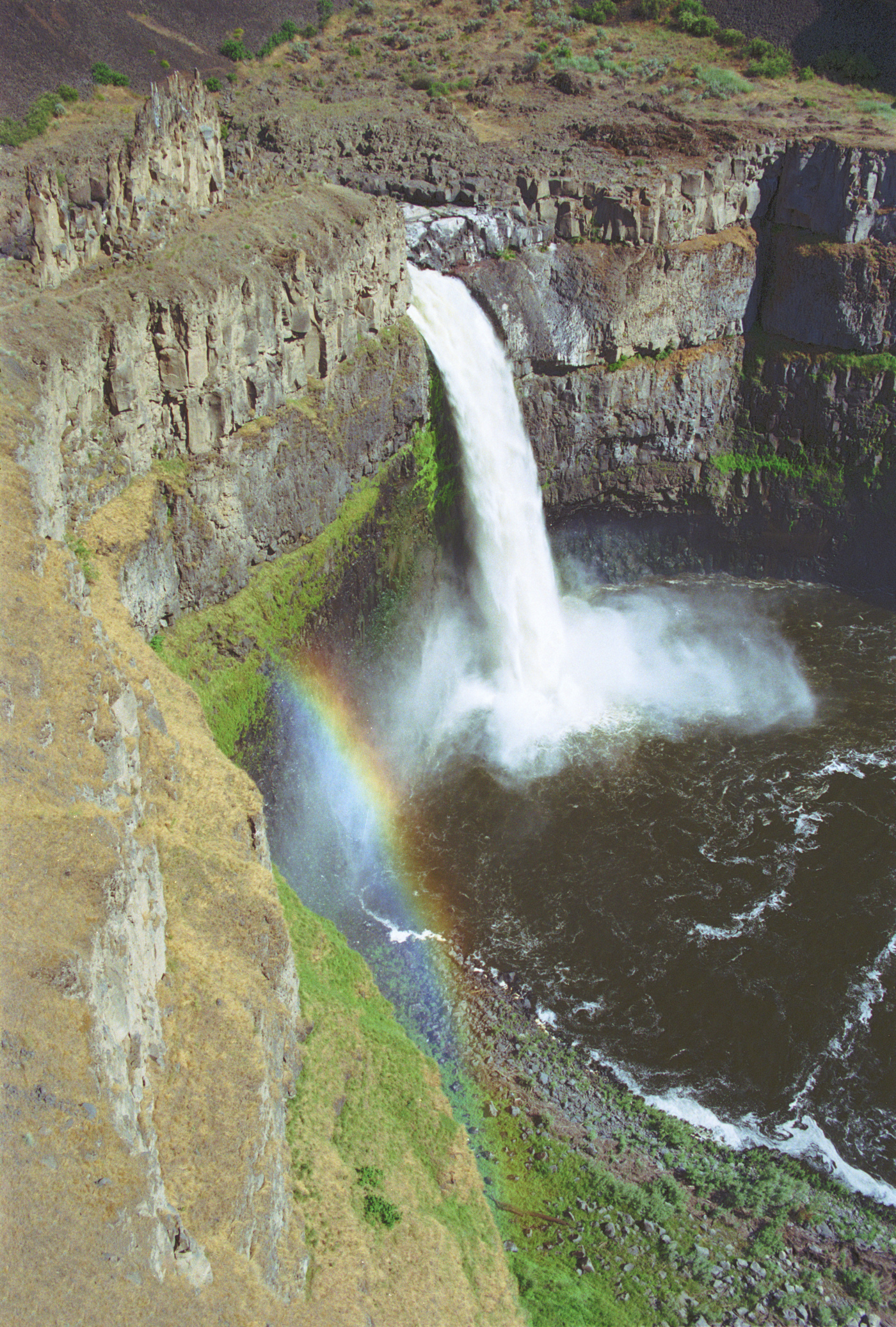
| Description | Palouse Falls |
| Date | |
| Source | Own work |
| Author | Dsdugan |
| Camera location | | View this and other nearby images on: OpenStreetMap |
|---|
Licensing
| I, the copyright holder of this work, release this work into the public domain. This applies worldwide. In some countries this may not be legally possible; if so: I grant anyone the right to use this work for any purpose, without any conditions, unless such conditions are required by law. |
Original upload log
| date/time | username | resolution | size | edit summary |
|---|---|---|---|---|
| 01:26, 14 January 2008 | User:Dsdugan | 340×472 | 49 KB |
File history
Click on a date/time to view the file as it appeared at that time.
| Date/Time | Thumbnail | Dimensions | User | Comment | |
|---|---|---|---|---|---|
| current | 01:50, 18 May 2014 | | 1,400 × 2,073 (2.51 MB) | Dsdugan~commonswiki | adjusted color balance |
| 03:46, 15 September 2012 |  | 1,395 × 2,048 (2.73 MB) | Dsdugan~commonswiki | high resolution scan | |
| 13:50, 6 February 2008 |  | 340 × 472 (49 KB) | BetacommandBot | move approved by: User:ChristianBier This image was moved from Image:02-15-21.jpg == Summary == {{Information |Description=Palouse Falls |Source=self-made |Date=June 2002 |Author= Dsdugan |Permission= |other_versions= }} == L |
File usage
The following pages on the English Wikipedia use this file (pages on other projects are not listed):
Global file usage
The following other wikis use this file:
- Usage on ca.wikipedia.org
- Usage on de.wikipedia.org
- Usage on en.wikivoyage.org
- Usage on es.wikipedia.org
- Usage on fa.wikipedia.org
- Usage on pl.wikipedia.org
- Usage on ru.wikipedia.org
- Usage on si.wikipedia.org
- Usage on uk.wikipedia.org