
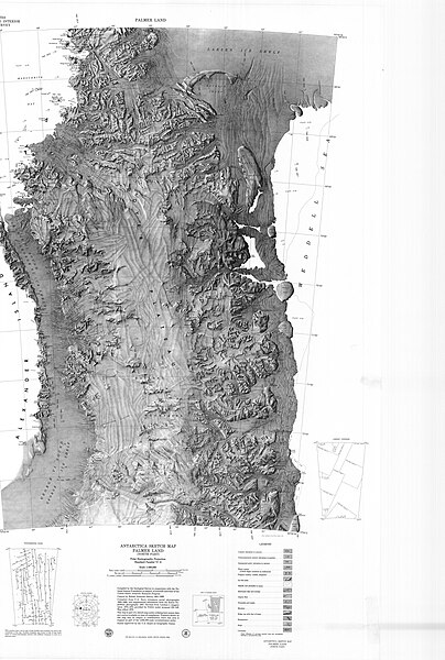
Size of this preview: 404 × 600 pixels. Other resolutions: 161 × 240 pixels | 323 × 480 pixels | 517 × 768 pixels | 690 × 1,024 pixels | 1,379 × 2,048 pixels | 2,759 × 4,096 pixels.
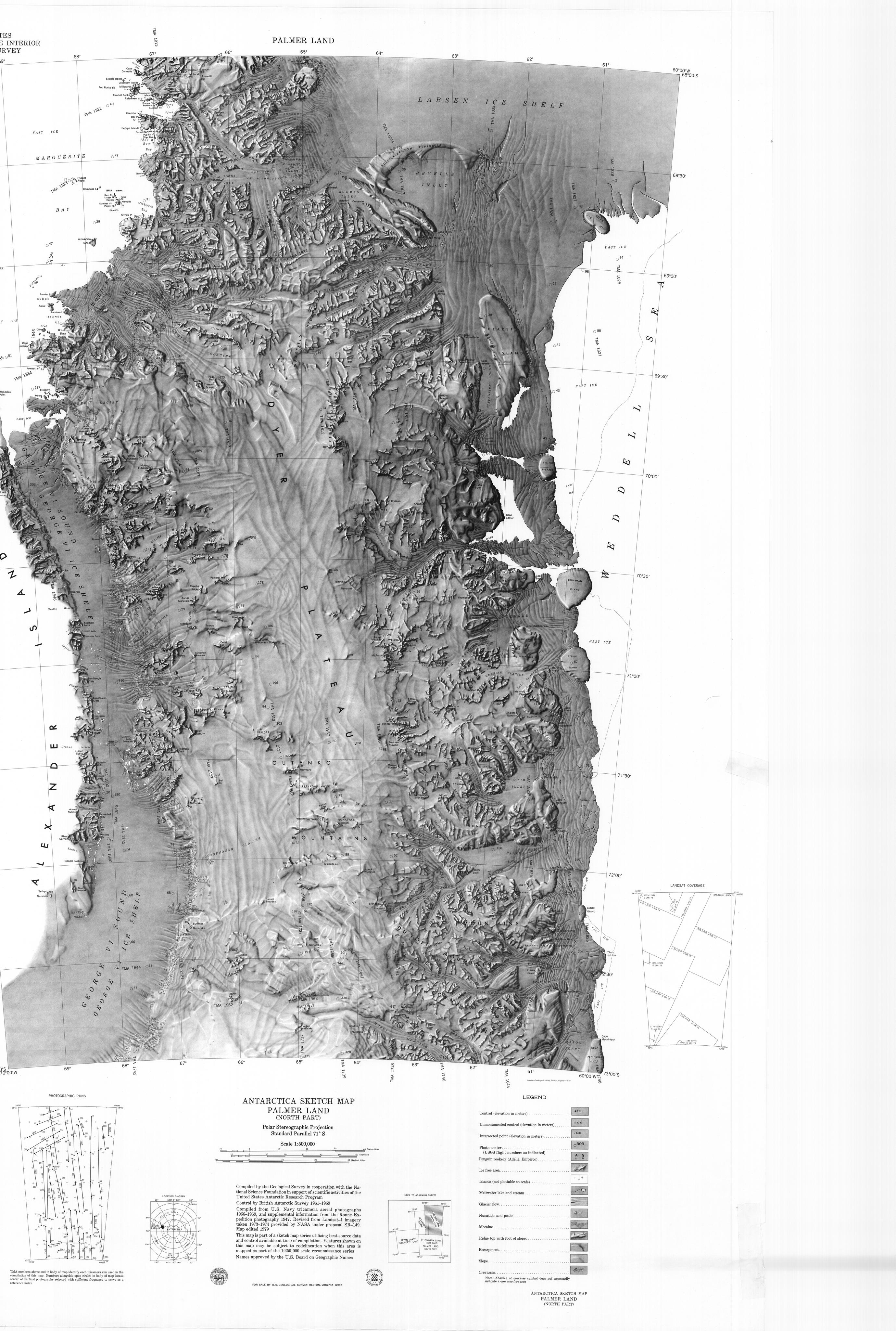
Original file (2,759 × 4,096 pixels, file size: 1.42 MB, MIME type: image/jpeg)
| This is a file from the Wikimedia Commons. Information from its description page there is shown below. Commons is a freely licensed media file repository. You can help. |
Summary
| Description |
English: Sketch map of northern Palmer Land in the Antarctic Peninsula |
| Date | |
| Source | https://maps.apps.pgc.umn.edu/id/112 https://data.pgc.umn.edu/maps/antarctica/usgs/08/preview/Palmer%20Land%20North.jpg |
| Author | USGS |
Licensing
This work is in the public domain in the United States because it is a work prepared by an officer or employee of the United States Government as part of that person’s official duties under the terms of Title 17, Chapter 1, Section 105 of the US Code.
Note: This only applies to original works of the Federal Government and not to the work of any individual U.S. state, territory, commonwealth, county, municipality, or any other subdivision. This template also does not apply to postage stamp designs published by the United States Postal Service since 1978. (See § 313.6(C)(1) of Compendium of U.S. Copyright Office Practices). It also does not apply to certain US coins; see The US Mint Terms of Use.
|
 | |
| This file has been identified as being free of known restrictions under copyright law, including all related and neighboring rights. | ||
File history
Click on a date/time to view the file as it appeared at that time.
| Date/Time | Thumbnail | Dimensions | User | Comment | |
|---|---|---|---|---|---|
| current | 16:08, 25 April 2024 | | 2,759 × 4,096 (1.42 MB) | Aymatth2 | Uploaded a work by USGS from https://maps.apps.pgc.umn.edu/id/112 https://data.pgc.umn.edu/maps/antarctica/usgs/08/preview/Palmer%20Land%20North.jpg with UploadWizard |
File usage
The following pages on the English Wikipedia use this file (pages on other projects are not listed):
- Bermel Peninsula
- Bowman Inlet
- Carey Range
- Casey Inlet
- Columbia Mountains (Antarctica)
- Condor Peninsula
- Dana Mountains
- Du Toit Mountains
- Eielson Peninsula
- Eland Mountains
- Eternity Range
- Goodenough Glacier
- Gutenko Mountains
- Hadley Upland
- Hilton Inlet
- Hollick-Kenyon Peninsula
- Hughes Ice Piedmont
- Kemp Peninsula
- Kvinge Peninsula
- Lehrke Inlet
- Merz Peninsula
- Mikkelsen Bay
- Mobiloil Inlet
- Mount Jackson (Antarctica)
- Neny Fjord
- Northeast Glacier
- Odom Inlet
- Rymill Bay
- Scripps Heights
- Smith Inlet (Palmer Land)
- Snyder Peninsula
- Stefansson Strait
- Terra Firma Islands
- Violante Inlet
- Wegener Range
- Welch Mountains