Size of this preview: 605 × 599 pixels. Other resolutions: 242 × 240 pixels | 485 × 480 pixels | 776 × 768 pixels | 1,121 × 1,110 pixels.
Original file (1,121 × 1,110 pixels, file size: 879 KB, MIME type: image/png)
| This is a file from the Wikimedia Commons. Information from its description page there is shown below. Commons is a freely licensed media file repository. You can help. |
Summary
| Description |
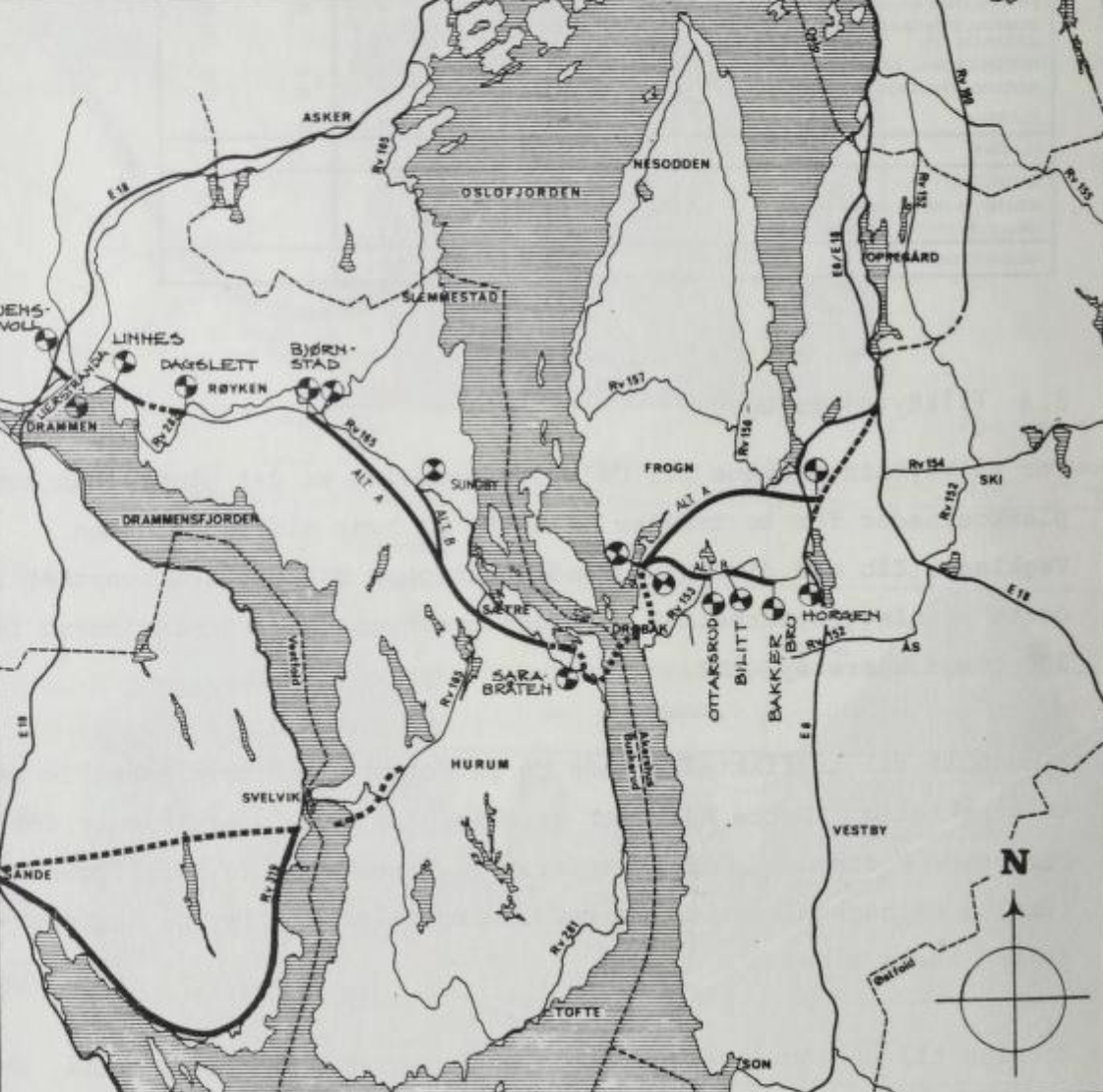
English: Map of a proposed Oslofjord Tunnel and Oslofjord Link showing various alternatives from a 1982 report. Norsk bokmål: Kart over forslag til Oslofjordforbindelse og Oslofjordtunnel fra en utredning fra 1982. |
| Date | |
| Source | http://www.nb.no/nbsok/nb/1774202c51ddd69a5782a382db4fbee3 |
| Author | Asplan / Ministry of Transport and Communications |
Licensing
| This file is in the public domain because legal statutes, administrative regulations, court decisions and other decisions by public authorities are unprotected. This is also the case with proposals, reports and other statements which concern the public exercise of authority, and which are made by a public authority, a publicly appointed council or committee, or published by the public authorities. Similarly, official translations of such texts are unprotected. Intellectual works ("åndsverk" as defined in § 2) which have not been produced specially for use in documents specified in the first paragraph, and from which parts are quoted or which are reproduced in a separate appendix, are not covered by this provision. The same apply to poetry, musical compositions or works of art.
|
 |
File history
Click on a date/time to view the file as it appeared at that time.
| Date/Time | Thumbnail | Dimensions | User | Comment | |
|---|---|---|---|---|---|
| current | 20:21, 19 September 2013 | | 1,121 × 1,110 (879 KB) | Arsenikk | Better quality |
| 20:16, 19 September 2013 |  | 918 × 910 (618 KB) | Arsenikk | User created page with UploadWizard |
File usage
The following pages on the English Wikipedia use this file (pages on other projects are not listed):